5 days in Adelaide, Australia- 5/17- 5/21/2024
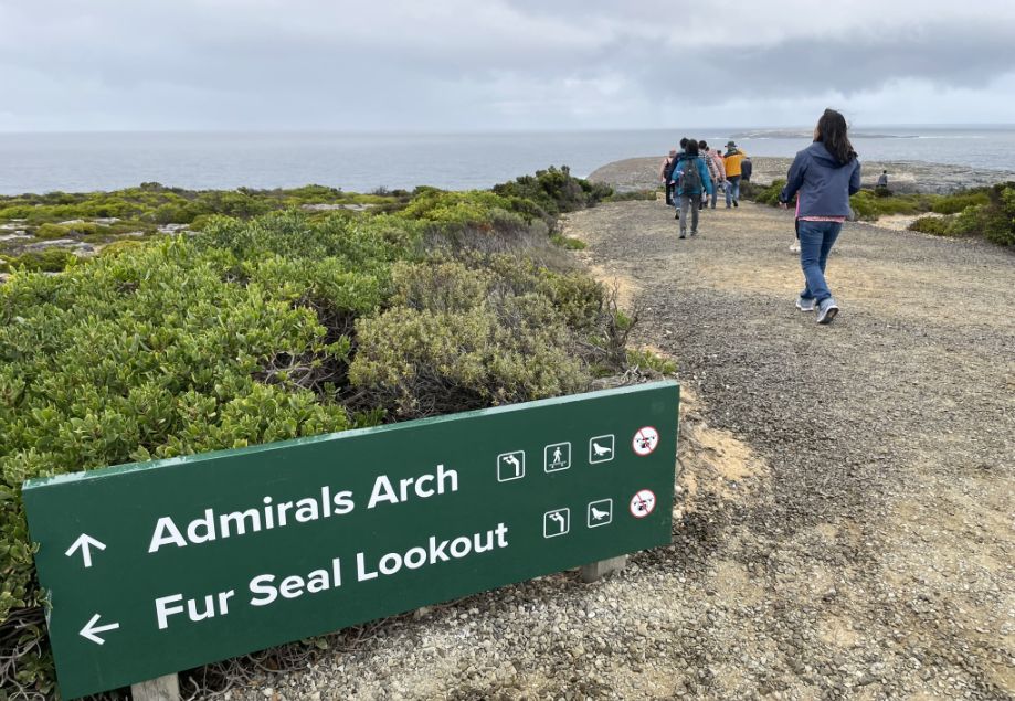
Day 4-Admiral's Arch, Kangaroo Island -5/20/2024
Admiral's Arch is one of the most stunning examples of coastal erosion in South Australia, located on the rugged coast of Flinders Chase National Park on Kangaroo Island. It is one of the most famous natural landmarks, a dramatic coastal rock formation shaped over thousands of years by the fierce winds and waves of the Southern Ocean. It sits within Flinders Chase National Park, near the western tip of the island, not far from the iconic Remarkable Rocks.
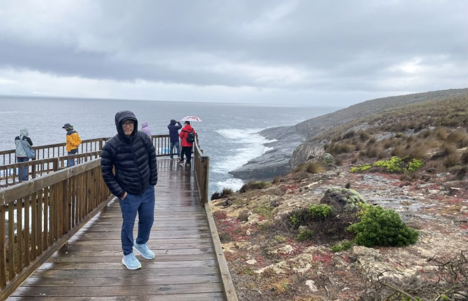
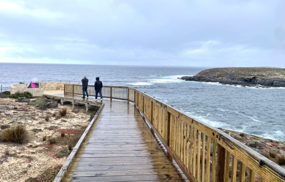
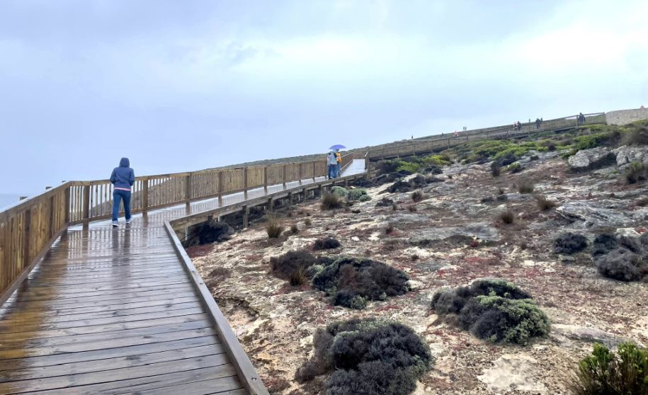
From the parking lot the boardwalk trail winds along the cliff tops overlooking the wild, restless ocean.
The weather is getting cloudy and it looks like it might rain at any time.
 |
 |
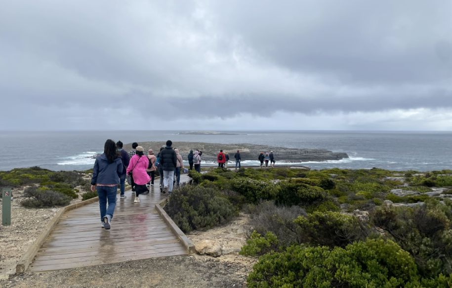
As we started walking along the wooden boardwalk, the sound of waves crashing below grew louder. To my left, the ocean stretched wide and restless under a cloudy sky.
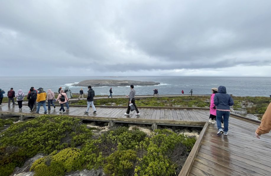
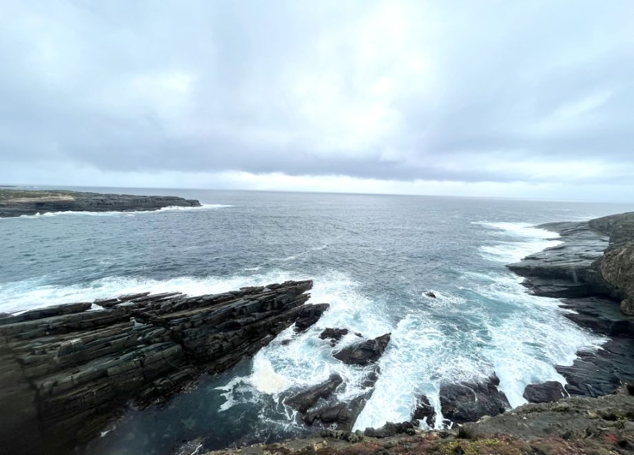
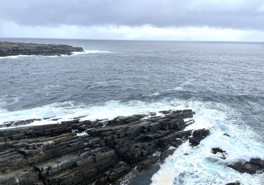
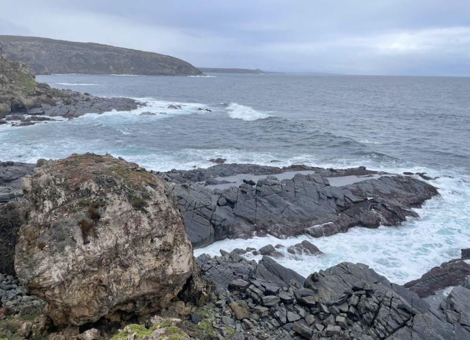
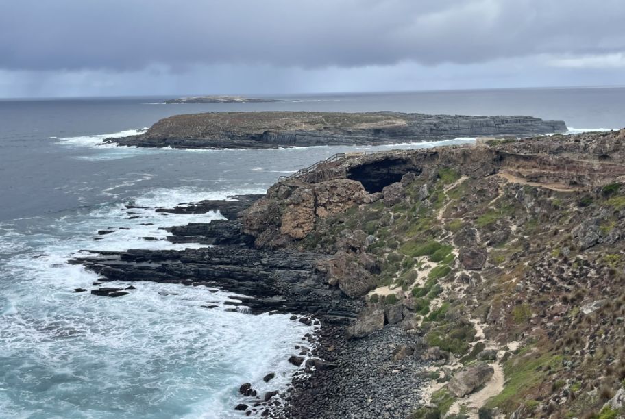
Between the boardwalk and the sea stood an oval-shaped rocky island, dark, rugged, the white foam curling around the edges of the rocks, creating a striking contrast against the deep gray water.
From this angle, I could see low bushes scattered across the rocky ground, their green leaves muted under the cloudy sky. The long wooden boardwalk stretched ahead, winding gently toward the cliffs.
Closer now, the oval rocky island stood out against the restless sea, its surface rough and dark, shaped by years of crashing waves. The wind brushed through the bushes and carried the distant roar of the ocean, setting a moody, powerful scene as we continued toward Admirals Arch.
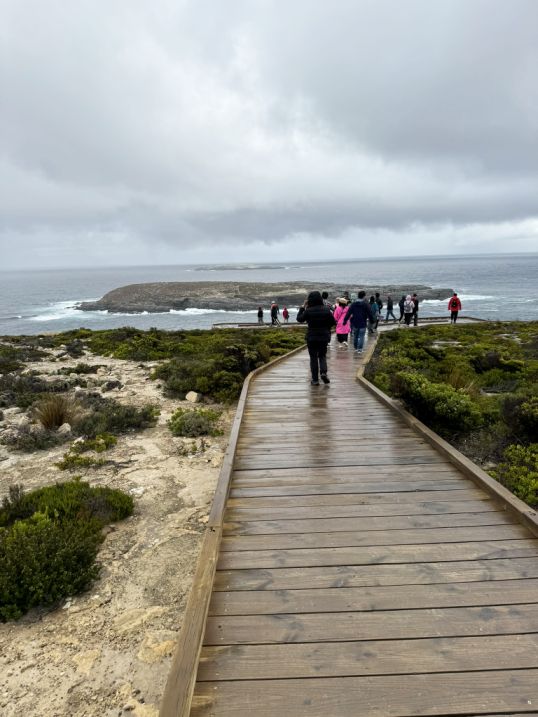
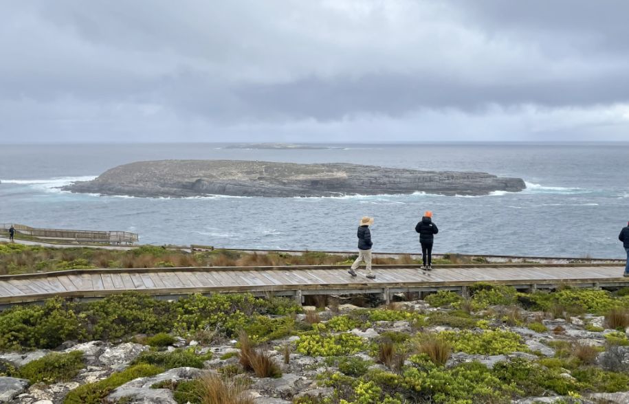
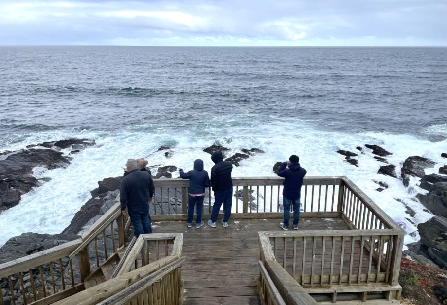
One of the first lookout, from here, the boardwalk stretched ahead on sturdy wooden stilts, standing high above the ocean below. It curved gently along the Cliffside, almost as if floating over the water.
Below, the waves crashed against the rocks beneath, sending bursts of white spray into the air. The sound of the wind and sea filled the space around me, and I could feel the raw energy of the coastline, wild, untamed, and endlessly beautiful.
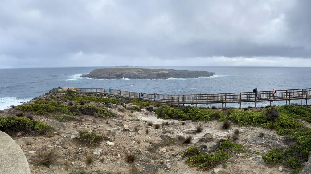
I took a panoramic photo from the lookout, capturing the long boardwalk running parallel to the ocean shore. From this view, the wooden path seemed to blend into the landscape, tracing the edge where the cliffs met the restless sea. The oval rocky island still stood just offshore, its dark surface shining faintly under the gray light. Even with the overcast sky, the scene felt breathtaking, the soft tones of gray, brown, and blue merging into a quiet, rugged beauty that only a cloudy day can bring.
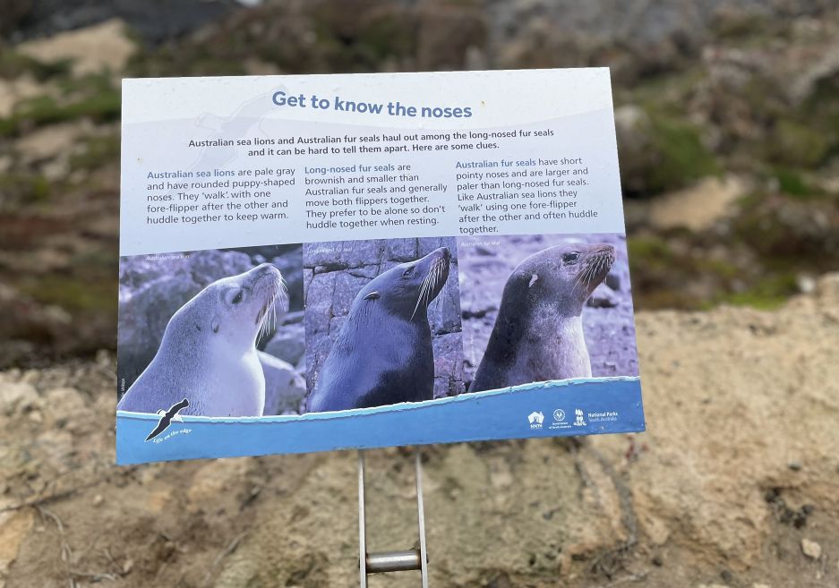
Along the boardwalk, we stopped by an information panel titled “Get to Know the Noses.” It explained how to recognize the New Zealand fur seals that live along this coastline. The signs described their pointed noses, thick brown-gray fur, and playful habits, often lounging on the rocks below or slipping into the waves with surprising grace.
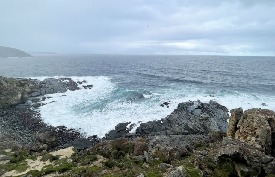
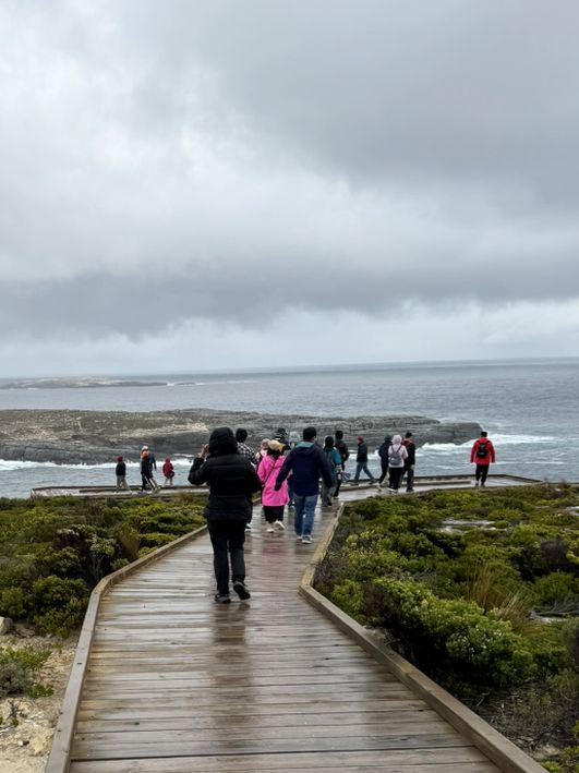
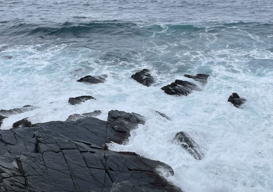
We looked down from the boardwalk and saw the restless sea churning below, its surface shifting from deep blue to gray with each passing wave. The water crashed and foamed against the dark stones that lined the shore, sending bursts of white spray into the air.
The sound of the wind and waves crashing along the shore, we could definitely feel the raw energy of the coastline, wild, untamed, and endlessly beautiful.
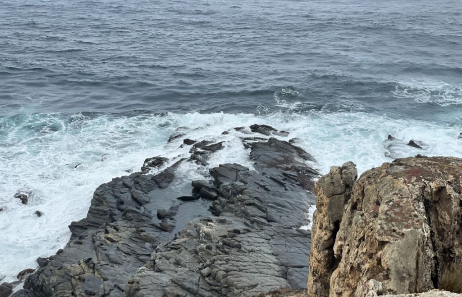
As we continued walking, the path curved slightly, and below us I saw a small U-shaped cove, almost like a hidden beach tucked between the cliffs. The waves are crashing beneath the long, dark rocks stretched out on both sides like arms protecting the little bay. The waves kept crashing and curling around the rocks, sending sprays of white water into the air. Even under the gray sky, the contrast between the black stones, white surf, and steel-blue sea was striking.
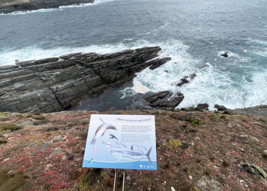
Standing on the cliff, I saw a panel saying" what's on the fur seal menu? These seals are expert, agile hunters, capable of diving very deep for extended periods to catch their food.
Their primary diet consists of three main categories: Fish, Cephalopods (Octopus and Squid), Crustaceans and Scavenging (while not their first choice, they will also consume shellfish and occasionally scavenge).
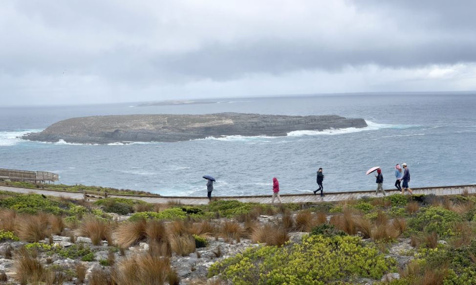
The waves are strong and big.
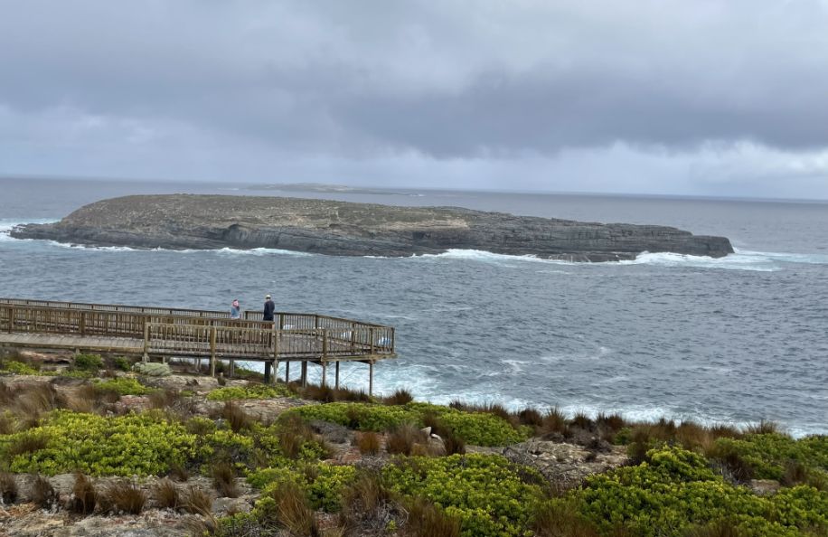
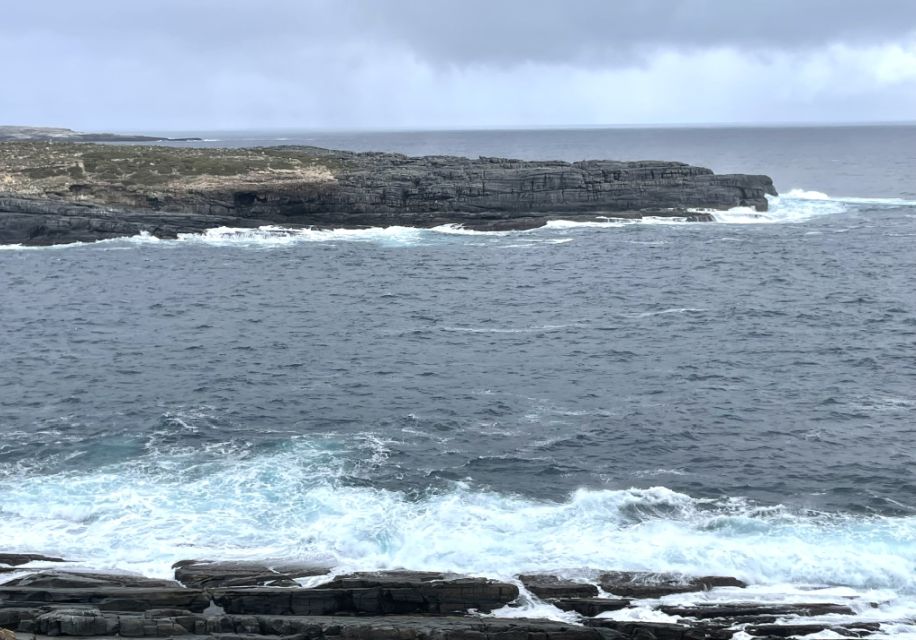
Reaching the second lookout.
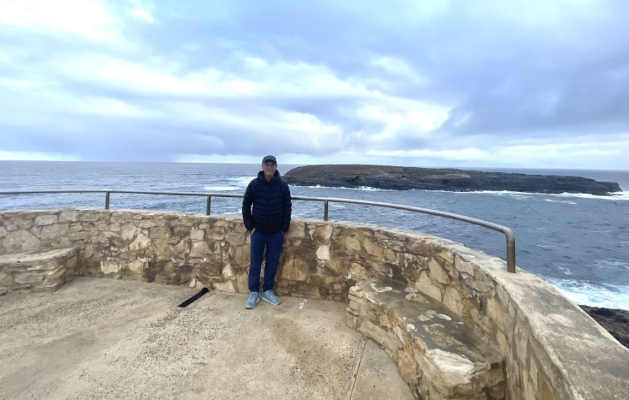
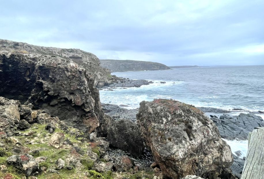
This is the second lookout on the path toward the Admiral Arch. We made a quick pause here to take in the panoramic view of the powerful Southern Ocean.
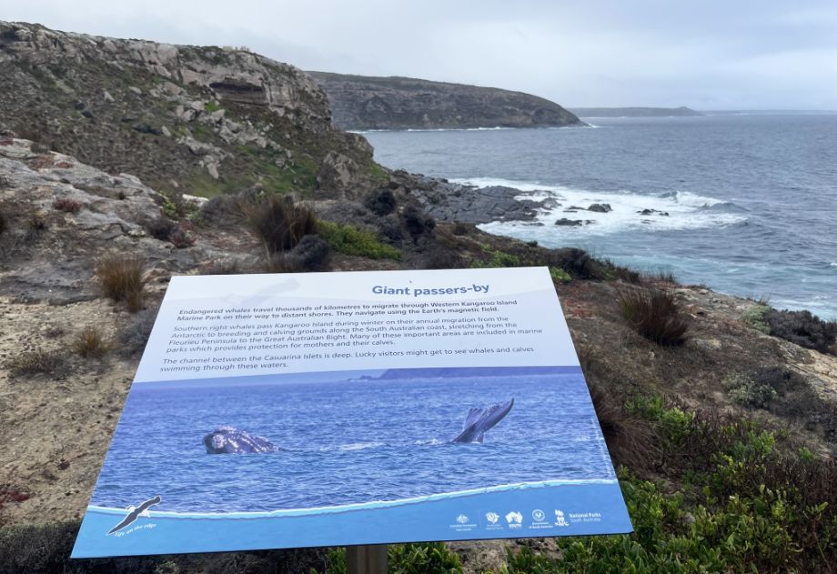
The sign is specifically calling attention to the incredible journey of the endangered Southern Right Whale (Eubalaena australis), and refers to the annual, massive migration these whales undertake, covering thousands of miles. These whales travel from the rich, frigid feeding grounds near Antarctica up to the warmer, shallower coastal waters of Australia. They migrate primarily to give birth and nurse their calves during the winter and early spring months (typically June through October). The shallow, sheltered bays along the south coast of Kangaroo Island provide a safer nursery environment for the vulnerable newborns. They were hunted almost to extinction during the whaling era. Although their numbers are slowly recovering, they remain highly vulnerable. Their migration route brings them right past the headlands and lookouts of Flinders Chase, making them the most impressive of all the "passers-by" in this wild part of the world.
We are now going down the stairs and at the bottom there is another lookout area with an infinite view of the Southern Ocean.
 |
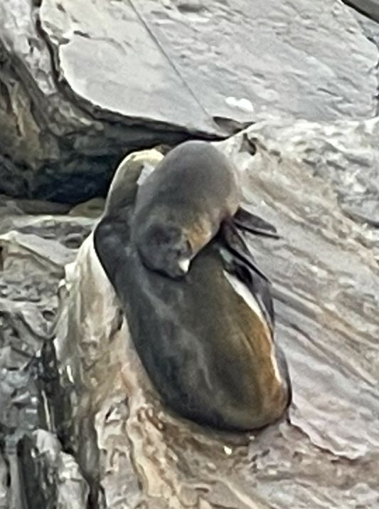 |
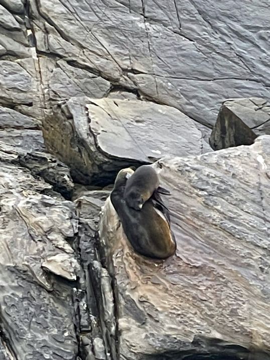
I looked down and sure enough, I could see a few dark shapes scattered across the rocks, blending almost perfectly with the wet stone. A mother seal and her baby resting comfortably on the rocks below. They are so cute together.
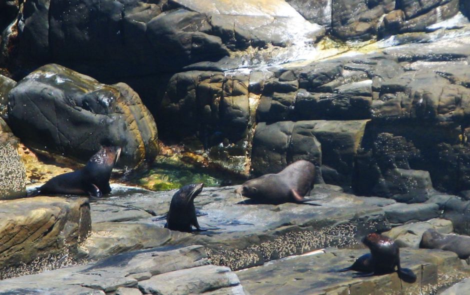
Nearby, plenty of seals are roaming around.
Because we are lower down, the thunder of the waves crashing into the shore is significantly louder and more dramatic.
Crashing waves.
How beautiful is this scenery?
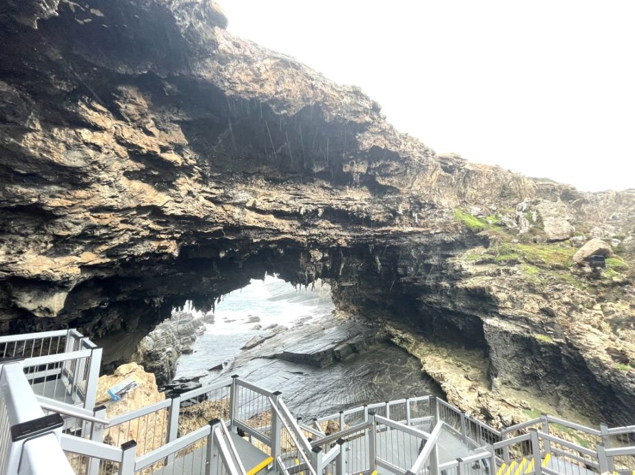
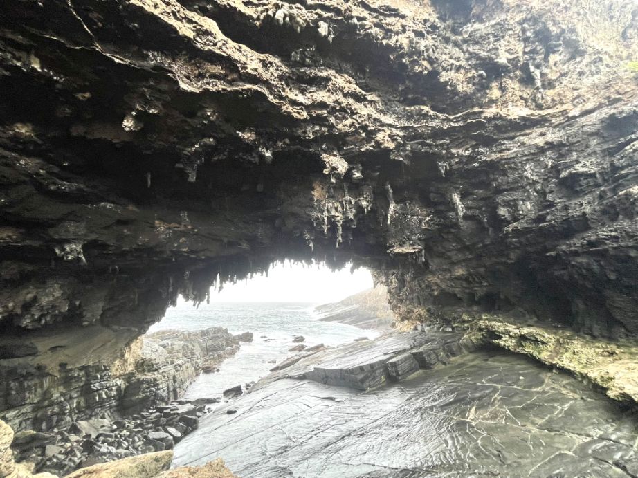
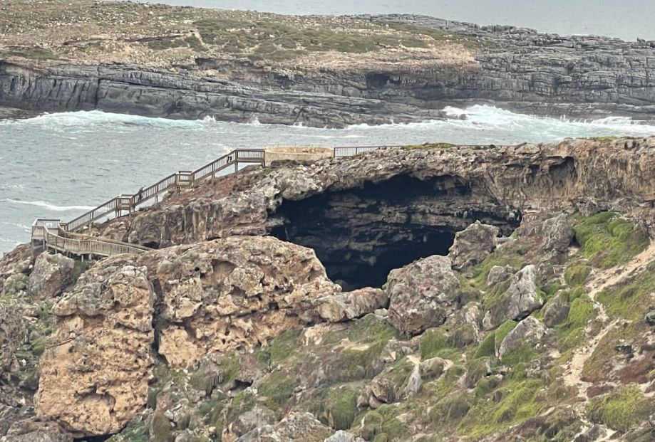
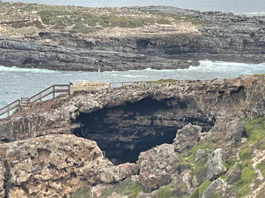
We finally arrived at the grand finale of the walk and in front of us is the famous Admirals Arch, a natural rock arch created by amazing forces of nature. The arch is sculpted by weathering and erosion from the sea over thousands of years. The arch is formed from softer limestone layers that sit above the ancient granite base (the same granite as the Remarkable Rocks). This limestone is vulnerable to chemical erosion by salt and mechanical erosion by waves
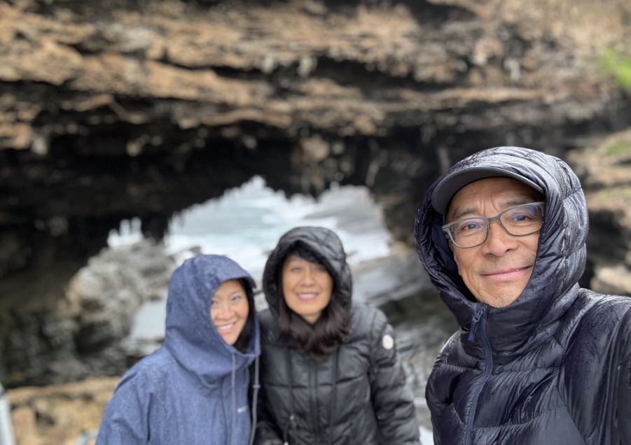
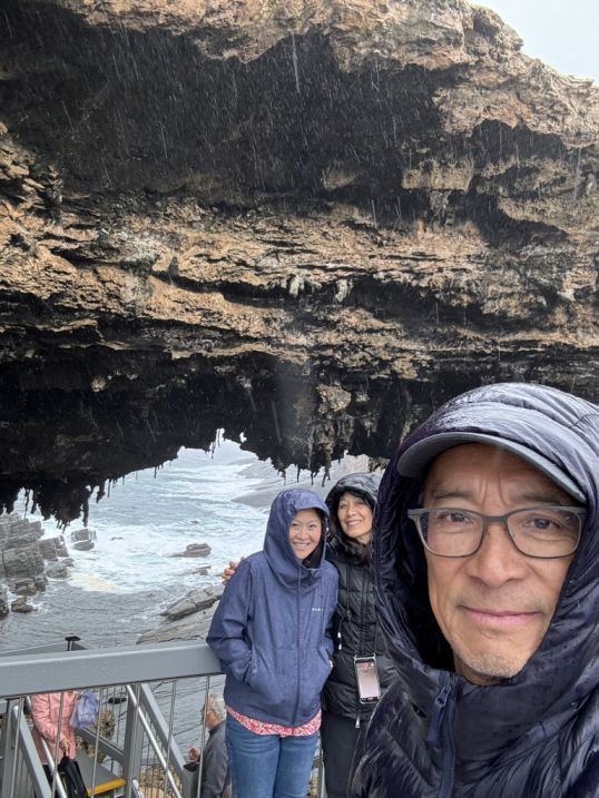
By the time we got to the Admiral's Arch it was raining, so all of us had to pull our hoods up.
 |
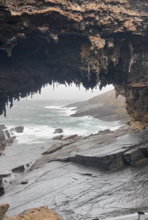 |
Despite the rain, Admirals Arch feels alive, raw, ancient, and untamed, a reminder of the relentless power that shapes Kangaroo Island’s coast. Notice the incredible limestone stalactites hanging from the roof of the arch. The roof of the arch is textured with smooth, drip-fed limestone stalactites, a rare feature in a sea cave environment, adding to its cathedral-like appearance
Admirals Arch was originally part of a sea cave formed in the rugged cliffs of Cape du Couedic. Over millennia, relentless erosion carved out the cave, and the roof eventually collapsed, leaving behind the striking natural arch you see today. It’s named “Admirals Arch” in homage to the many naval officers and ships that once navigated the waters around Kangaroo Island, a nod to the island’s maritime heritage.
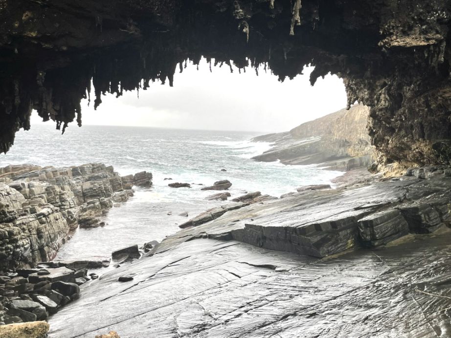
Through the opening, you can see waves surging through the rocks, foaming white against the basalt cliffs. Hanging from the roof of the arch are stalactites, glistening like glass in the rain. For thousands of years, the pounding surf and wave action have attacked a section of the cliff, gradually wearing away the rock. This created a sea cave which eventually eroded through, leaving behind the spectacular, high archway and grotto you see today. The rocky platform beneath the Arch and the surrounding ledges provide essential shelter from the powerful winds and high summer temperatures.
We are now done with the visit and going back to the parking lot.
The coastline is rugged but so beautiful!
As we walked back to the parking lot, we looked back to capture a panoramic view of the coastline, and seeing the entire Admiral's Arch headland clearly in the distance.
From this vantage point, the arch appeared as a massive rocky mountain with a hole in the center, its scale emphasized by the delicate wooden visitor pathway visible along its extremity. This final, broad view perfectly framed the entire wave-carved monument against the ocean.
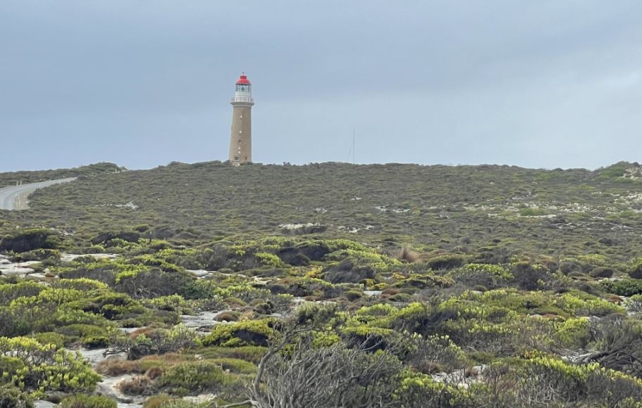
The Cape du Couedic Lighthouse, was built and completed in 1909, built from locally quarried stone, to guide ships through these perilous waters, which were notorious for wrecks before its construction. The construction was a massive logistical challenge in such a remote location. This lighthouse is incredibly significant because it stands as a testament to the difficult and often tragic maritime history of Kangaroo Island.
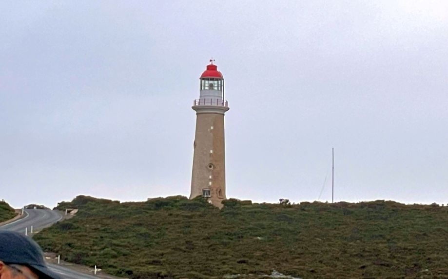
This coastline, facing the full force of the Southern Ocean, was notorious for shipwrecks in the 19th century due to strong currents, unpredictable weather, and hidden reefs. The lighthouse was absolutely vital for preventing disasters. For decades, the lighthouse was staffed by keepers and their families, living in relative isolation in the keepers' cottages nearby. Their job was relentlessly focused on maintaining the light, which was originally fueled by vaporized kerosene. It was automated in the 1970s, but the original tower and the keepers' cottages (which are often available for visitor accommodation) remain today, preserving that fascinating chapter of the island's past.
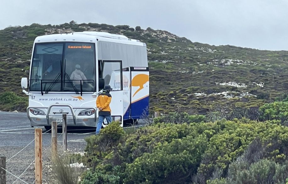
Here is our bus, waiting for all of us to take us into our next stop.
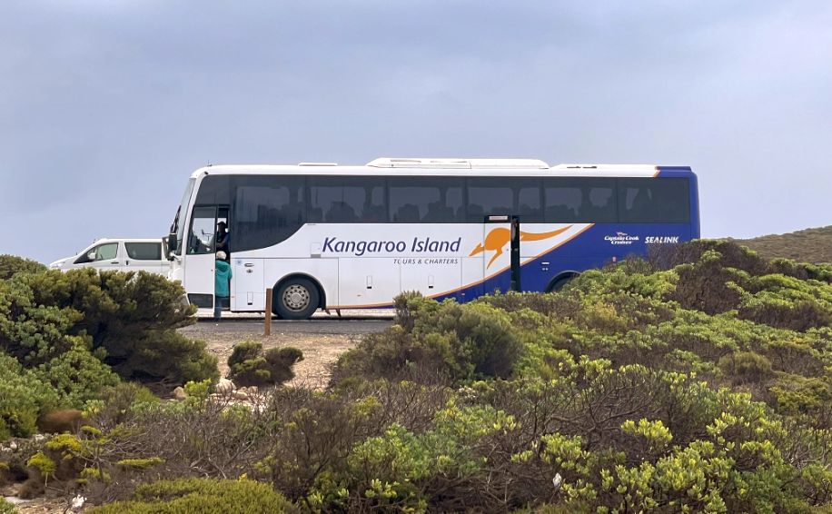
This bus is quite big and very comfortable.
NEXT... Kangaroo Island Wildlife Park