6 days Tasmania, Australia- 5/11- 5/16/2024
5 day tour of Tasmania
Day 5 of 5 - Wineglass bay-5/16/2024
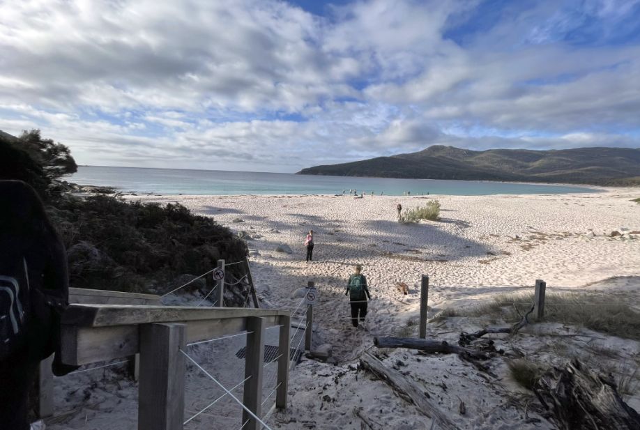
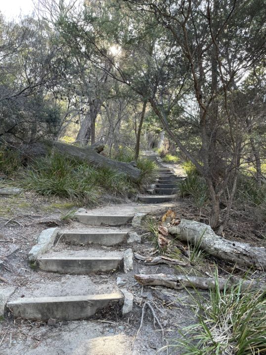
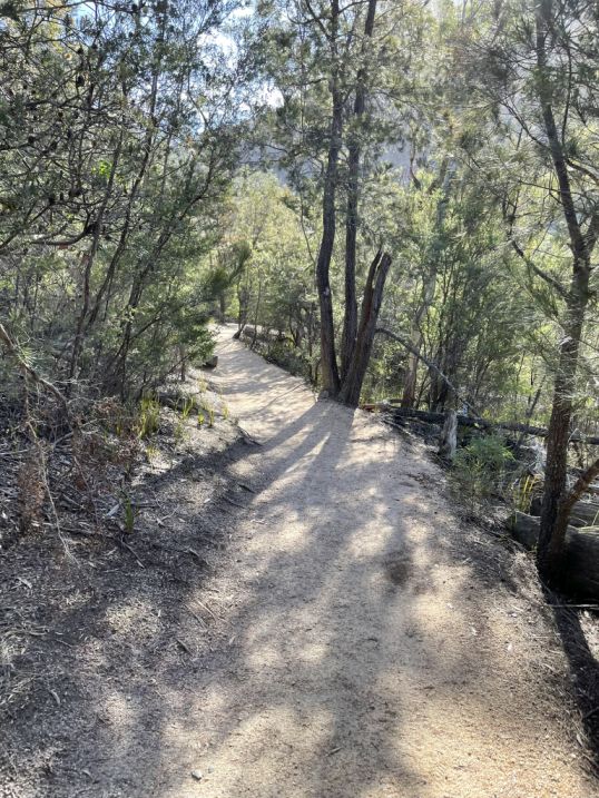
As we continued our descent, the trail turned into a long stretch of wooden stairs winding down toward Wineglass beach and Wineglass Bay.
The stairs were carefully built between granite rocks and clusters of dry coastal trees, following the natural slope of the hill.
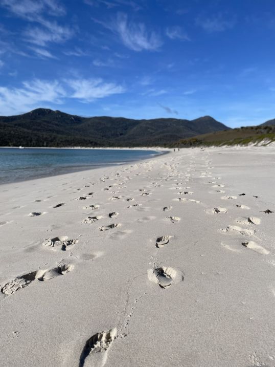
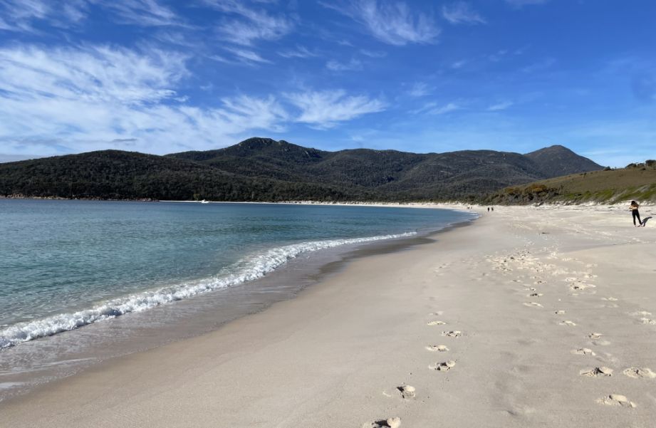
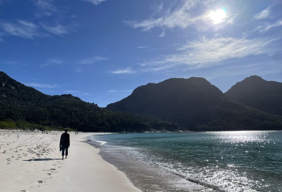
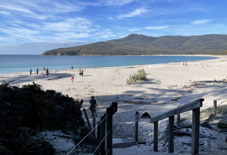
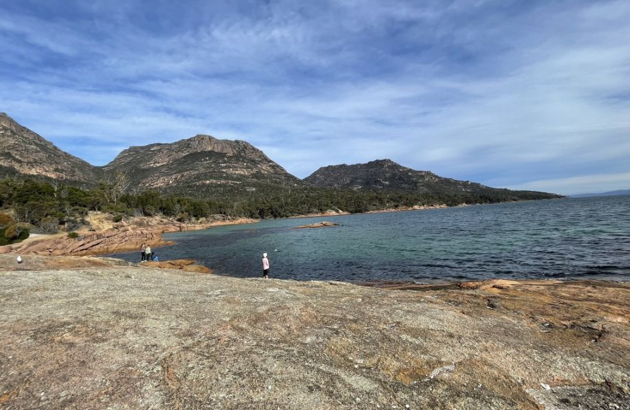
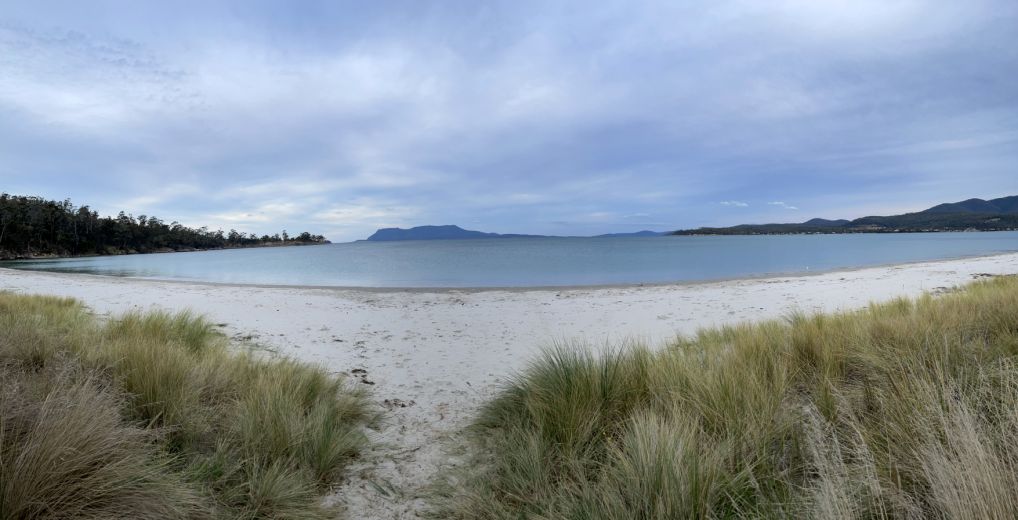
As we finally stepped onto the soft, white sand of Wineglass Bay, the view opened up in all its beauty.
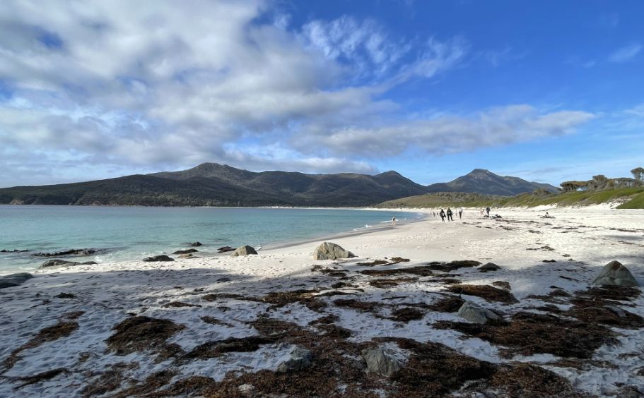
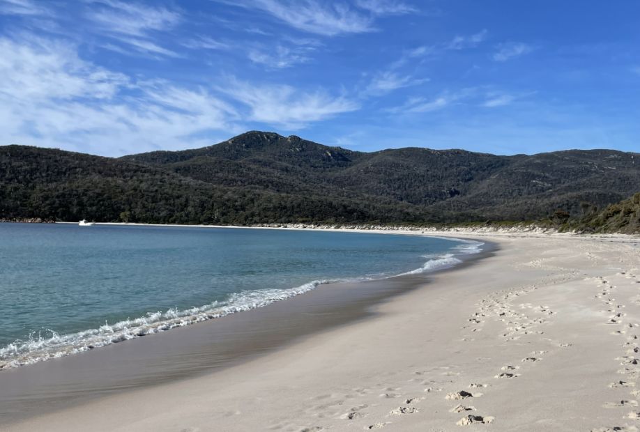
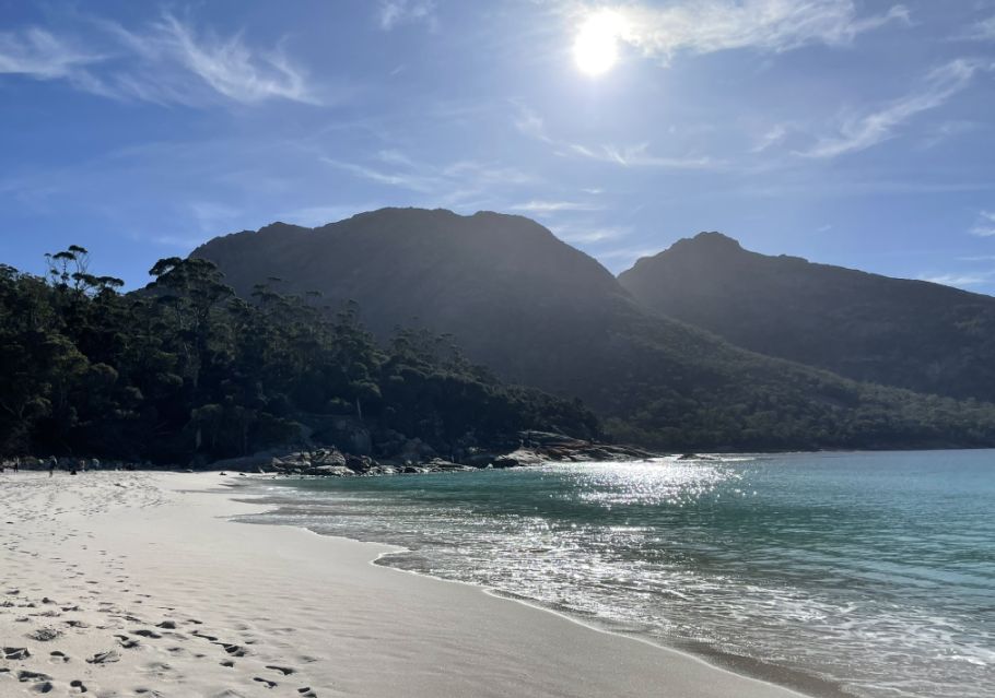
The curve of the bay stretched gracefully from one end to the other, perfectly framed by the Hazards Mountains rising in the distance. The water shimmered in shades of turquoise and deep blue, reflecting the light of the sun that peeked between drifting clouds.
We were lucky that the sun came out, and the weather was perfect for a day on the beach.
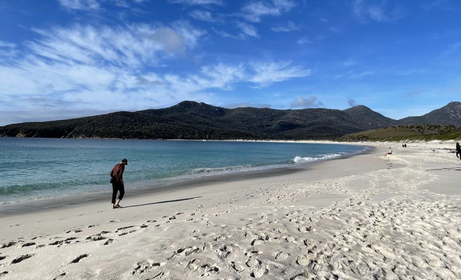
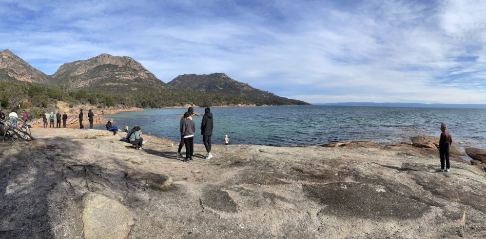
The sandy beach of Wineglass Bay is one of Tasmania’s most iconic and photographed spots, a breathtaking stretch of pure, white sand curving in a perfect arc between two rocky headlands.
Here we are walking to the right (toward the eastern end of the bay), the distant peaks you’re seeing are Mount Graham and Mount Freycinet. These belong to the southern part of the Freycinet Peninsula and separate Wineglass Bay from the remote, rugged coastline facing the Tasman Sea.
The sand here is incredibly fine and soft, almost powdery underfoot, and it glows almost white against the brilliant turquoise water of the bay.
Here you can also see the peaks of Mount Graham and Mount Freycinet.
If paradise exit, I would imagine it would look like this place.
 |
 |
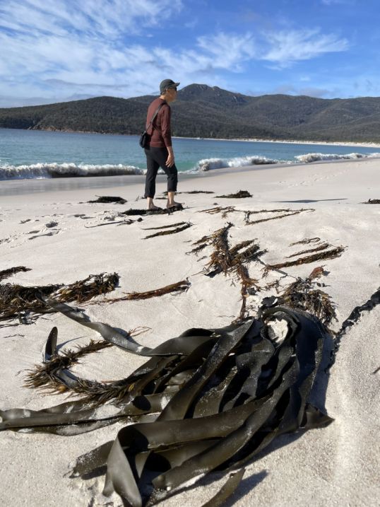
As we walked along the sandy shore of Wineglass Bay, I noticed patches of sea algae scattered near the water’s edge, delicate strands of green and brown tangled together, glistening under the sunlight. Some had been washed ashore by the gentle waves. The algae added a touch of texture and color to the otherwise pristine white beach, a small reminder of the rich marine life that thrives just beyond the shoreline.
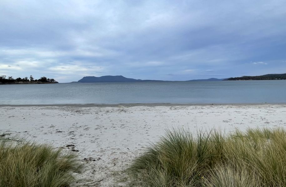
Behind the beach, dense coastal forest and the granite slopes of the Hazards Mountains rise sharply, creating a dramatic backdrop that contrasts beautifully with the smooth, gentle curve of the shore.
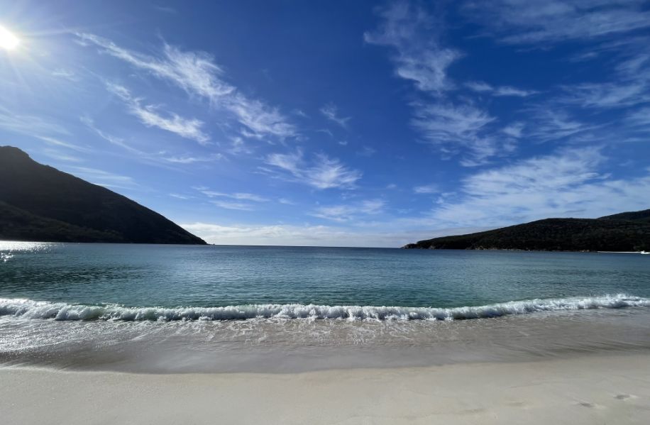
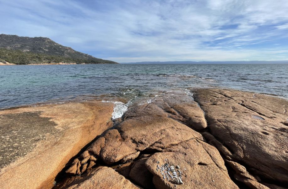
Because the bay faces the Tasman Sea, the waves are often calm and steady, giving the place a quiet, remote feel.
There are no buildings, roads, or signs of development, just nature at its most pristine. It’s the kind of beach that feels almost untouched, where the only sounds are the waves, the wind, and the occasional call of seabirds circling above.
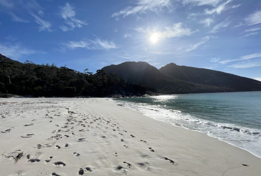
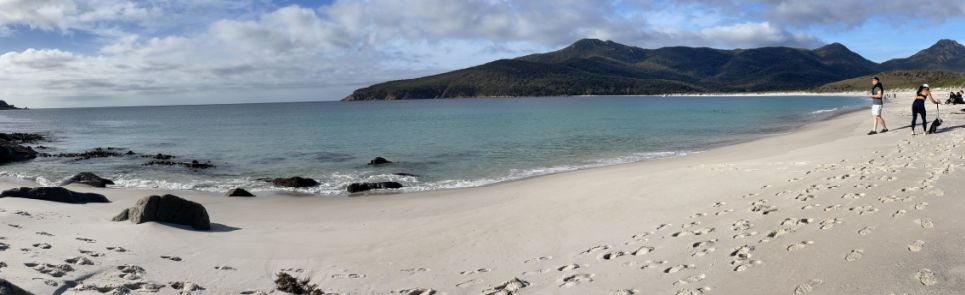
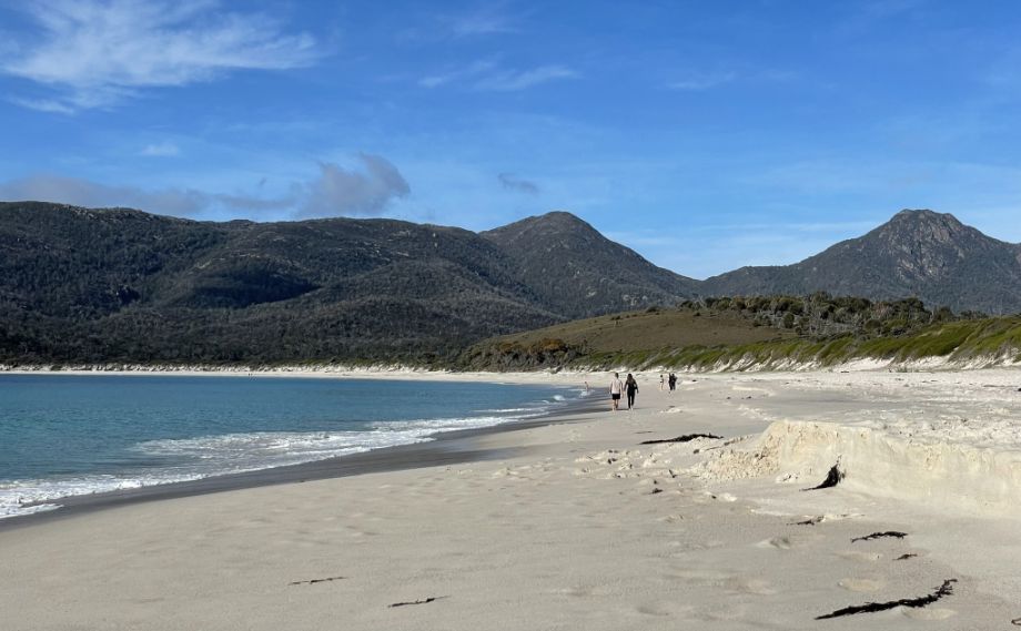
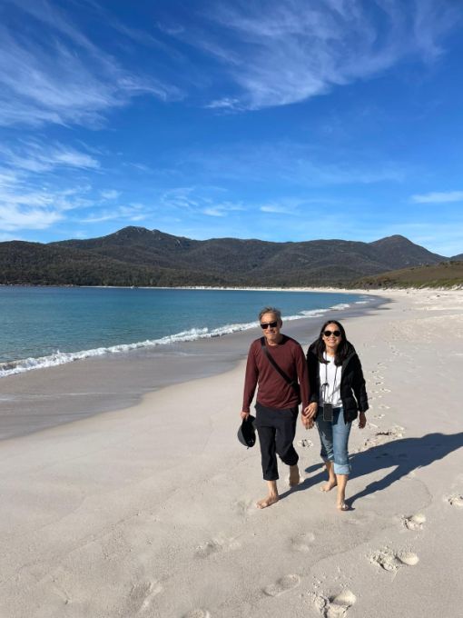
We are now going to left (toward the western end of the beach), the mountains you see rising above the coastline are Mount Amos and Mount Dove, which are part of the Hazards Range.
These granite peaks are famous for their pink hue at sunrise and sunset, and they form the dramatic backdrop we saw earlier from the lookout.
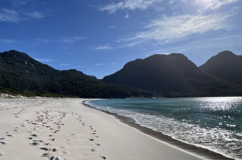
The beach stretches for about a mile, offering plenty of space to wander, rest, or simply take in the stunning surroundings.
 |
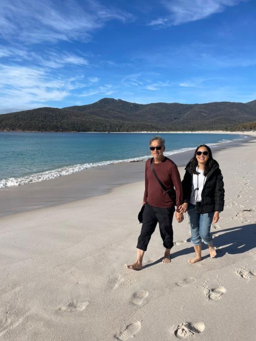 |
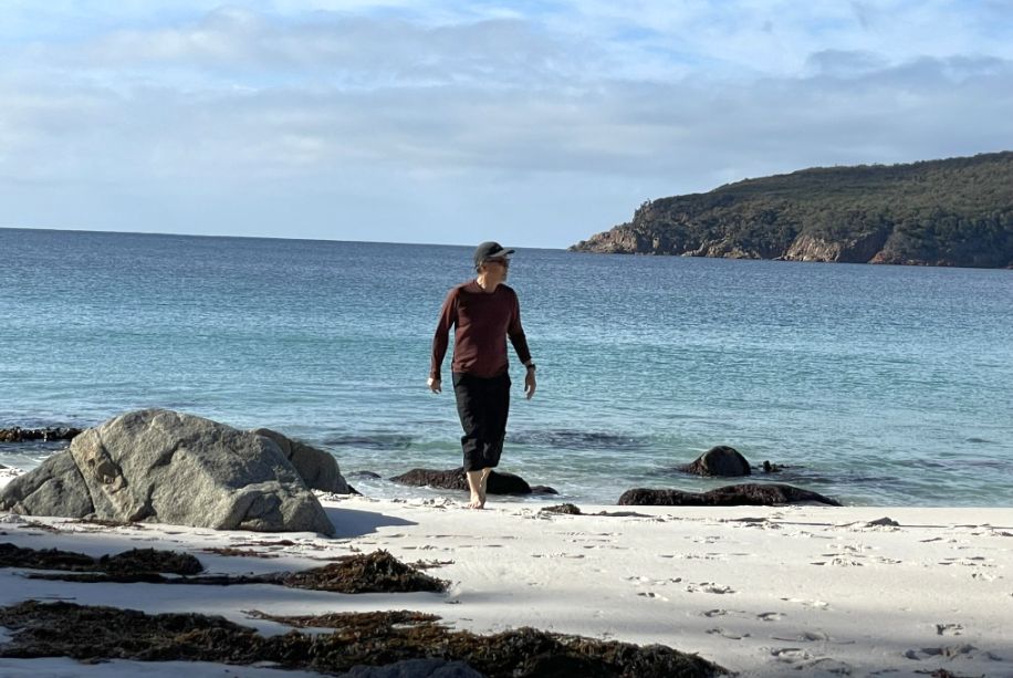
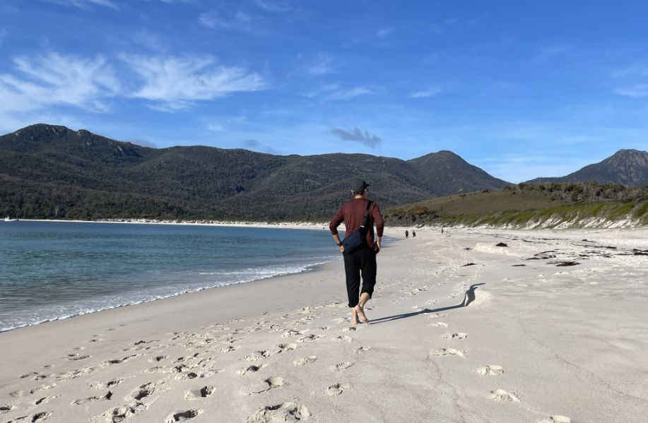
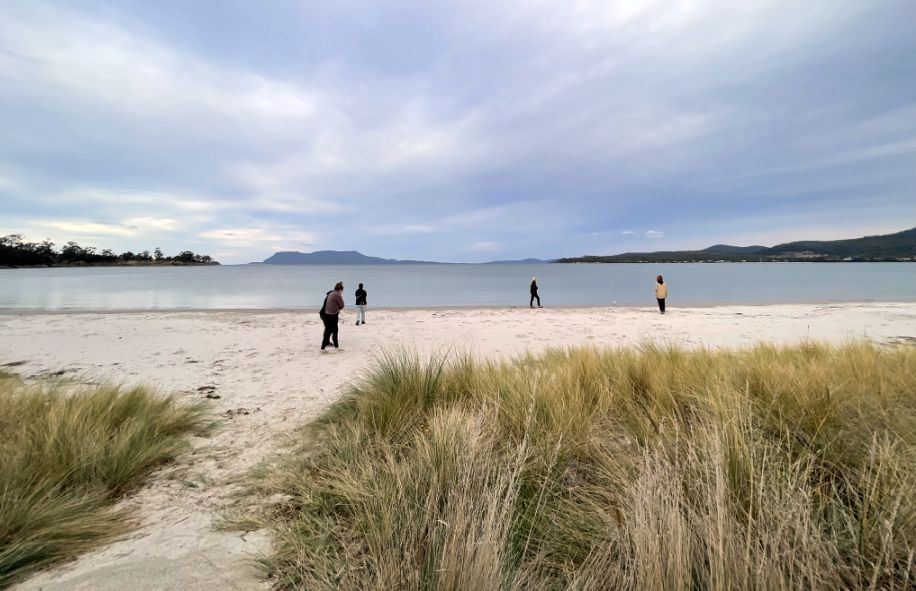
Charlotte took a few pictures of us walking on the beach.
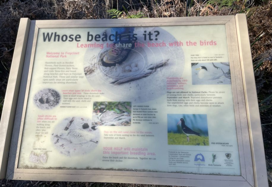
A panel informing visitors to learn to share the beach with birds. Shorebires such as Hoodre, Plovers etc.. make nest in small scarping in the dry sand. their eggs and chicks blend in well with the sand, shells and seawwed, and people should not disturb them so they can stay with their eggs and chicks.
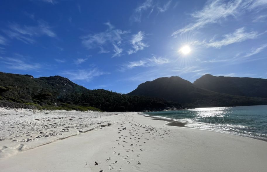
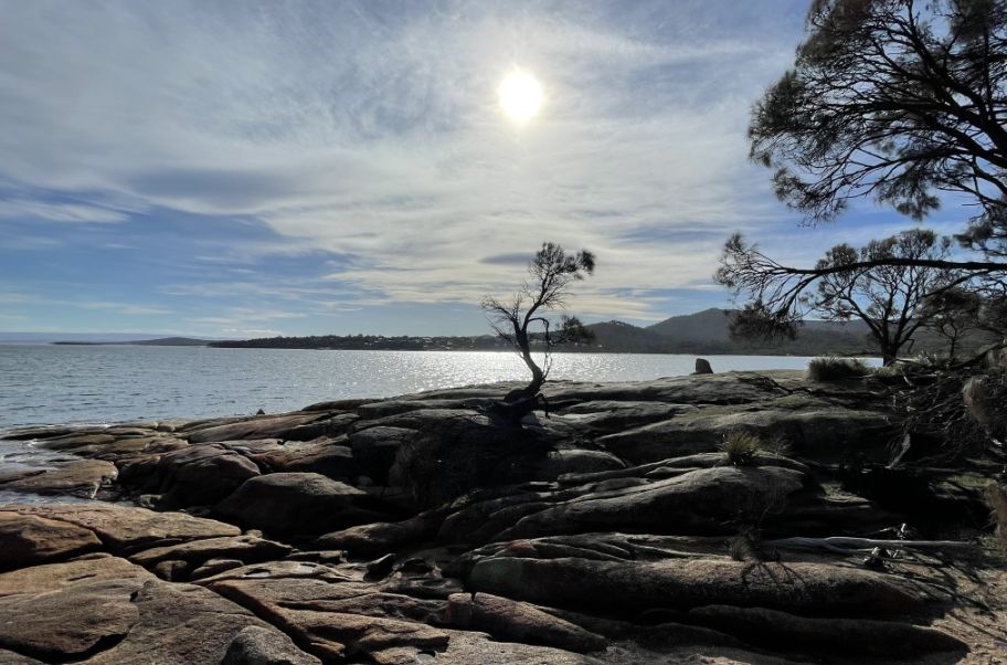
One last view of the bay before we taking off.
 |
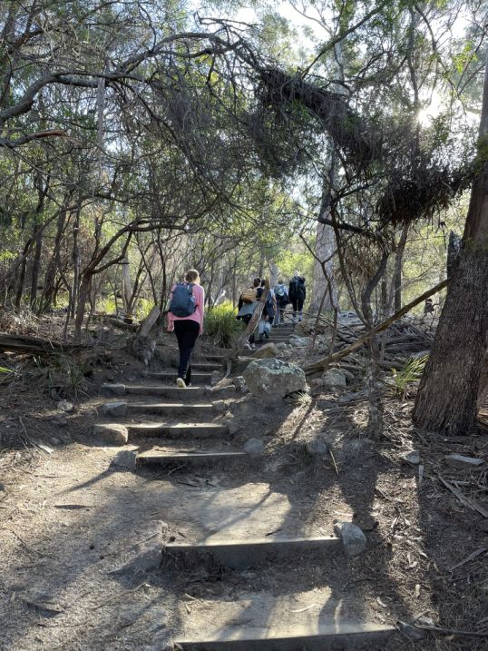 |
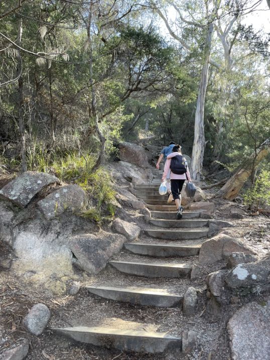
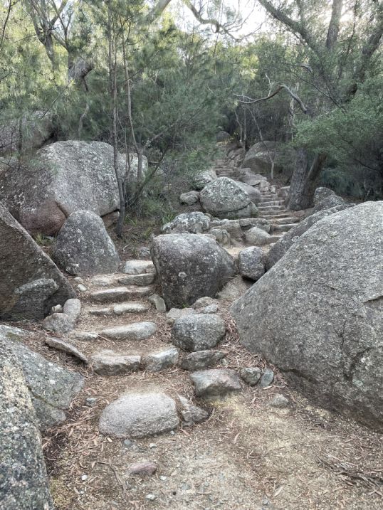
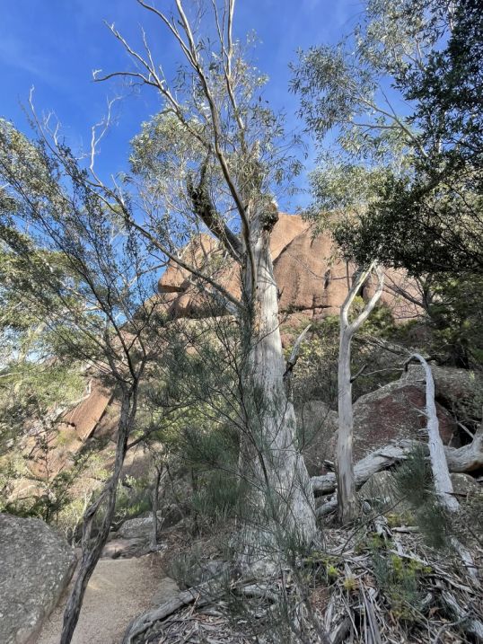
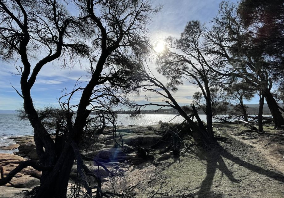
Leaving Wineglass Bay Beach, the trail back up is a real climb, a steady, heart-pumping ascent of hundreds of wooden and stone steps winding through the forest.
The path is well-maintained but steep, rising quickly from the sand into the dry, rocky bushland above.
 |
 |
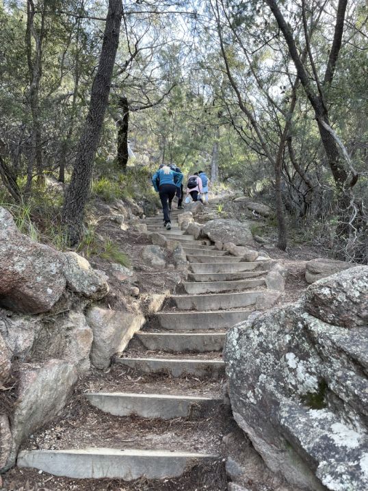
Seems like the stairs are endless...
 |
 |
Though it’s a demanding walk, every step upward feels rewarding, a reminder of the effort it takes to reach and leave one of Tasmania’s most beautiful and remote beaches.
 |
 |
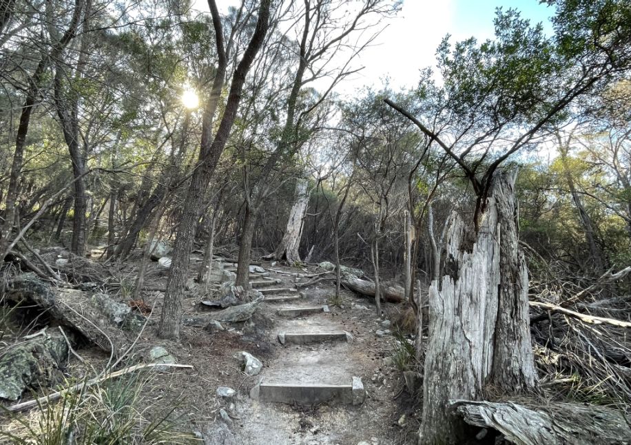
The stairs twist and turn through granite outcrops and tall eucalypts, with occasional breaks where we can catch our breath ,
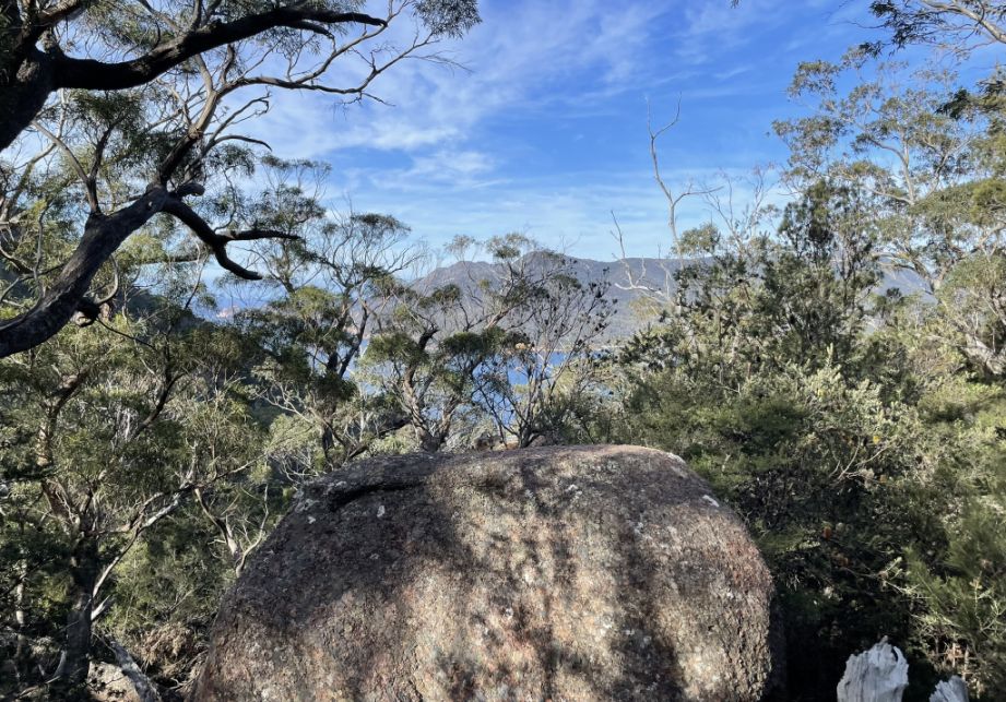
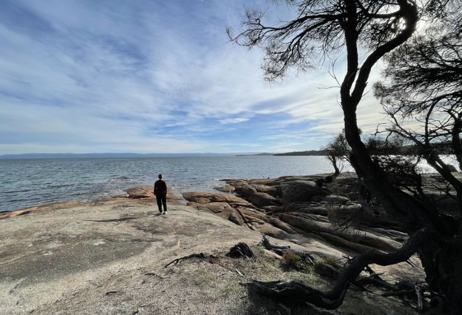
We are now above the bay and we get to take a glimpse back at the brilliant turquoise water below.
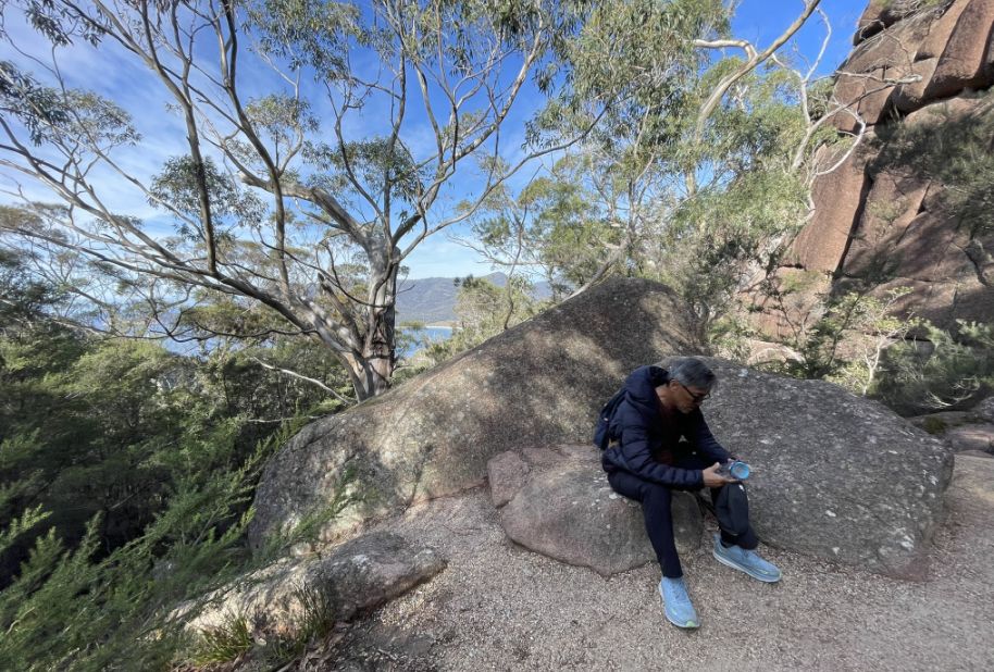
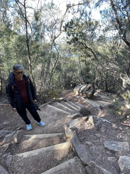
Hoa resting a bit after climbing so many steps.
 |
 |
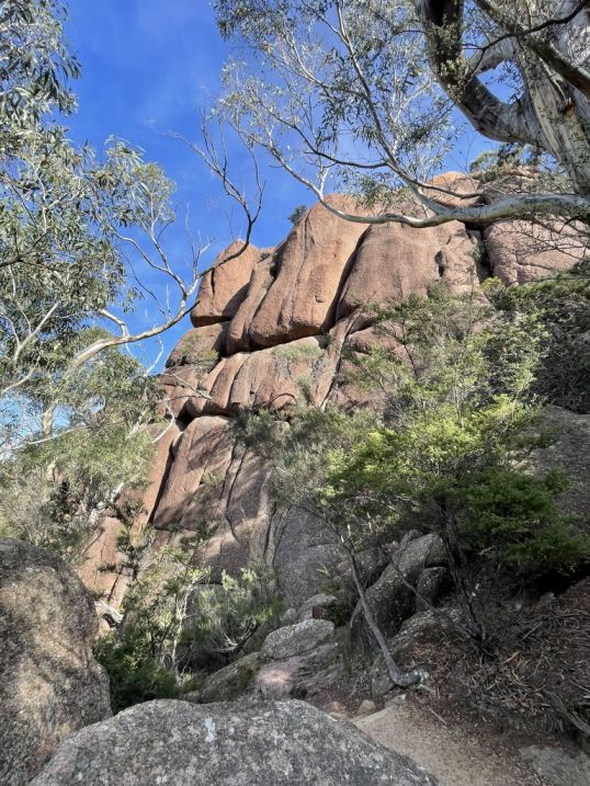
Huge boulders along the trail.
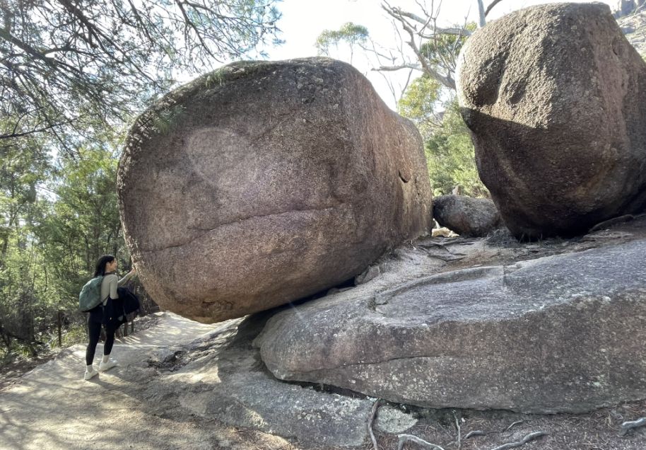
As we made our way up the trail, we passed by enormous granite boulders towering beside the path, these one are so massive they seemed almost impossibly balanced. One in particular caught our eye, its bulk tilted precariously, with most of its weight resting on the narrow edge of another granite platform below. It looked as if a single push could send it rolling, yet it had likely sat there for thousands of years, unmoved by time or weather.
 |
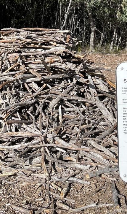 |
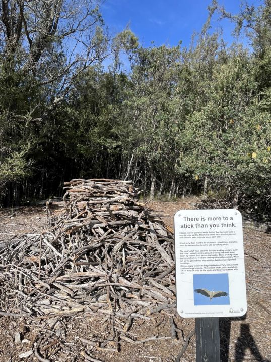
Along the trail, we came across a small interpretive sign that read, “There’s more to a stick than you think.” Curious, we paused to read. It explained how, in this seemingly dry and rugged landscape, even something as simple as a fallen stick or branch plays an important role in the ecosystem.
These sticks provide shelter for insects, lizards, and small mammals, helping to retain moisture and nutrients in the soil. As they slowly decompose, they return vital minerals to the earth, supporting the growth of new plants. What looks like a piece of dead wood is, in fact, part of a quiet cycle of life that keeps the bushland thriving. It was a lovely reminder that in Tasmania’s wild places, every detail, even a stick on the ground, has a story and a purpose.
![]()
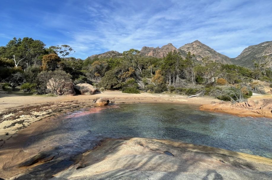
Honeymoon Bay
Honeymoon Bay is one of the most picturesque spots in Freycinet National Park, a peaceful little cove tucked between granite headlands not far from Coles Bay.
The bay is small and sheltered, with clear turquoise water lapping gently against a crescent of white sand and smooth pink granite rocks glowing in the sunlight.
The surrounding scenery is classic Freycinet with the Hazards Mountains rising in the background, their pinkish peaks reflecting beautifully in the calm water.
It’s a favorite place for picnics, swimming, and snorkeling, thanks to the bay’s shallow, tranquil waters and the vibrant marine life found just offshore.
What makes Honeymoon Bay so special is its quiet charm, it feels intimate and secluded, a perfect spot to relax after a long hike or simply sit on the warm rocks and watch the changing colors of the sky and sea.
Standing on the rocky shore overlooking Honeymoon Bay, the view below is striking.
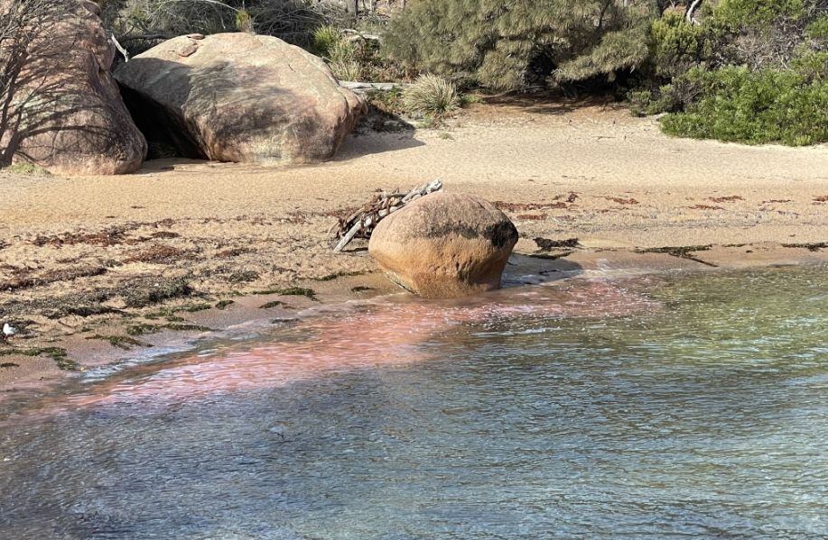
On the beach, a large rounded boulder sits near the water’s edge, its smooth surface catching the soft light. Just beside it, the shallow water shimmers with a pinkish hue. The pinkish hue in the water at Honeymoon Bay is not due to the water itself, but is a reflection of the peninsula's famous pink granite.
The crystal-clear water acts like a mirror, reflecting the rose-colored mineral orthoclase feldspar within the granite boulders and the surrounding cliffs of the Hazards Mountains, giving the bay its unique, beautiful rosy glow near the shore.
 |
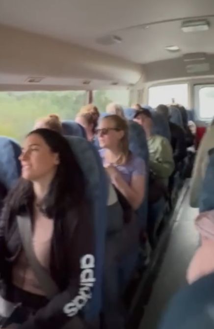 |
One of the most memorable moments of our trip was when Tom shared a story from his younger days in France. To make money, Tom used to sing on the steps of the Sacré-Cœur Basilica which is one of the best and most famous panoramic views of the entire city. At first, he sang for hours with little reward, until he discovered that when the Eiffel Tower lights came on (5 minutes at the beginning of every hour), the crowds would gather nearby. So one evening, as the lights began to sparkle, Tom started singing “Hallelujah”, people gathered around him, hugged each other, and listened in awe of the power of the song, and with the tower sparkling and glowing in the background. From then on, he only needed to sing for a few minutes, and earned more than he ever did in a full day.
Knowing that story, I couldn’t resist asking Tom to sing “Hallelujah” for us on the bus. He laughed and said it was the first time he had ever sung on a bus, but he agreed. As his voice filled the air, the whole group joined in, singing softly along with him. It was a beautiful, spontaneous moment, the perfect reflection of the bond we had built over the past five days, ending our Tasmanian adventure on a warm and heartfelt note.
![]()
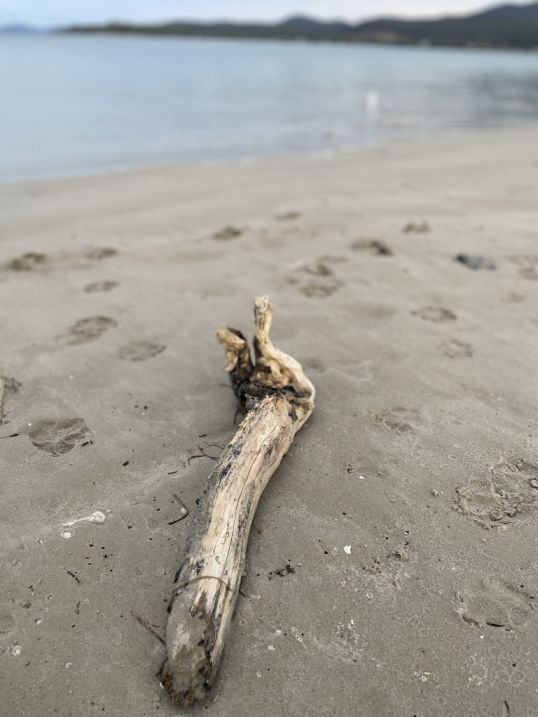
Raspins Beach is known for its beautiful, long stretch of white sand, and the water is often described as having stunning, clear colors. It is generally a calm, family-friendly beach, ideal for swimming and seaside relaxation.
The "Conservation Area" designation is particularly important because the northern end of the beach is a vital sandspit and bird sanctuary. This area is recognized as an Important Bird Area (IBA) and is a critical breeding site for threatened species, including the Fairy Tern, Red-capped Plover, and Hooded Plover.
This is an incredible spot that is so magical, calm, serene, at there are nobody there but our group.
 |
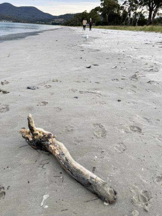 |
A dead branch of the beach.
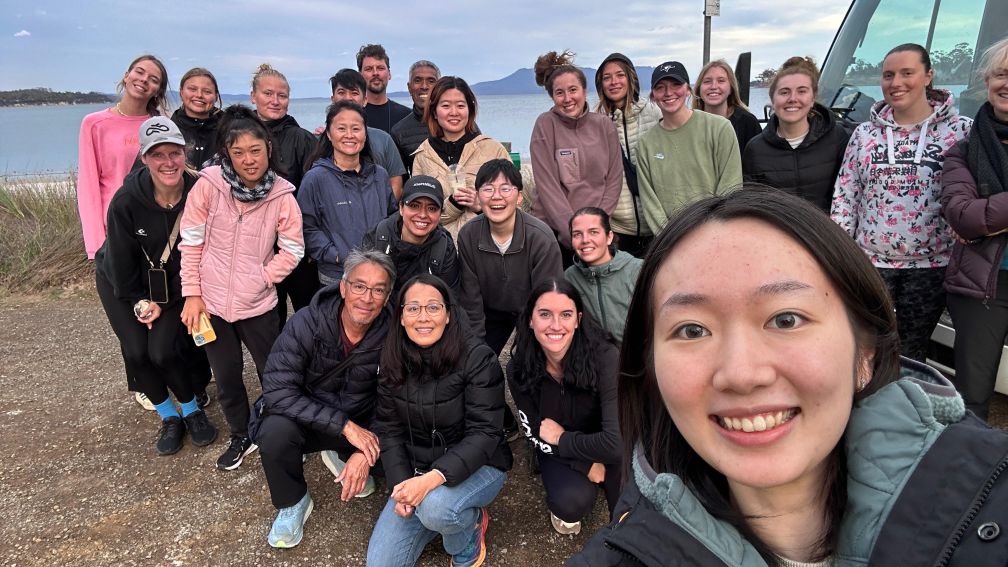
The last selfie with the whole group.
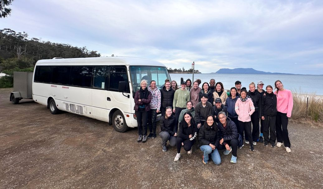
Hoa wanted a picture with the whole group and the bus and Tom knew exactly the location for the final picture with the whole group standing next to the bus.
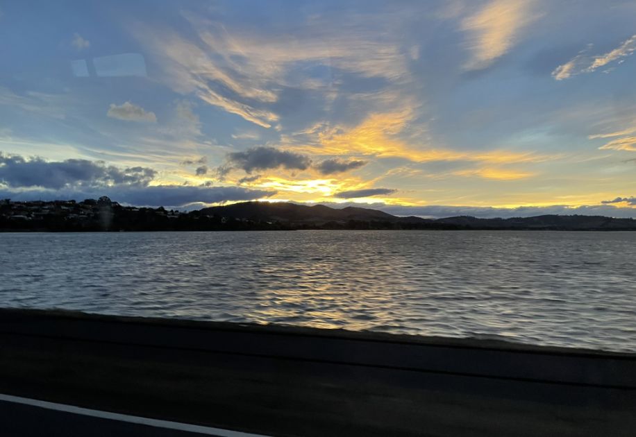
On our way back to Hobart along the A3, the bus crossed the Orielton Lagoon. The sun was beginning to set, casting a soft golden glow over the landscape. Through the windows, we could see the mountains in the distance, their slopes bathed in warm light, while gentle clouds drifted above them.
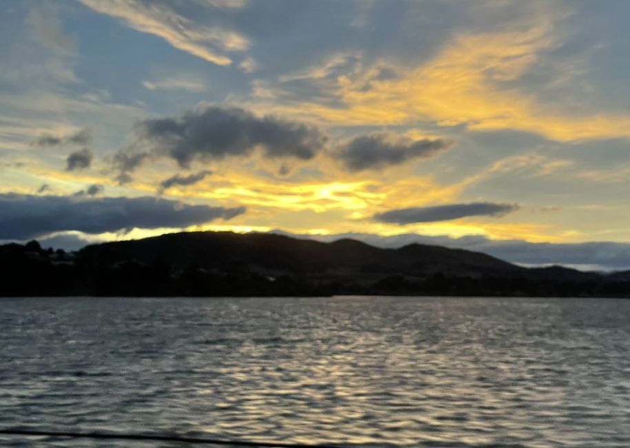
The reflection of the sky shimmered on the still water of the lagoon, creating a peaceful, almost dreamlike scene. It was the perfect ending to our journey, a calm, golden farewell to five unforgettable days in Tasmania.
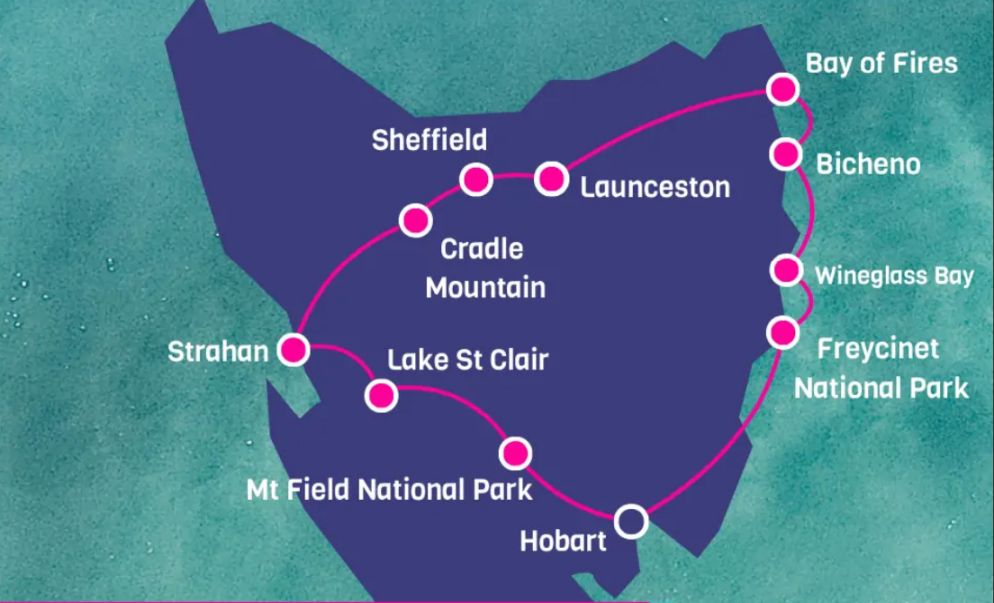
Tom drove about 750 miles around the island of Tasmania in 5 days and these are all the stops we made along the way.
Our five-day bus tour of Tasmania has come to an end, and what an incredible journey it has been. Our group of 24 travelers from 14 different countries came together like old friends, sharing laughter, stories, and unforgettable moments along the way. Leading us through it all was Tom, our wonderful and passionate tour guide, whose deep knowledge, humor, and enthusiasm made every stop come alive. He shared insights about Tasmania’s landscapes, wildlife, and history that turned each day into an adventure.
Even Tom admitted that it’s rare for a group to connect as closely as ours did, from the very first day, there was an easy warmth and camaraderie that made the trip feel special. We began our journey in Hobart, traveling west to the misty forests of Mount Field National Park and the serene beauty of Lake St. Clair, before heading to the old mining town of Queenstown. From there, we explored the alpine wonders of Cradle Mountain, the glowing shores of the Bay of Fires, the seaside charm of Bicheno, and the sweeping coastal scenery of Wineglass Bay and Freycinet National Park before finally returning to Hobart.
In Bicheno, the group enjoyed a wonderful evening at the Lobster Shack, where the atmosphere was full of laughter, good food, and cheerful conversation. That night turned extra special when we discovered it was Eifie’s birthday, and we all joined in to sing "Happy Birthday", raising our glasses in a joyful, impromptu celebration that brought even more warmth to an already unforgettable night.
Over the course of 750 miles, we saw Tasmania’s wild heart, from rainforest to rocky coast, and formed friendships that made every mile worthwhile. It was a journey filled with breathtaking views, shared laughter, and the kind of memories that stay with you long after the road ends.
NEXT... Adelaide