6 days in Tasmania, Australia- 5/11- 5/16/2024
5 day tour of Tasmania
Day 5 of 5 - Freycinet National Park-5/16/2024
Freycinet National Park, located on Tasmania’s East coast, is one of the island’s most stunning and iconic natural reserves. It’s famous for its dramatic granite mountains, secluded beaches, and crystal-clear waters. The park is home to the Hazards Range, whose pink granite peaks rise sharply from the sea, as well as the world-renowned Wineglass Bay, often listed among the most beautiful beaches in the world. Freycinet is rich in both wildlife and history, it’s a place where wallabies, sea birds, and dolphins are often seen, and where the Palawa people lived for thousands of years before European arrival.
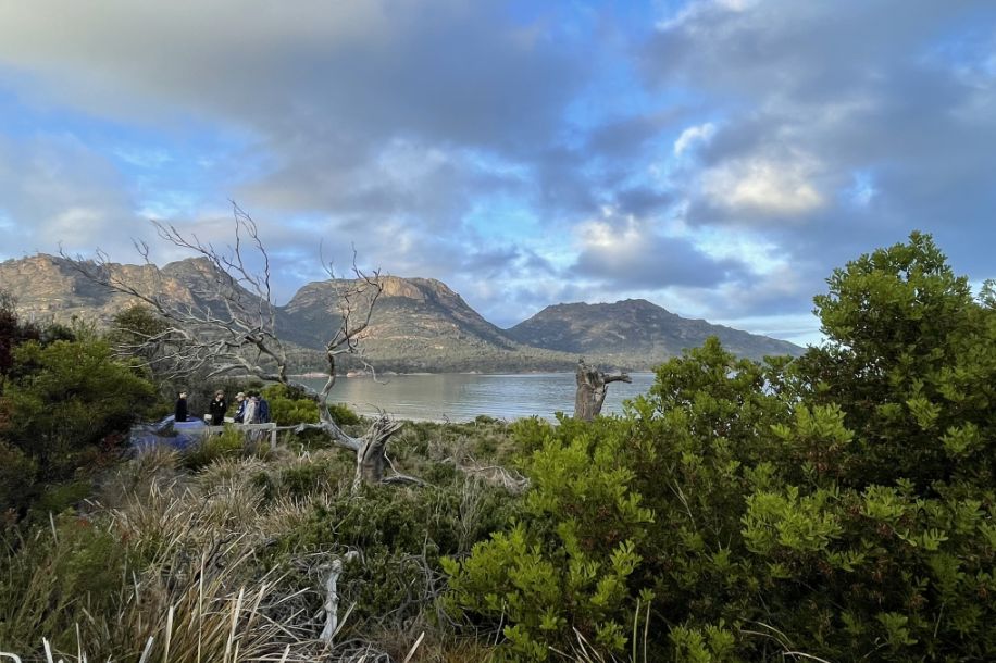
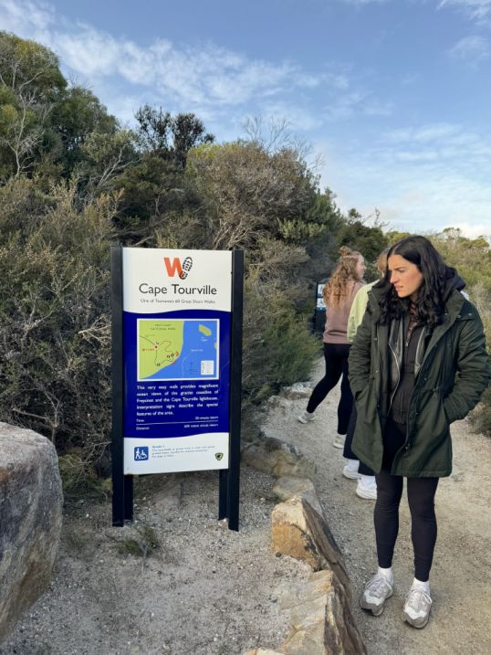
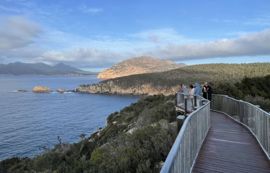
Our first stop is Cape Tourville that sits on the northeastern edge of the park and offers one of the most breathtaking views along the Tasmanian coast. A short, easy boardwalk trail leads to the Cape Tourville Lighthouse, winding through coastal heathland and offering panoramic views over the Tasman Sea, Sleepy Bay, and The Nuggets, a group of small rocky islets just offshore.
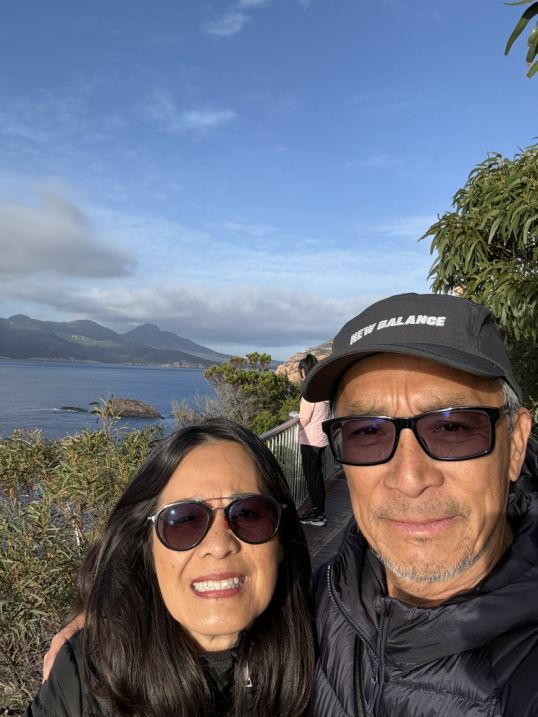
Near the visitor areas and trailheads, you can see Coles Bay, a picturesque inlet that serves as the main gateway to the park. After parking the bus, the view opens up beautifully. The calm waters of Coles Bay, framed by dense bushland and coastal trees. In the distance rise the three distinctive granite peaks of the Hazards Mountains: Mayson, Amos, and Dove with their pinkish tones glowing softly under the daylight.
It’s a stunning scene that captures everything special about Freycinet, where wild mountains meet tranquil sea, and every view looks like a painting, and we haven't walk in the Freycinet National park yet.
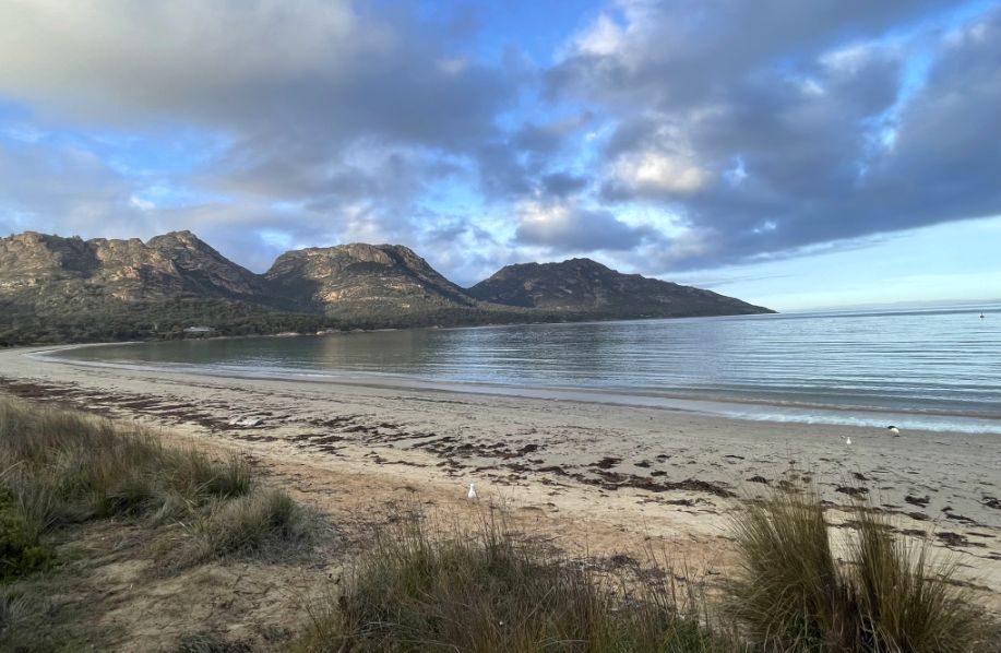
We are walking past the beautiful Coles Bay, nestled directly beneath the imposing, pink-hued granite mountains known as The Hazards range, which rise dramatically from the water. This incredible contrast of rugged mountains and serene water is one of its most defining features.
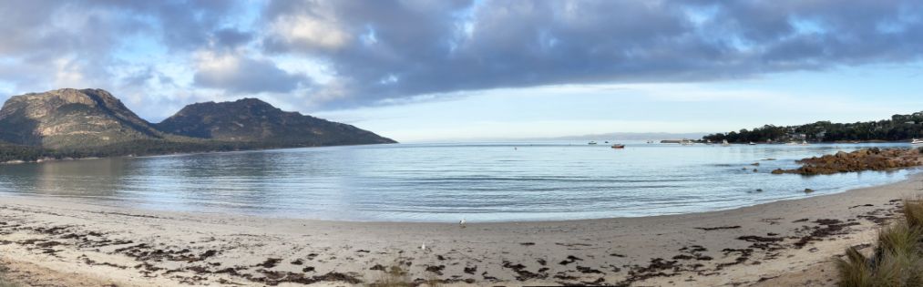
Coles Bay sits on the edge of the calm waters of Great Oyster Bay, offering crystal-clear swimming, fishing, sea kayaking, and boating opportunities.
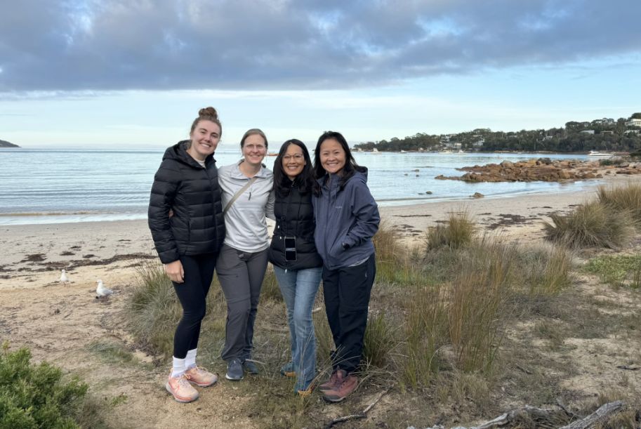
Rebekka, Miri, Me, and Lisa standing near the shore of Coles Bay. The beaches here are a prime example of a protected coastal wilderness. Because the area is part of a National Park, the environment is strictly conserved, resulting in an incredibly pristine and wild appearance. The native coastal scrub and bushes are preserved right up to the sand to maintain the natural ecosystem and prevent erosion. This protection is the reason why the water is famous for being so crystal clear and turquoise, and the sand, composed of fine quartz, is sparkling white and pure.
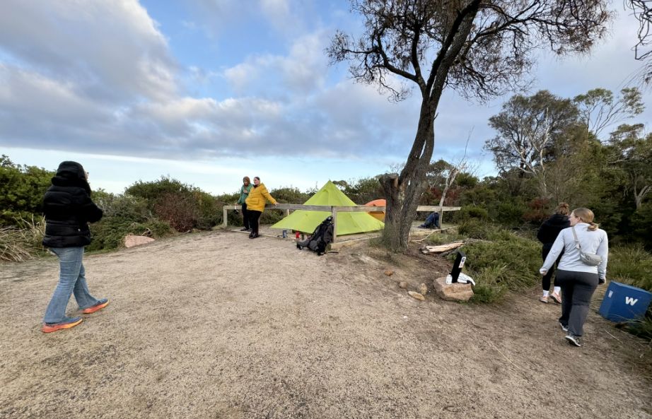
Along the way, we encountered people camping in a designated campgrounds located near the park entrance and Coles Bay. These spots are highly sought after because they offer beachfront camping right inside the park boundaries, a rare treat. Apparently people have to plan far in advance to win the ballot or they were lucky enough to get a booking and securing a fantastic base for exploring the park's trails.
 |
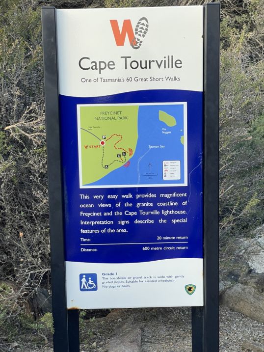 |
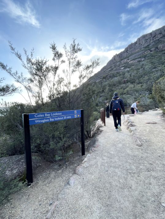
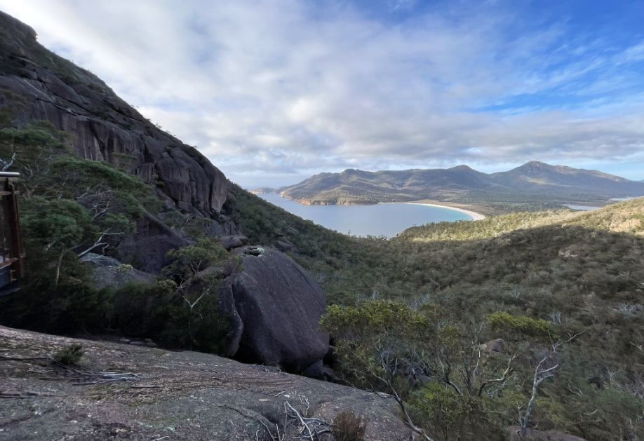
Cape Tourville is a highlight of Freycinet National Park, known for providing maximum views with minimal effort.
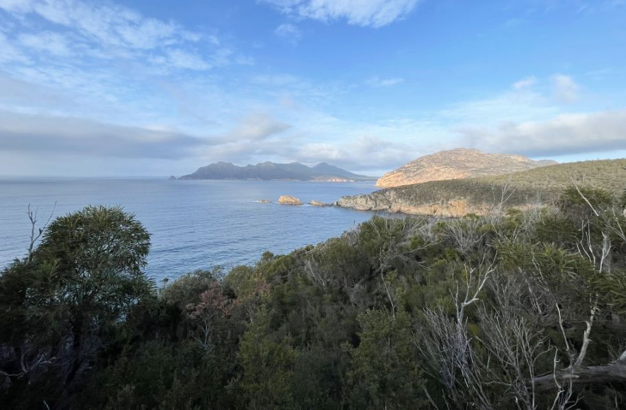
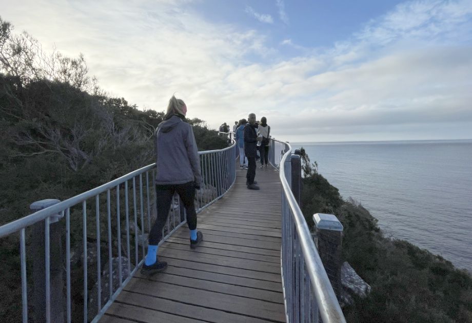
Standing on the elevated boardwalk of the Cape Tourville Circuit, the sheer scale of the landscape was breathtaking. As I looked along the coast, a majestic curtain of green trees tumbled down to the ocean, meeting a rugged shoreline, with the dramatic granite peaks of the Hazards mountain range proudly lining the distant horizon. The view truly captured the wild, untamed beauty of the Freycinet Peninsula.
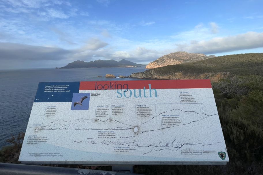
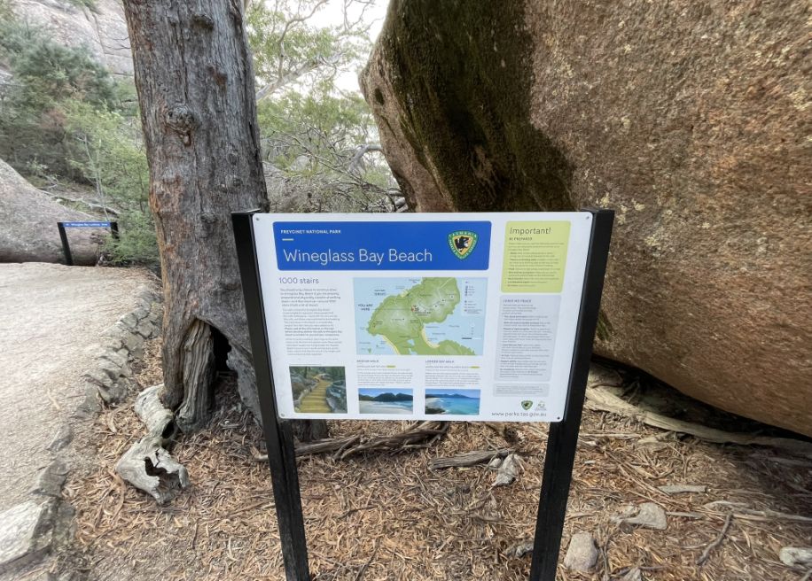
The panel tells us that we are now standing 328 ft. above sea level, and The Freycinet National Park extends southward for another 16 miles, and identifies other nearby features, such as Carp Bay and Sleepy Bay, and highlights the towering pink and grey granite peaks of the Hazards mountains (like Mount Graham and Mount Freycinet) that form the dramatic backbone of the peninsula.
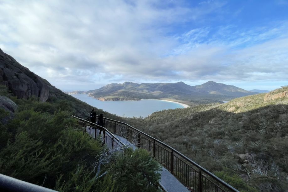
The board walk is about 0.4 miles in lenght, well-maintained, and mostly comprised of elevated boardwalk and compacted track. It is considered one of Tasmania's "60 Great Short Walks".
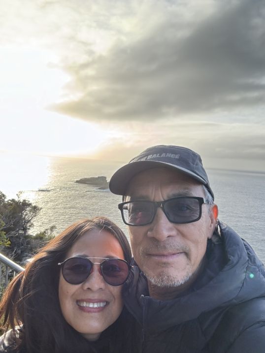
Walking the Cape Tourville pathway early in the morning, as the sun begins its ascent, is a truly magical experience.
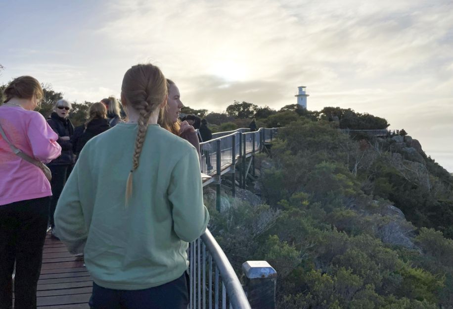
Just beyond the main lookout, we continued along the elevated boardwalk, and the path gracefully curved, momentarily dipping me underneath the dense, leafy canopy of the coastal trees before it opened up again to the dramatic cliffside views.
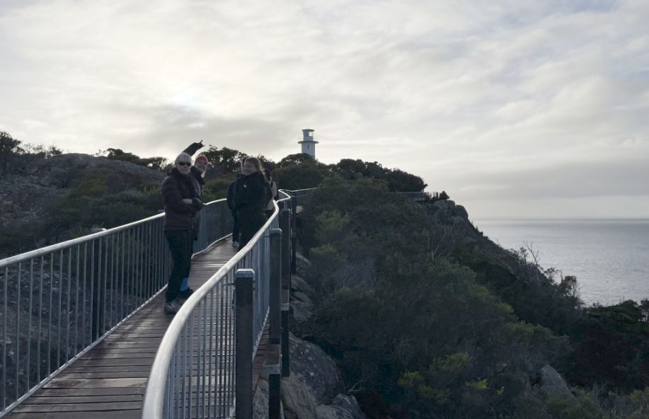
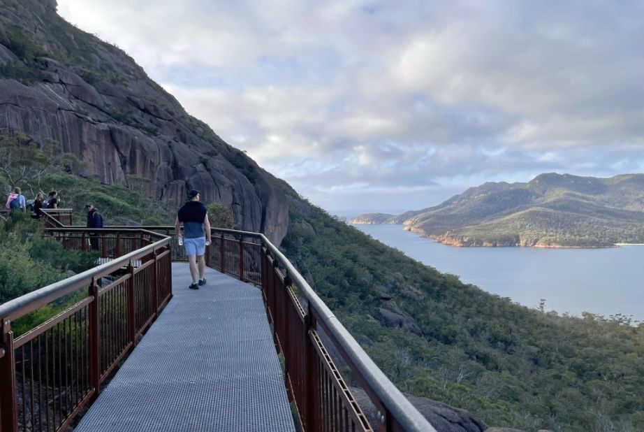
In the distance, the stark white cylindrical tower of the Cape Tourville Lighthouse, an elegant maritime beacon, could be seen peeking out above the rugged granite headland in the distance.
Then, turning back toward where we have been, the sight of the viewing platform itself was a spectacle, perched right at the cliff's edge where the rugged, tree-lined cliffs plunged dramatically down into the deep blue of the Tasman Sea.
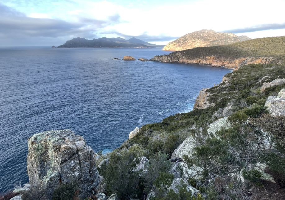
Peering over the safety rail of the lookout, the immediate view was a jagged tumble of rocky cliffs studded with clinging coastal trees, while the sweeping panorama to the south revealed the stunning, distant Hazards mountains tracing their magnificent line along the horizon.
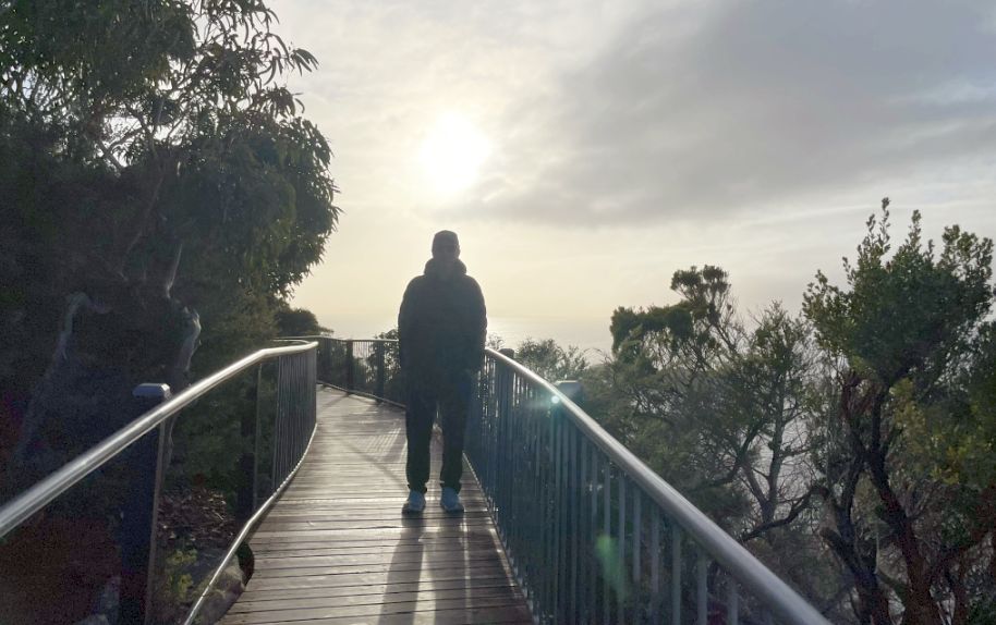
The morning sun, now midway up the sky, created a dramatic challenge for photography; shooting directly into the light caused my picture to be silhouetted and dark in the foreground, yet this technical 'flaw' beautifully highlighted the bright, glorious halo of the sunburst in the background.
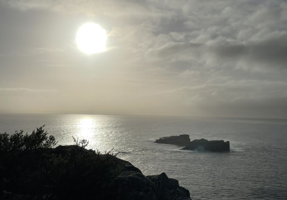
From the perfect vantage point of the platform, I was able to capture a new shot where the mid-morning sun caught the surface of the vast Tasman Sea, transforming the water into a brilliant, shimmering expanse of light.
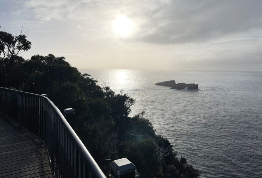
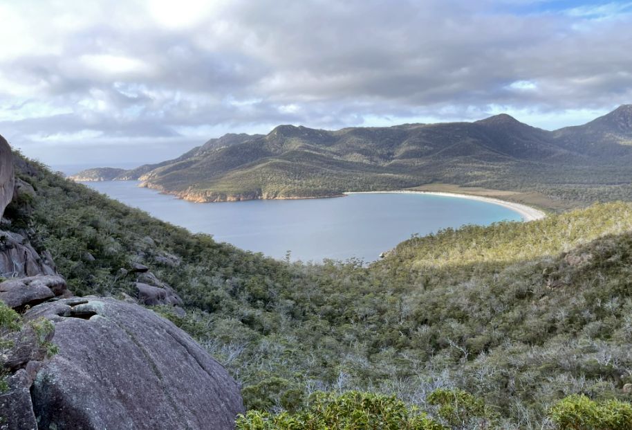
We spotted the Nuggets which are a cluster of small, rocky islands just off
the coast from the Cape Tourville Lookout.
While they may look like just two or three islets from the mainland, they are
officially recognized as a close group of four granite islets. Their primary
significance today is as an important wildlife sanctuary.
They are a protected area crucial
for various species of seabirds.
 |
 |
Beautiful scenery!
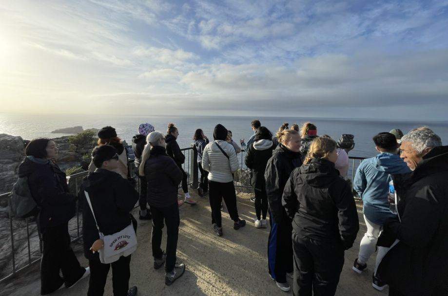
Moving towards the end of the lookout, our group gathered to take in the awe-inspiring view.
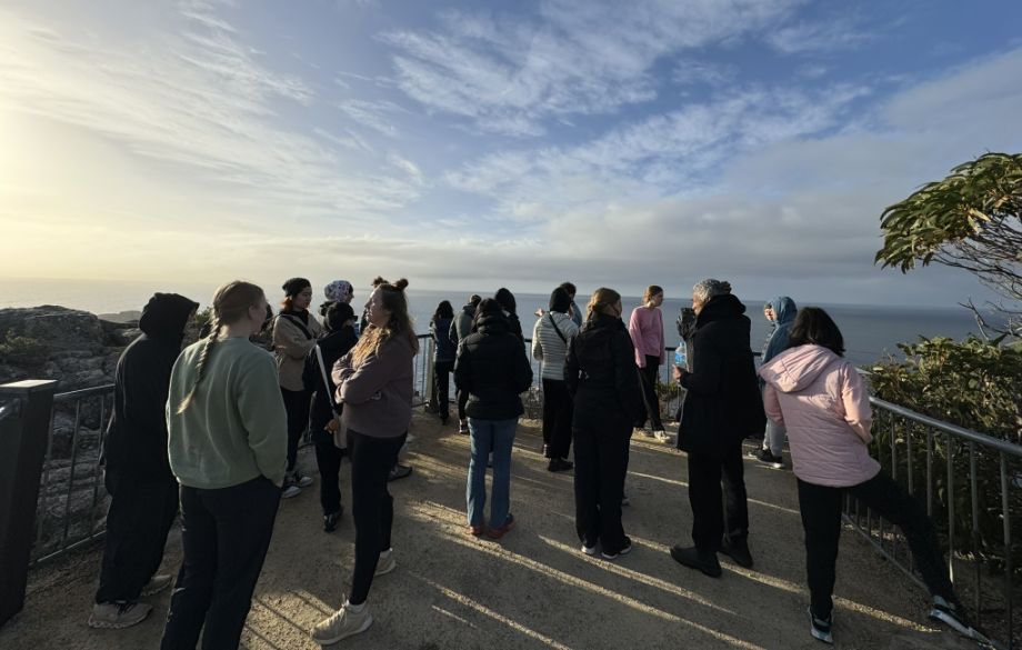
The spectacle was truly amazing here, with bright rays of the sun dramatically rising at the horizon, casting a magnificent light over the vast ocean.
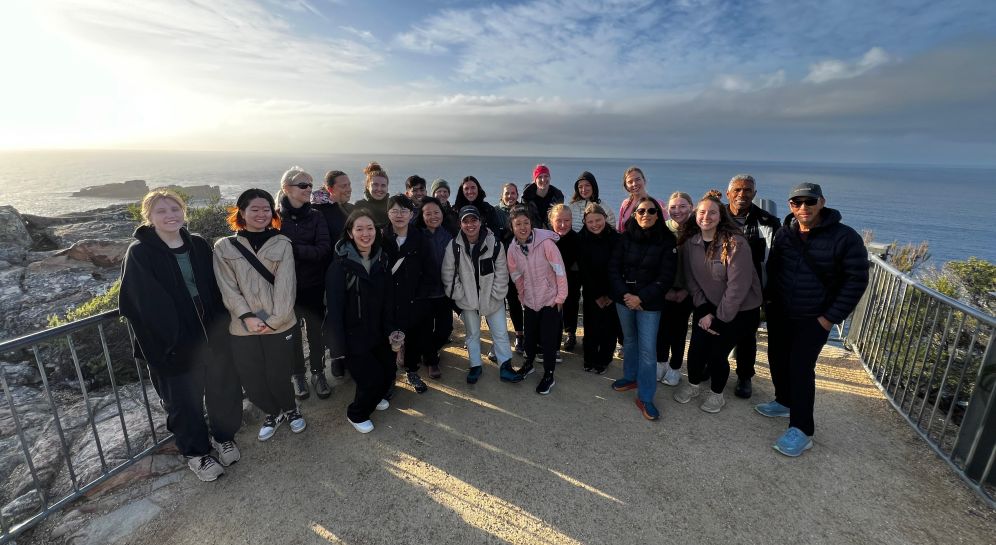
A picture with the whole group for posterity!
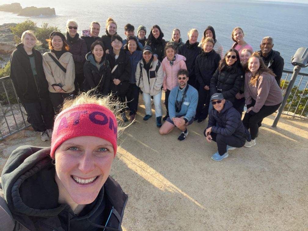
A quick selfie with the whole group.
![]()
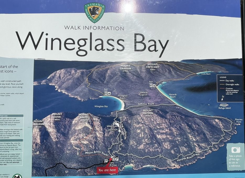
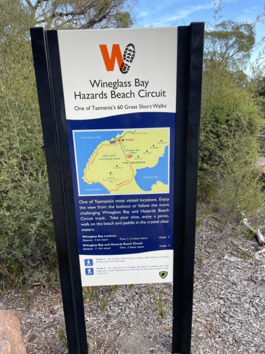
Wineglass Bay Hazard Beach Circuit
.Next, Tom drove us to the near by Wineglass Bay–Hazards Beach Circuit which is a fantastic way to experience the full beauty of Freycinet National Park.
 |
 |
It is one of Tasmania’s most rewarding coastal walks, combining dramatic mountain scenery, forest trails, and pristine beaches. The whole look loop is about 6.8 miles and takes about 4 to 5 hours to complete the circuit.
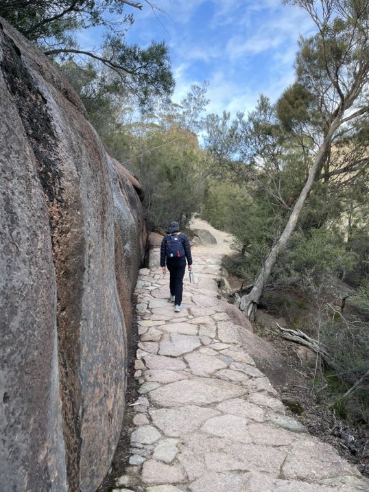
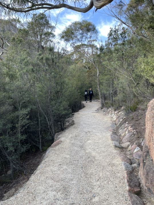
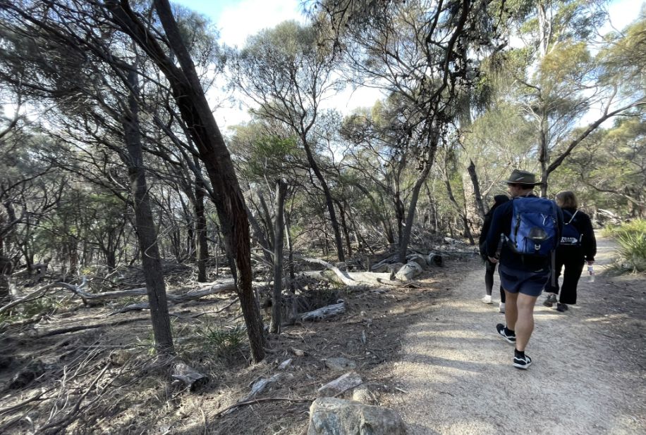
As we started along the Wineglass Bay–Hazards Beach Circuit, the first thing I noticed is the dirt trail stretching ahead, curving gently as it winds through the landscape. On either side of the path, there are dead trees, their pale trunks and twisted branches standing starkly against the earth, a quiet reminder of how nature constantly renews itself. The road bends ahead, disappearing around a curve, inviting us deeper into the rugged, untamed beauty of Freycinet. Even in this sparse beginning, there’s a raw, haunting charm, the contrast between the lifeless trees and the living bush beyond hinting at the wild scenery still to come.
View of Coles bay in the distance.
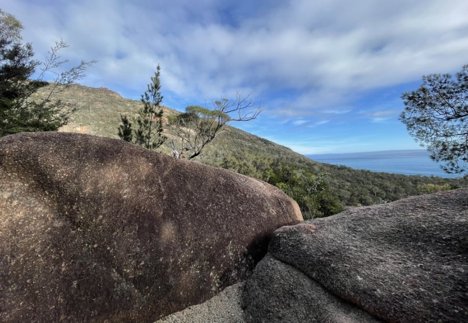
Large rocky boulders beside the track with Coles Bay, visible in the distance.
As we continued along the trail, I couldn’t help but notice how different this landscape was from the lush forests of Tasmania’s west coast. Out there, the scenery had been dense and green, thick rainforests filled with towering myrtles, ferns, and moss-covered trunks, where the air felt cool and damp. But here, on the Wineglass Bay–Hazards Beach track, the environment feels much drier. The soil is sandy and pale, the vegetation low and scattered. Instead of dense canopies, we see hardy eucalypts and coastal shrubs, and the contrast is striking from the rainforest’s deep greens to this sunlit, open terrain shaped by granite, sea breeze, and dryness.
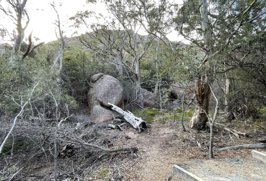
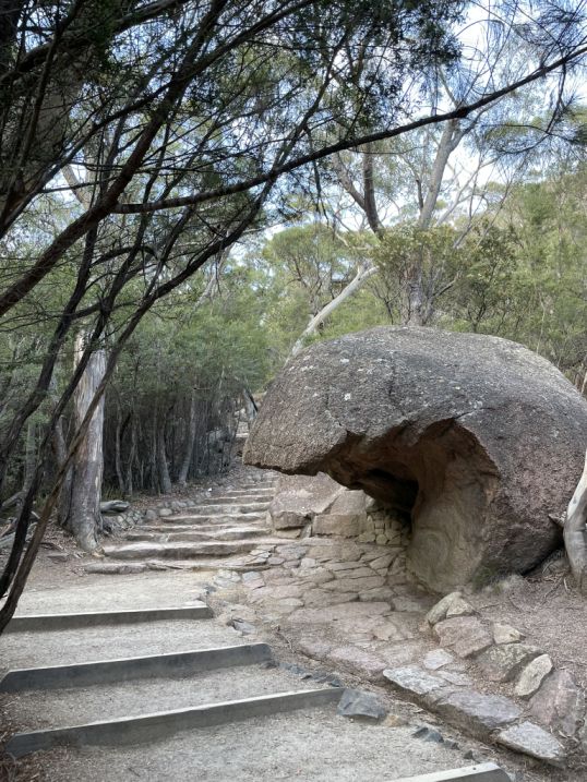
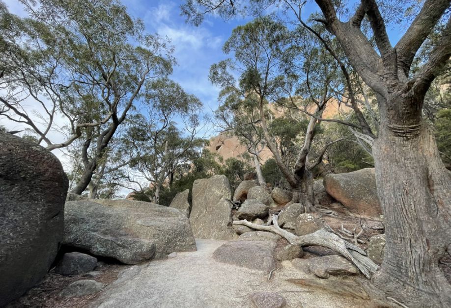
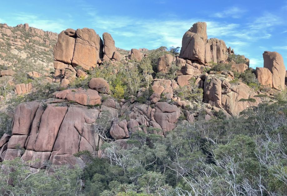
The large boulders scattered around the Wineglass Bay–Hazards Beach area are a defining feature of Freycinet National Park’s granite landscape. These boulders are actually part of the ancient Hazards mountain range, formed over 400 million years ago from pink granite.
 |
 |
Over time, erosion, wind, rain, and temperature changes slowly broke down the massive granite domes into separate rounded boulders. The process is called granite weathering that happens when cracks form in the rock and gradually widen, causing big chunks to split off and roll downhill. The smooth, curved shapes you see today come from spheroidal weathering, where the corners of the rock erode faster than the flat faces, rounding them out.
A lookout area on top of a rocky hill.
 |
 |
We are continuing our walk to the Wineglass Bay Lookout.
 |
 |
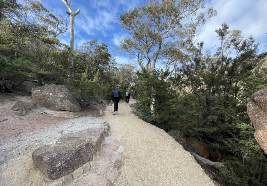
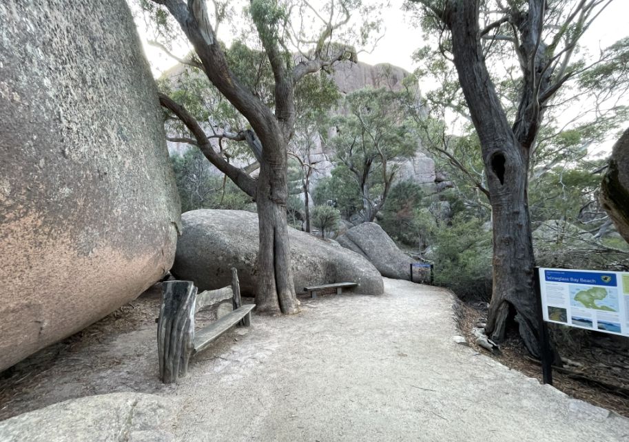
The walk up to the Wineglass Bay Lookout is one of the most popular hikes in Freycinet National Park, and it’s easy to see why as the view from the top is breathtaking. But getting there takes some effort!
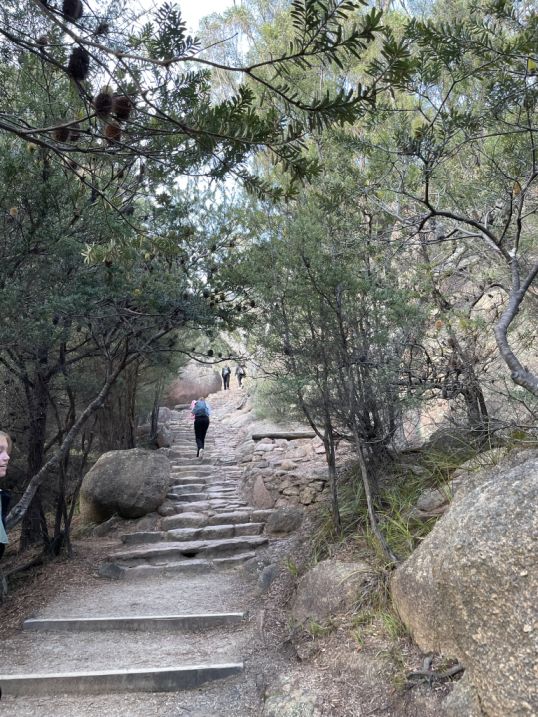
Trails, like the Wineglass Bay Circuit, are often dry, sandy, and rocky.
 |
 |
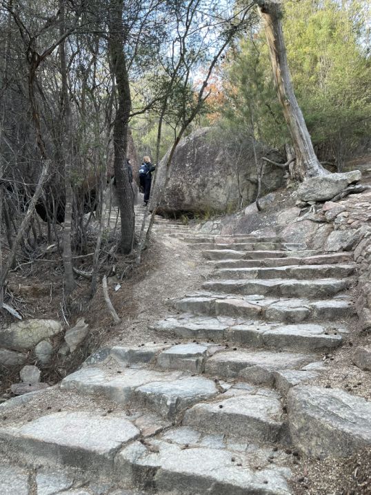
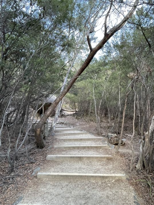
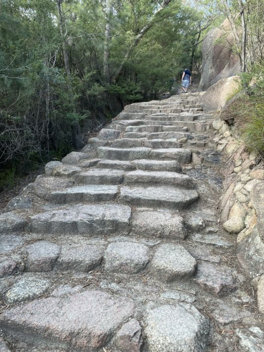
As we moved further along, the trail starts to climb steadily, and soon you’ll reach the series of steps that make this walk famous.
 |
 |
There are around 1,000 steps in total. Some sections are made of natural rock, others of wooden or stone steps built into the slope
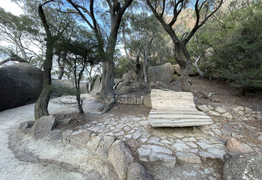
A rest area along the path.
The landscape is quite dry because in the East coast of Tasmania, the weather is drier and sunnier because the central mountains block much of the western rain. This leads to an environment of dry sclerophyll (hard-leafed) forests and coastal scrub.
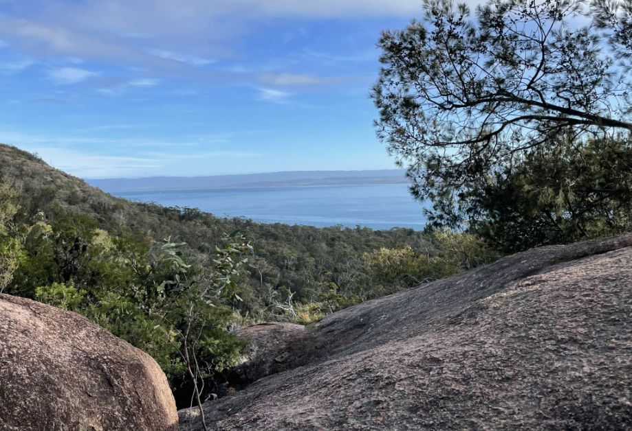
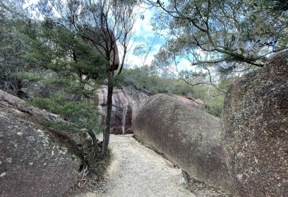
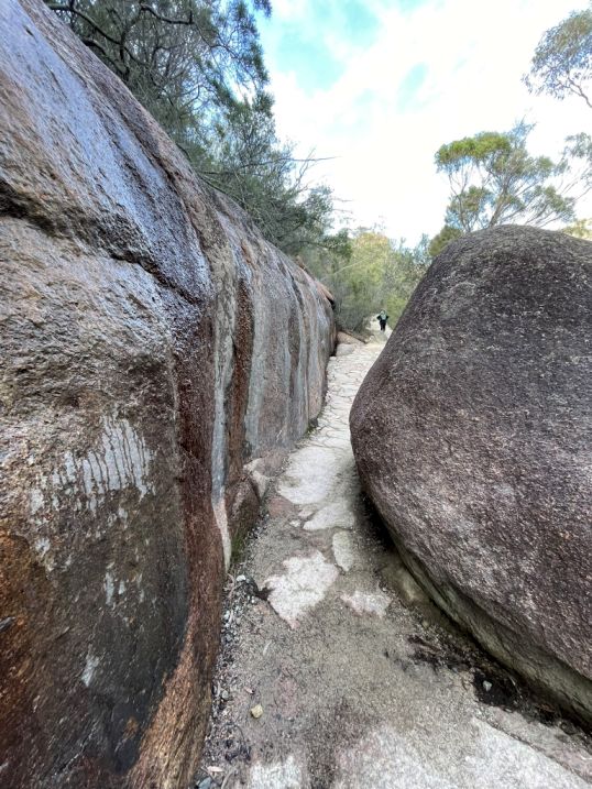
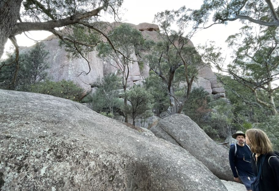
Along the way, we passed between granite boulders, banksia and she-oak trees, and occasional lookouts where you can pause to catch your breath and admire Coles Bay and the Hazards Mountains behind us.
We are now heading to the Lookout.
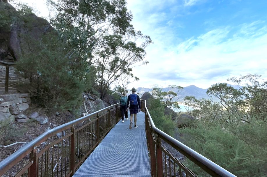
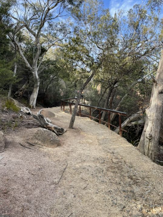
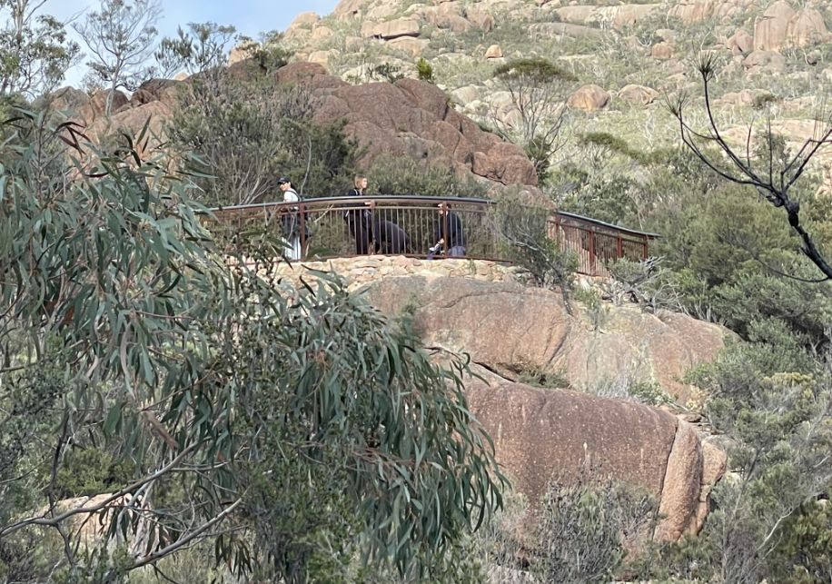
This elevated metal walkway marks the final approach to the Wineglass Bay Lookout. The path here is beautifully constructed, blending into the rugged granite landscape while giving visitors a safe, stable way to enjoy the view. As you walk along the metal bridge, you can feel the elevation and the view of the bay below is simply amazing.
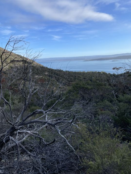
As the walkway opens up to the viewing platform, the landscape suddenly unfolds with Wineglass Bay stretches below in a perfect crescent of white sand and vivid turquoise water, framed by the Hazards Mountains and dense coastal bush. It’s a breathtaking sight, calm, remote, and perfectly balanced between sea and stone. Wineglass Bay is one of Tasmania’s most famous and breathtaking natural landmarks.
Despite its beauty, the bay’s history has a darker side. In the early 19th century, during the height of whaling operations, the area was used as a base by whalers. When whales were hunted and processed in the bay, the water would sometimes turn red from the activity, and that’s one theory of how Wineglass Bay got its name: the curved shape resembling a wineglass, and the color of the water during whaling times recalling red wine.
From the Wineglass Bay Lookout Track, the view is one of the most iconic in all of Australia, especially when the sunlight catches the water and the colors shift from deep blue to emerald green (so I was told). Today, the bay is a protected and pristine environment, far removed from that past. It’s home to diverse wildlife such as wallabies, sea eagles, dolphins, and sometimes whales can be seen in the area.
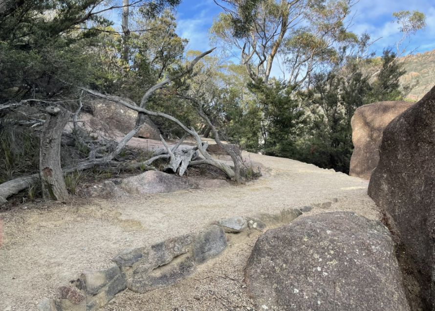
The walk along the Wineglass Bay Lookout is short but spectacular. The metal walkway gently curves around the granite slope, offering glimpses of the coastline through gaps in the trees as you approach the viewing platform.
The area is surrounded by rugged granite boulders rise from the hillside, and patches of hardy eucalypts and coastal shrubs cling to the rocks.
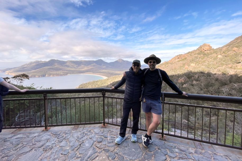
Hoa and Tom at the end of the Lookout platform. The view is breathtaking.
As we started descending toward Wineglass Bay, the trail led us through a strikingly different landscape.
Huge granite boulders lined the path, some stacked on top of one another with their smooth and rounded surfaces. They seemed almost sculpted by time, silent giants scattered across the slope.
A little further down, the scenery changed again. We came upon an area that looked like it had been burned or damaged by fire, the ground was darker, and many fallen trees lay tangled across the forest floor.
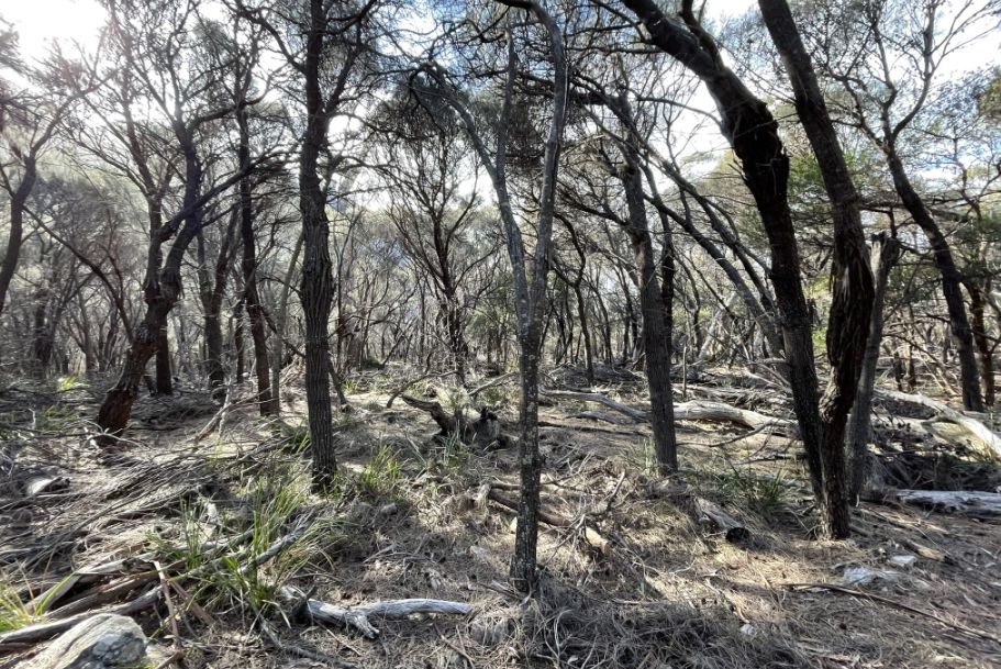
Charred trunks and bare branches stood among new green shoots beginning to grow back, a quiet reminder of how Tasmania’s bushland regenerates after fire.
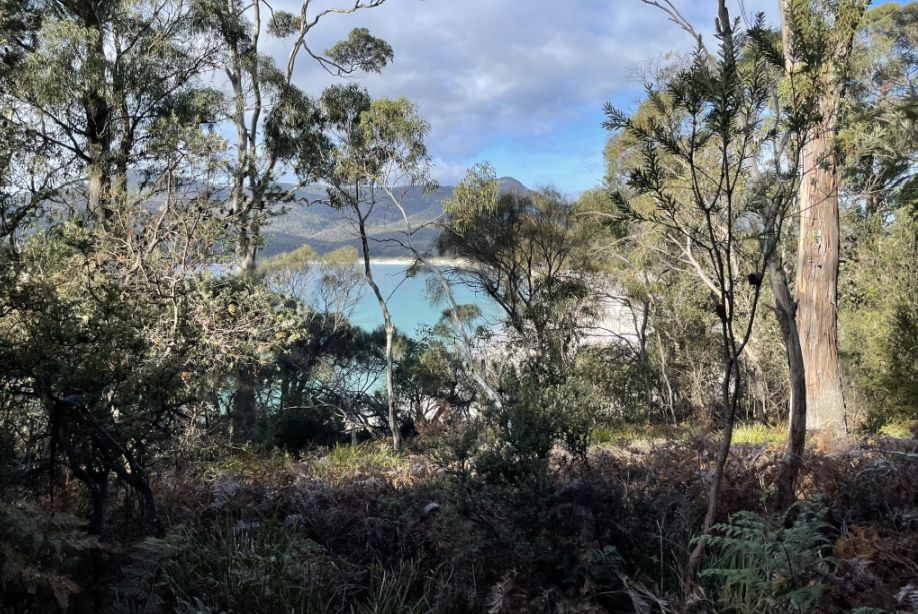
Finally, as the trail curved downward, the trees began to thin, and through the branches we caught our first full glimpse of Wineglass Bay below. The view felt almost hidden, framed by trees but the crescent of white sand and brilliant turquoise water was unmistakable.
NEXT... Day 5- Wineglass Bay/Honeymoon Bay/ Raspins Beach