4 days in San Diego- 8/31- 9/3/2024
Day 1- Torrey Pines State Natural Reserve-8/31/2024
As we climbed higher into Torrey Pines State Natural Reserve, the view behind starts to feel expansive.
Looking down, the land rolls into soft, hilly shapes, mostly green with scattered brown patches where the soil is thinner and drier. Beyond the hills, the Pacific Ocean stretches out, deep blue and endless, with the highway tracing the coastline like a thin ribbon between land and sea.
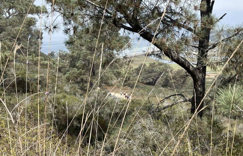
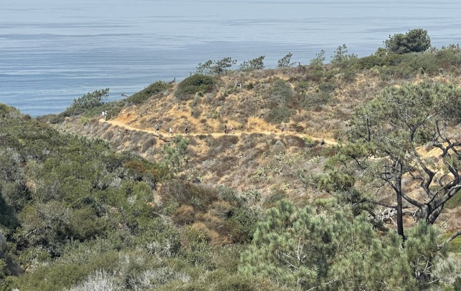
As we climbed higher, the view began to reveal itself in layers. Through the wild plants and twisted Torrey pines, I could look down and spot a tiny dirt path far below, with people moving slowly along it, almost blending into the landscape. Half-hidden by the vegetation, the ocean peeked through in the distance, flashes of blue framed by branches and brush.
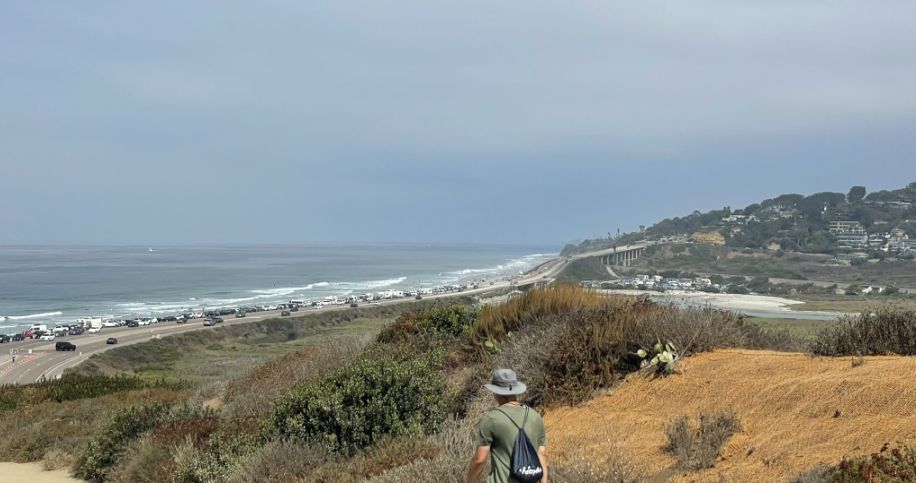
Looking past the bushes, the wetland spread out below, a wide, quiet patchwork of water and narrow strips of land in between. Farther still, the scene shifted again, the parking lot and highway came into view, lifted on tall concrete pillars that looked surprisingly delicate from this height. It was a reminder of how many worlds exist at once here.
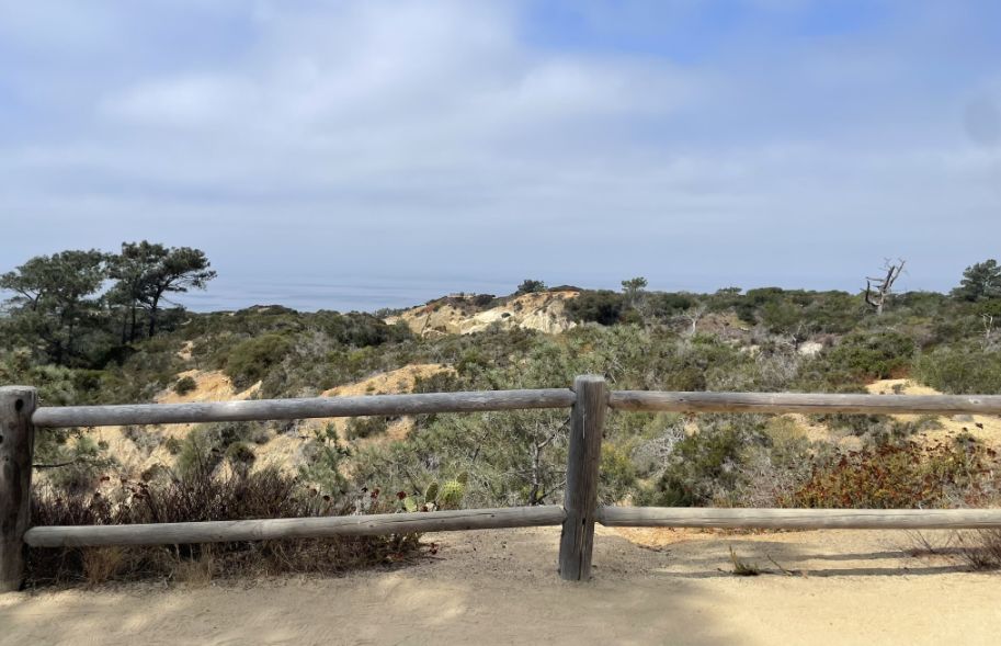
We kept going, following the dirt path alongside the main road, gaining elevation step by step, watching the coast, the wetland, and the city slowly fall away beneath us.
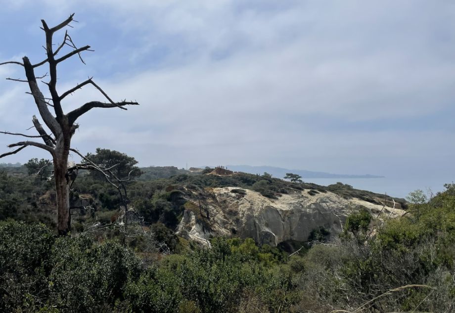
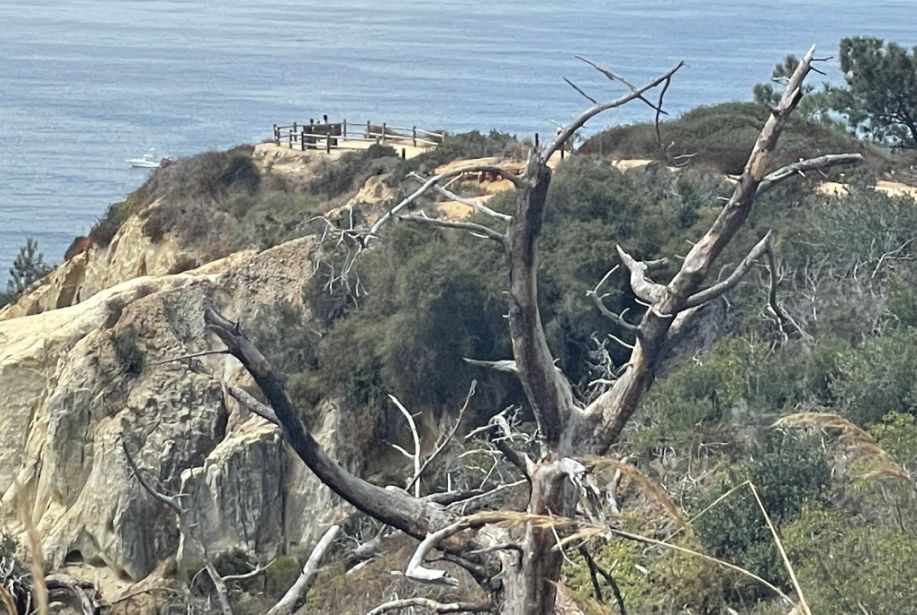
We reached the High Point Overlook, where the trail levels out and the space feels calm and enclosed by trees. Around us, the Torrey pines frame the view, their branches twisted by wind and time. One dead tree stands quietly among them, its pale trunk stark against the greenery, a reminder of how exposed and weathered this place can be.
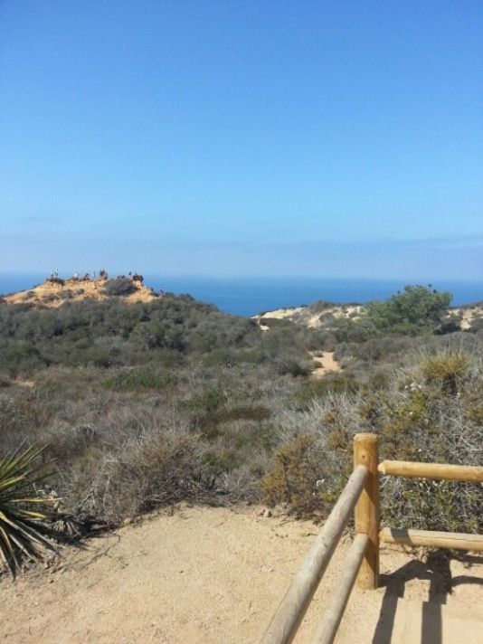
In the distance, I noticed a stretch of bare, gray cliffs, the rock exposed and rugged, contrasting sharply with the surrounding green vegetation. Farther out, a massive rock formation rises from the ground, its surface sculpted and pale, drawing the eye immediately. People stood on top of it, silhouetted against the sky, taking in the sweeping ocean views below.
From up here, everything feels layered and expansive, trees close by, cliffs and rock formations beyond, and the Pacific stretching endlessly in the distance. It’s a quiet, powerful vantage point that makes the climb feel completely worth it.
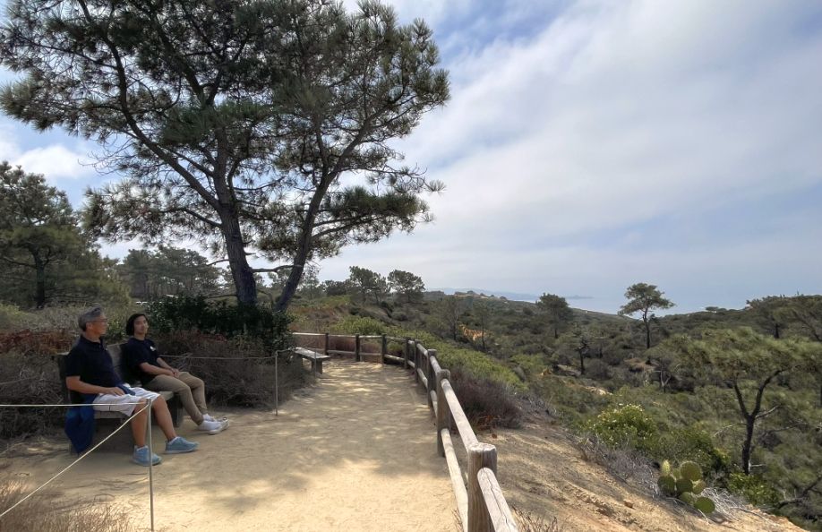
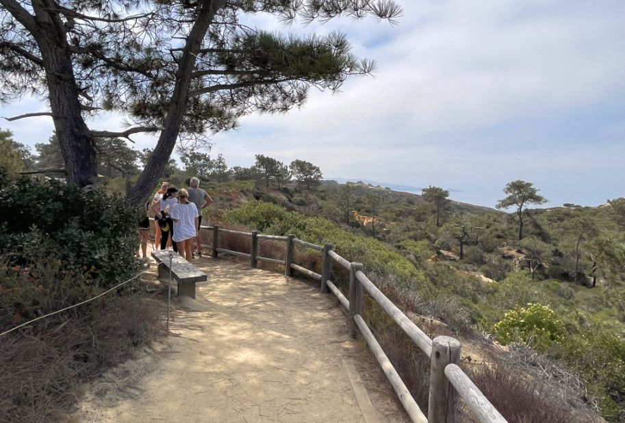
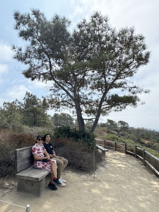
We then stopped at the West Lot Overlook Trail, a quiet pause point with a simple bench inviting people to sit, rest, and take everything in.
From the bench, a dirt walkway stretches forward, bordered by wooden fences, guiding the eye toward a wide view of rugged hills that roll gently before dropping off toward the ocean at the horizon.
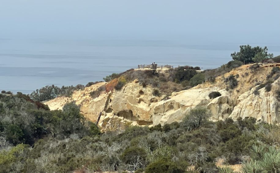
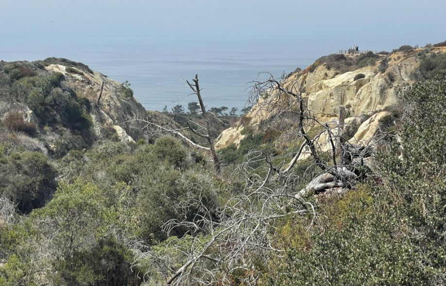
In the distance is the Razor Point or Yucca Point overlooks perched at one of the dramatic peninsula points that jut out over the Pacific with two people sitting far away.
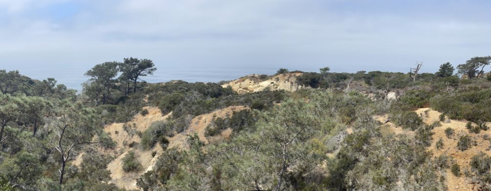
Panoramic view of the area.
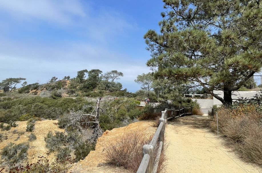
We continue our walk further.
 |
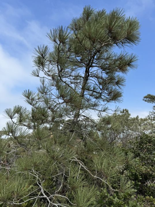 |
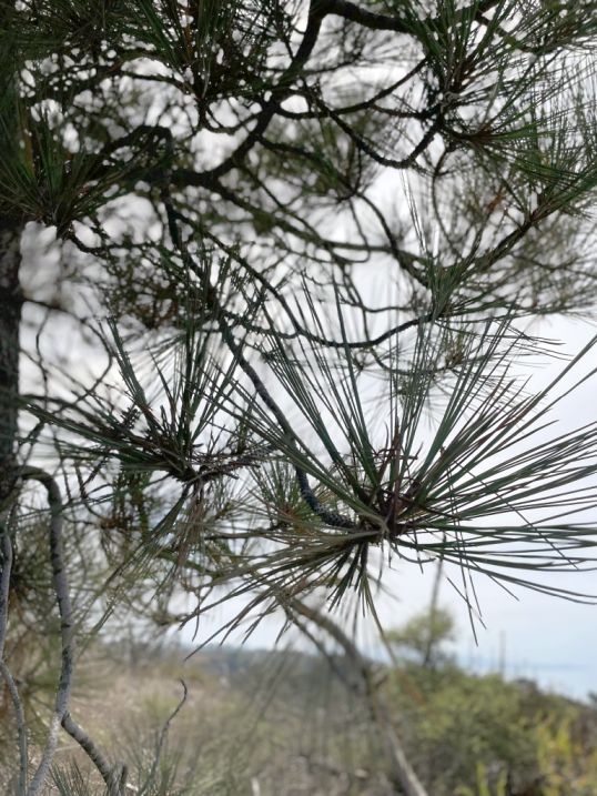
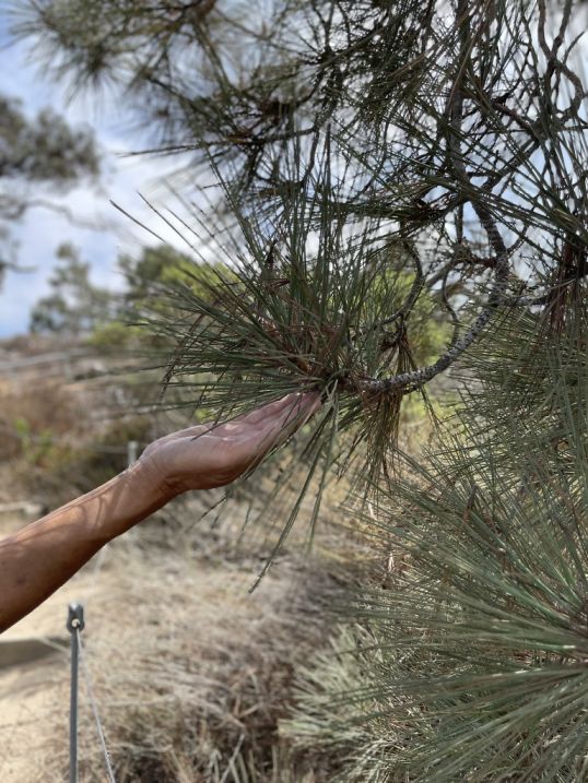
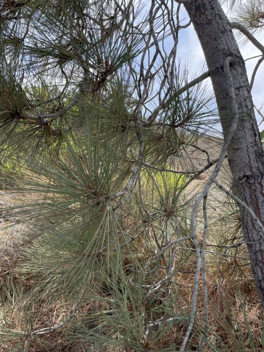
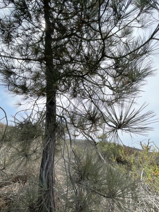
Surrounding us are the Torrey Pines which is officially the rarest pine species in North America.
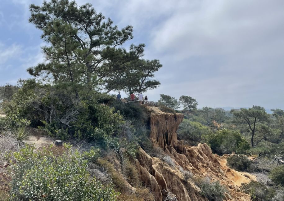
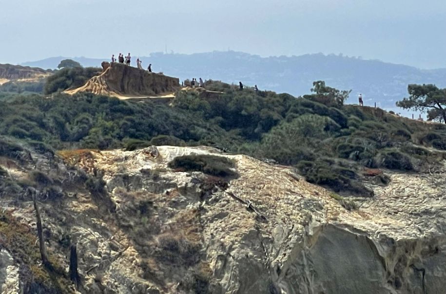
This terrain is one of the most iconic geological features of Torrey Pines! What you are looking at is a prime example of badlands topography carved into the Torrey Sandstone and the Linda Vista Formation. This is a very fragile landscape. Because the sandstone is held together so loosely, even a footprint can cause a mini-landslide and destroy shapes that took decades to form. This is exactly why fences are so important so that people cannot access the area.
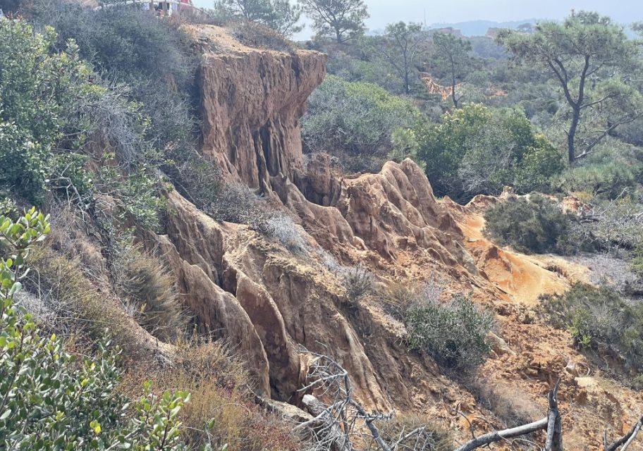
The terrain looks like a miniature mountain range of sharp ridges and deep grooves because of a process called differential erosion. The orange and buff-colored cliffs are made of relatively soft sandstone. When the infrequent but heavy San Diego rains hit this exposed earth, the water doesn't soak in evenly. Instead, it creates tiny channels that eventually deepen into these dramatic "rills" and "gullies."
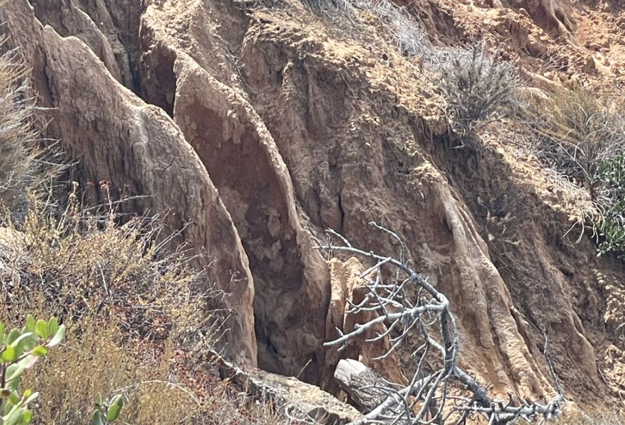
The reddish tint you see at the top, part of the Linda Vista Formation is rich in iron oxide (essentially rust). This top layer is slightly harder than the white/tan sandstone underneath. When the harder top layer crumbles, the softer sand underneath erodes rapidly, leaving behind those jagged, rib-like structures.
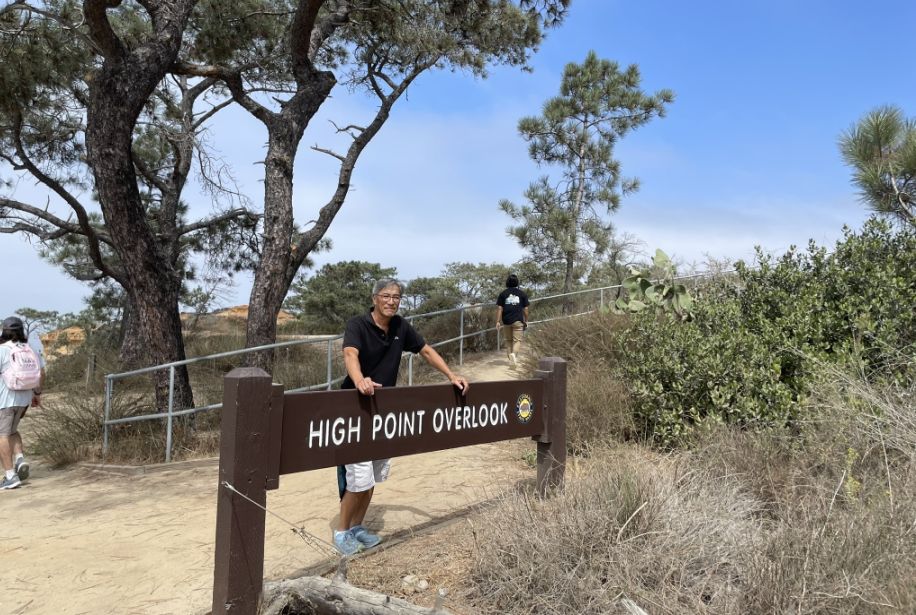
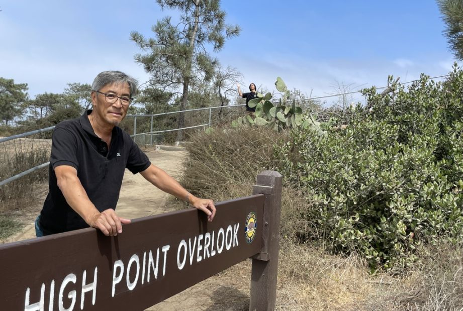
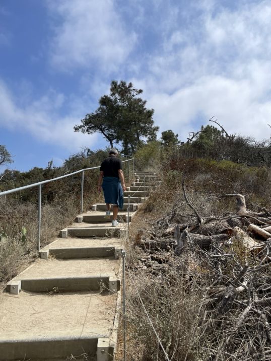
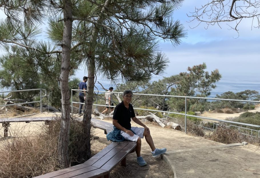
We are now at the High point overlook
The trail consists almost entirely of a set of steps cut directly into the dirt or stone.
 |
 |
The walk to the High Point Overlook is the shortest but steepest "jaunt" in the reserve, involving a brief climb of about 100 yards.
While it only gains about 39 to 52 feet in elevation, it is considered steep because the climb happens so quickly.
Once you reach the summit, it is at the tallest point in the reserve, which rewards you with a rare 360-degree panoramic view.
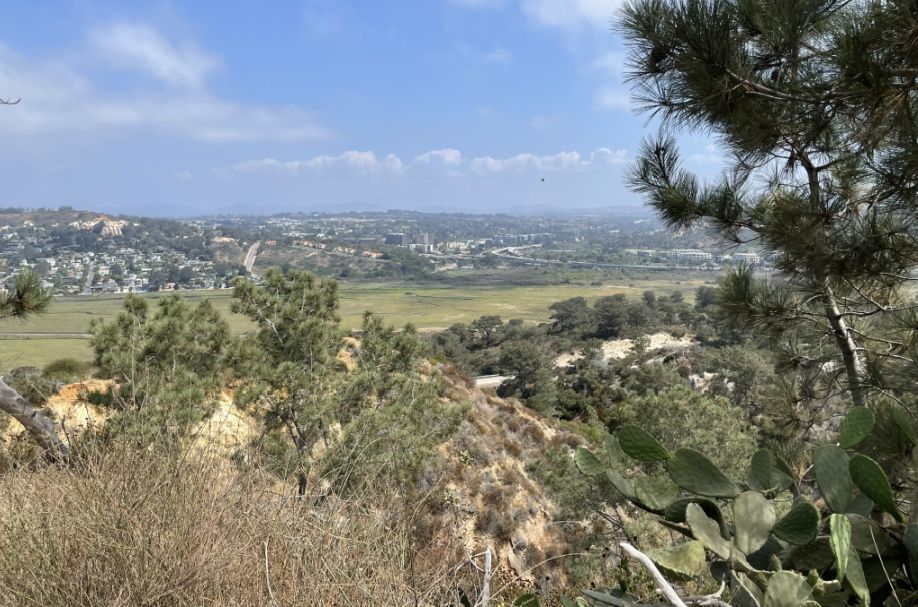
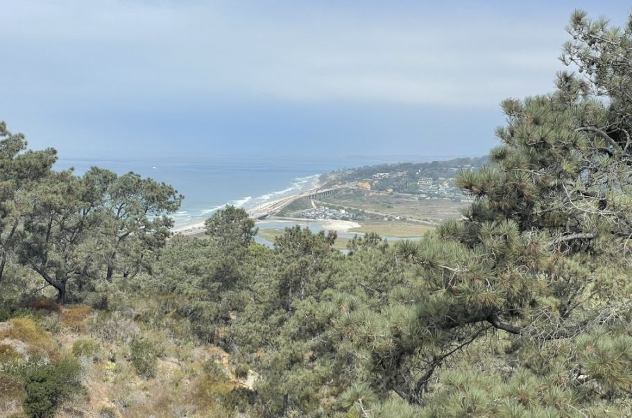
To the North you get a clear bird’s-eye view of Los Peñasquitos Lagoon and the coastline toward Del Mar.
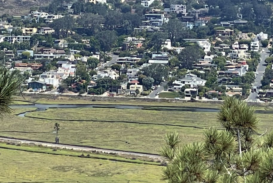
You can clearly see Los Peñasquitos Lagoon, the large, flat expanse of water and marshland directly below you is a vital coastal salt marsh. It serves as a nursery for fish and a resting spot for migratory birds. And then so many homes that are part of the Del Mar and Carmel Valley areas. They sit on the surrounding ridges that overlook the lagoon, illustrating how closely the residential neighborhoods press up against this protected wild space.
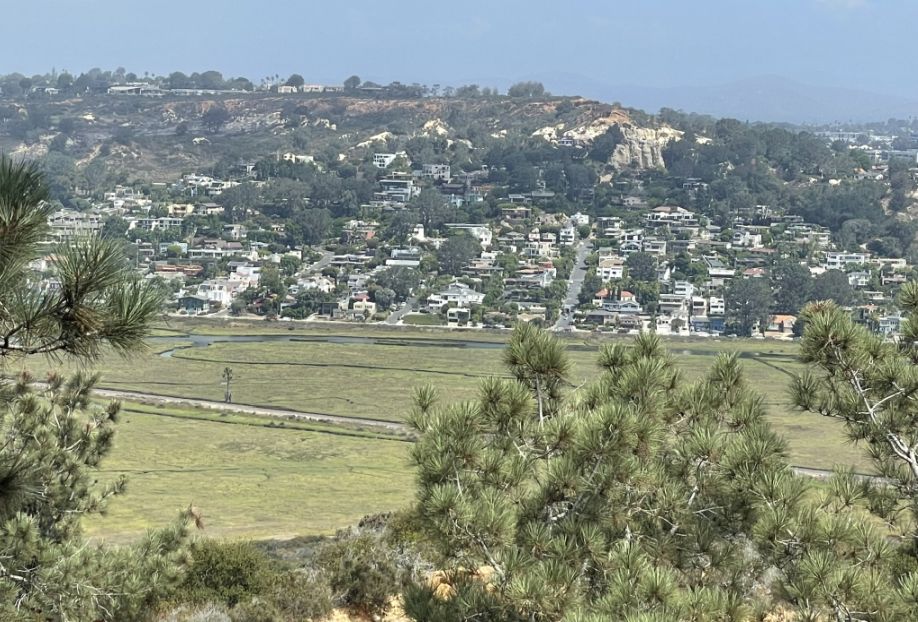
From this specific peak, the highest in the park, you can clearly see the "boundary" of the reserve. It provides a 360-degree perspective that shows exactly how the Torrey Pines forest is an "island" of rare habitat surrounded by the Pacific Ocean on one side and bustling San Diego development on the other.
Rest area with 360 degree of the whole area. This area is full of Torrey pines, the rarest pine species in North America.
 |
 |
In the wild, the Torrey pine can only grow in two places on Earth: right here in San Diego, and on Santa Rosa Island off the coast of Santa Barbara. These trees are "relics." During the cooler, wetter Pleistocene epoch, they likely covered much of the coast. As the climate warmed, they retreated to these tiny coastal pockets where the cool ocean fog keeps them alive.
 |
 |
If you look closely at a bundle of needles (called a fascicle), you’ll see they almost always come in groups of five. Most other common pines in California come in twos or threes. Because San Diego is technically a semi-arid desert, these trees shouldn't really thrive here. They survive through a clever trick called fog harvesting. The long, stiff needles act like combs that catch moisture from the heavy morning "marine layer" fog. The water beads up, drips off the needles, and waters the tree’s own roots even when it hasn’t rained for months.
The Torrey pines near the cliff edges look twisted and stunted (like giant bonsai), while those further inland grow straight and tall. This isn't genetic; it's the wind and salt spray literally "sculpting" the tree as it grows.
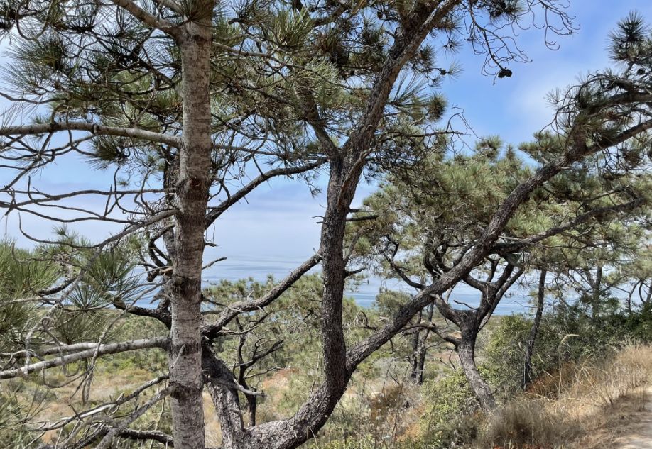
Razor point view from the highest point of the Reserve.
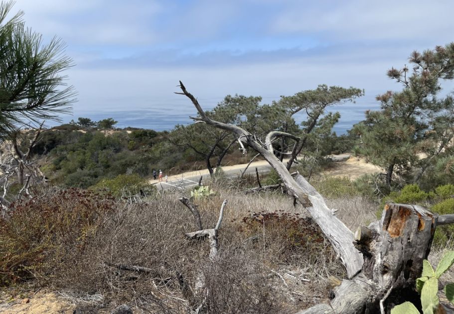
View to the West is the vast Ocean stretching out to the horizon.
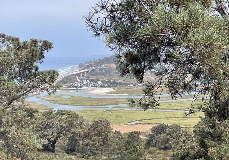
Even looking west, you can see the mouth of the lagoon where it meets the sea. This area is a critical "estuary," where fresh water from inland creeks mixes with the salt water of the Pacific.
The "freeway" look-alike you see is likely North Torrey Pines Road (the historic Highway 101) or the Interstate 5 further inland, alongside the Coaster/Amtrak railway tracks that hug the coastline.
We are at the highest point in the reserve, and standing roughly 300 feet above sea level, the contrast between the lush green of the Torrey Pines, the deep blue of the water, and the sandy "badlands" we saw earlier is what makes this park so famous among photographers.
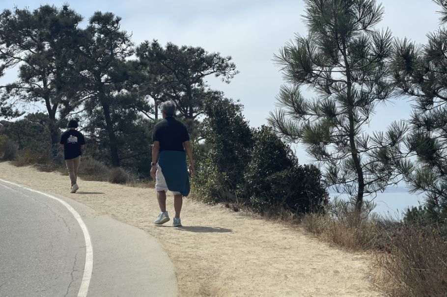
We are now going back down. In the distance we can see a dirt trail with people hiking.
We are now all the way down to the bottom of the hill.
As we finished your descent and reach the base of the cliffs where the reserve meets the sand, we are entering a dramatic transition zone between the ancient sandstone bluffs and the Pacific Ocean.
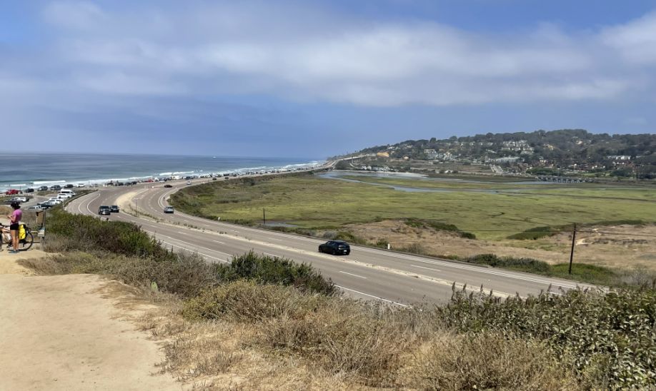
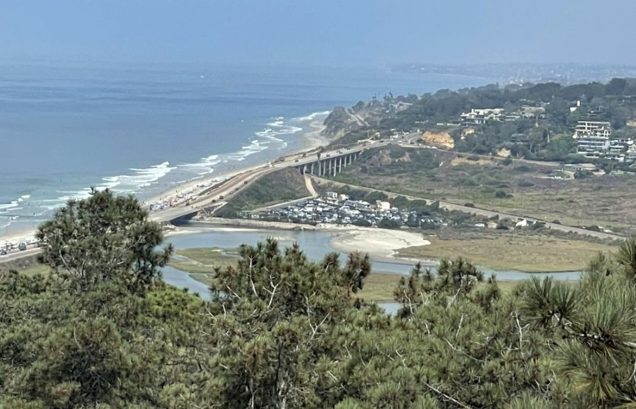
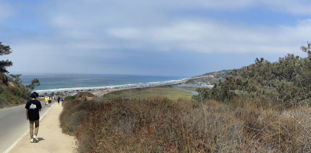
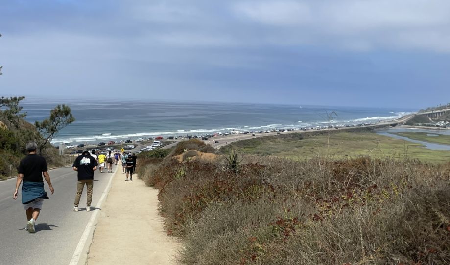
This particular stretch is one of the most recognizable views in the reserve. As we head down from the High Point area toward the park exit, you are walking parallel to North Torrey Pines Road (which many locals call the "freeway" because of its speed and size), which curves around the Los Peñasquitos Lagoon located on the right.
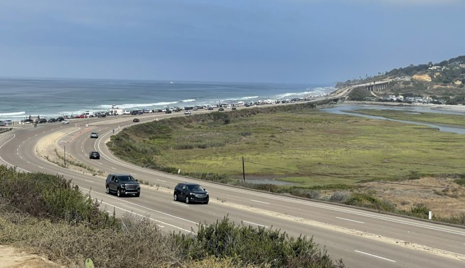
The road below follows the natural contour of the lagoon's edge. Because we are still elevated, we get that "toy car" perspective of the traffic moving between Del Mar and La Jolla. To the right of the road, you see the marshy channels of the lagoon. This is where the salt water meets the land, and it is a protected sanctuary for birds.

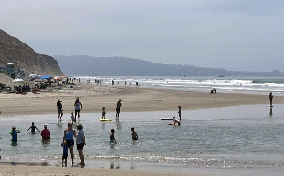
We are now entering South Beach
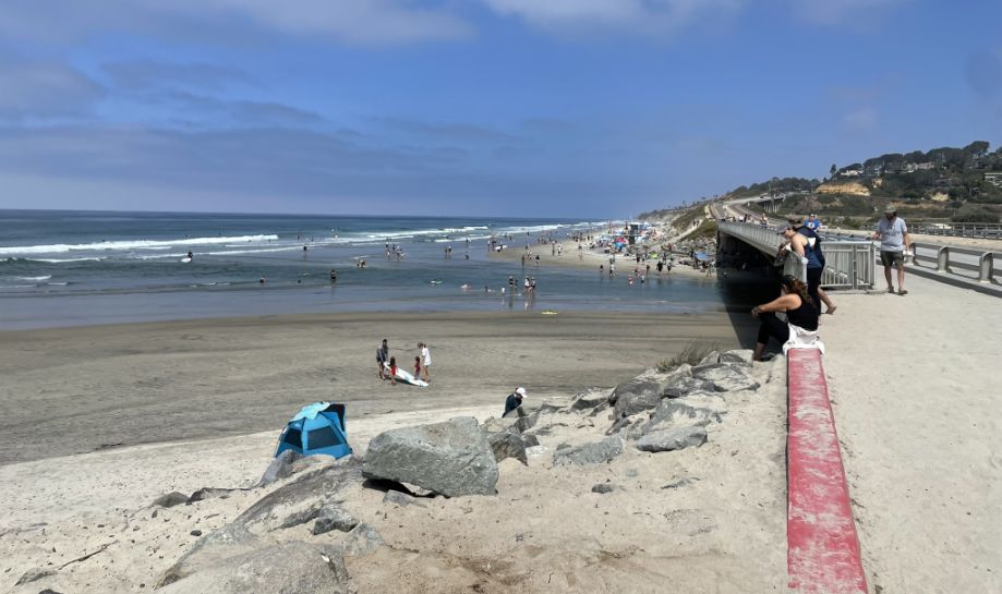
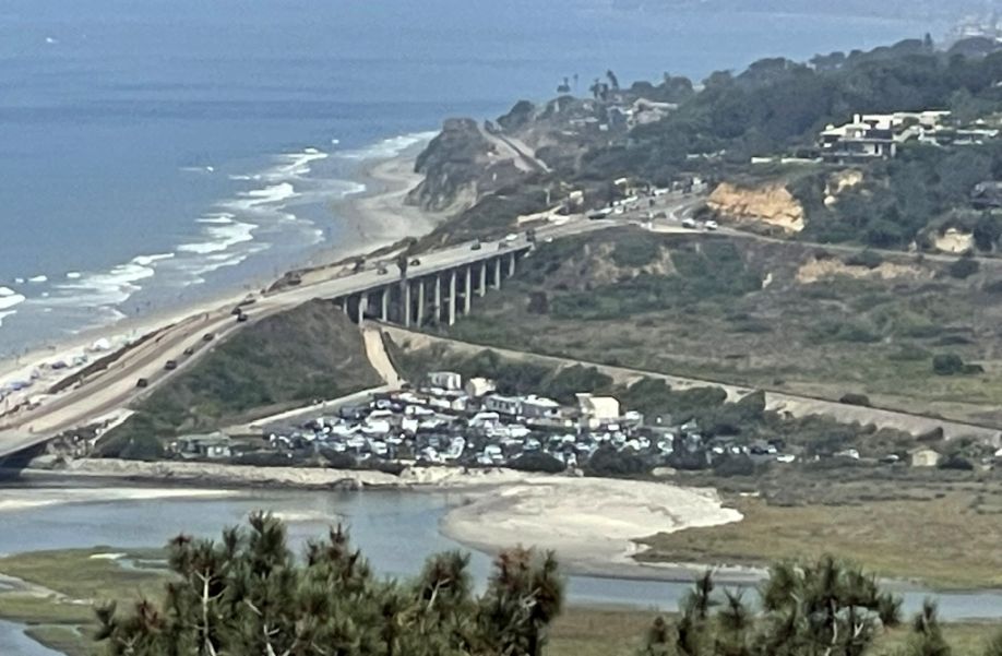
Straight ahead is the North Torrey Pines Bridge, which spans the channel where the Los Peñasquitos Lagoon meets the Pacific Ocean. The prominent beach between the lagoon and the ocean is a natural barrier. During certain times of the year, park rangers or heavy machinery have to manually clear sand from this opening to ensure the lagoon stays oxygenated and healthy for the fish and birds.
The shallow water you see is the "mouth" of the lagoon. Because it is a tidal estuary, the depth changes constantly; at low tide, it often looks like a series of shallow pools and sandbars.
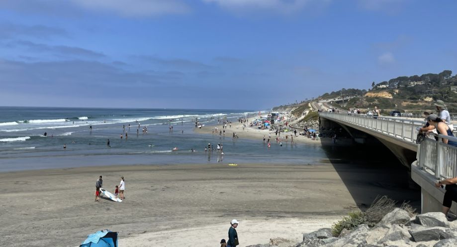
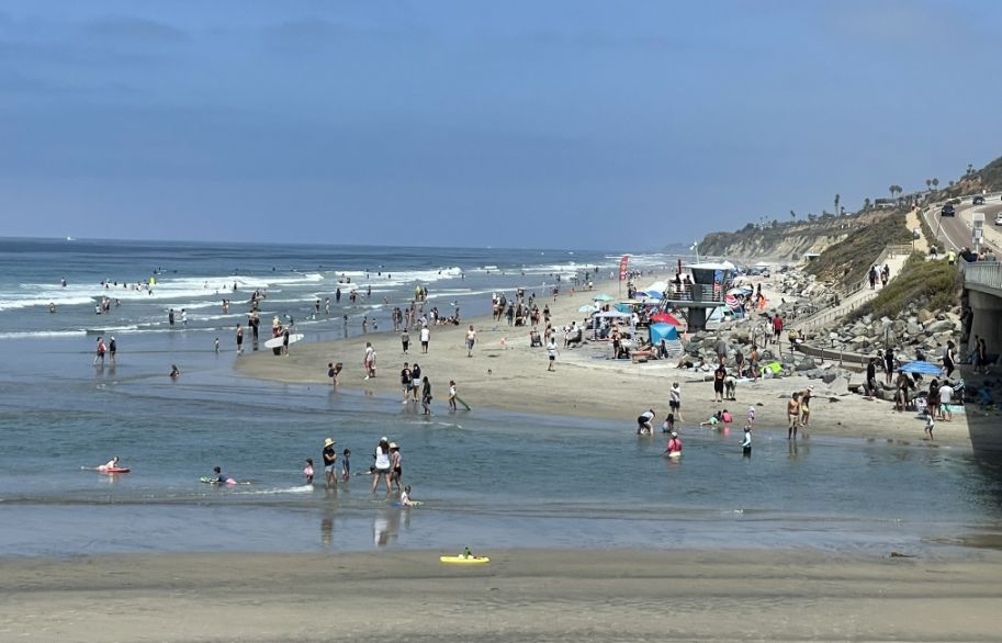
This is one of the most popular spots in the park because it offers the "best of both worlds." To your right, you have the calm, warmer waters of the lagoon channels, and to your left, the crashing waves of the Pacific. It’s a favorite spot for families because children can splash in the shallower, calmer lagoon water without facing the big ocean swells.
It’s a favorite spot for families because children can splash in the shallower, calmer lagoon water without facing the big ocean swells.
To the right thee "raised platform" you see is a San Diego State Lifeguard tower. During the summer and busy weekends, this area is heavily monitored because the currents where the lagoon drains into the ocean can be surprisingly strong, even if the water looks shallow.
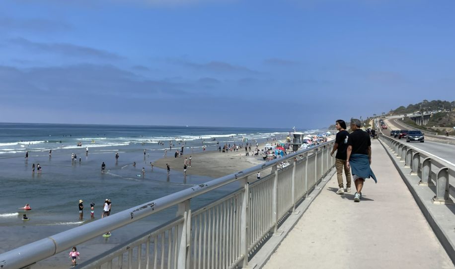
Crossing the North Torrey Pines Bridge
From the bridge the view of the ocean is so calm and relaxing.
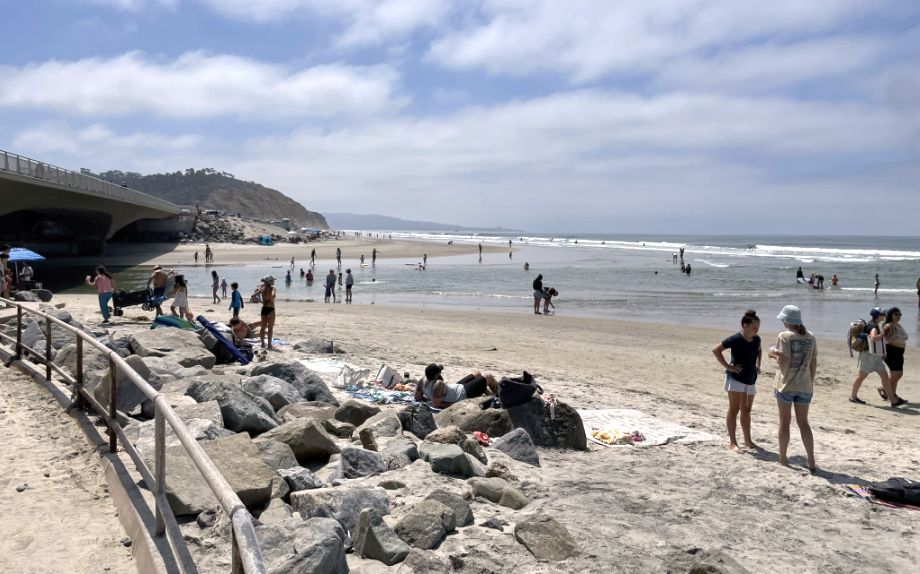
We got off the bridge and we are now at the path next to the beach. Those "huge rocks" you see are known as riprap. They are placed there intentionally to protect the bridge footings and the roadway from the massive erosive power of the Pacific tides and winter storms.
The lagoon and the South beach in the distance.
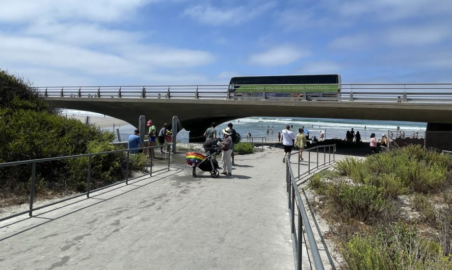
This area is a favorite local "secret" spot! Going under the North Torrey Pines Bridge gives you a completely different perspective of the engineering and the raw power of the ocean.
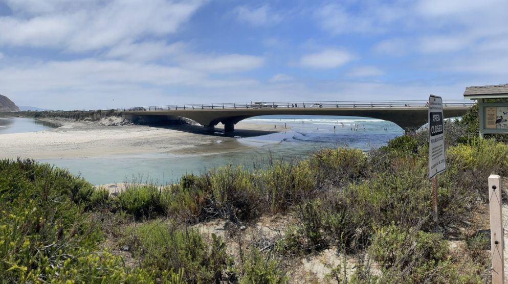
As we stepped out from under the bridge, this view captures the striking intersection of San Diego’s natural beauty and its coastal infrastructure. From this vantage point, the North Torrey Pines Bridge serves as a dramatic horizontal line that carries the highway across the sensitive Los Peñasquitos Lagoon. Beneath the bridge, the shallow, turquoise waters of the lagoon’s mouth flow over a prominent sandbar to meet the Pacific Ocean. The foreground is filled with resilient coastal sage scrub and wild plants that thrive in the salty air, while the "Area Closed" signs protect the delicate balance of this vital estuary. Together, these elements showcase a rare landscape where rugged sandstone badlands, protected wetlands, and the open sea all converge in a single, breathtaking scene.
![]()
The Wedding
 |
 |
We are attending Tiffany and Brian's wedding at the Hyatt in Carlsbad

Tiffany walking out with her parents.
 |
 |
Reception and dinner.

The reception room was magnificent with all the lights and the flowers.

Hoa, Me, my cousin Lan Huong and her husband Vinh.
NEXT... Day 2- Sunset Cliffs Natural Park