4 days in San Diego- 8/31- 9/3/2024
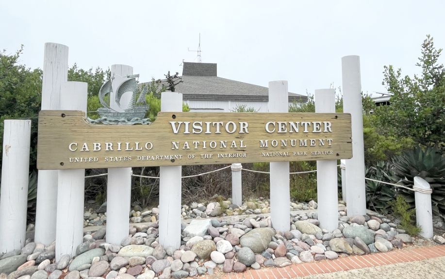
Day 2- Cabrillo National Monument-9/1/2024
Perched at the southern tip of the Point Loma Peninsula, the
Driving through the gate into Cabrillo National Monument feels like entering a lookout at the very edge of the continent.
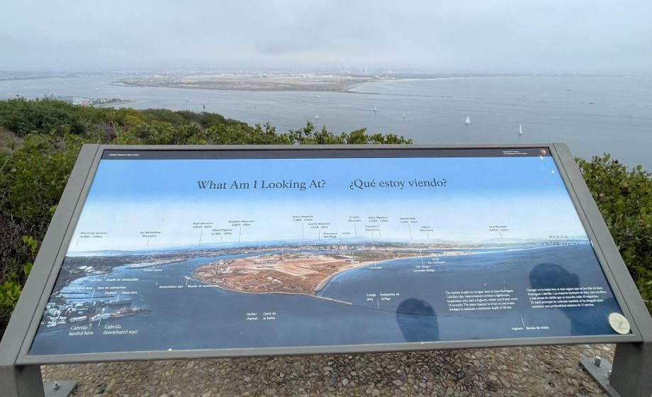
Standing in front of the “What Am I Looking At?” panel, the view spreads out like a giant map made of water, land, and sky.
Directly ahead, the Pacific Ocean dominates everything, wide, deep blue, and seemingly endless. The surface shifts with light and wind, darker farther out, lighter and textured closer to shore. On clear days, the horizon feels razor sharp, emphasizing just how exposed this point of land is.
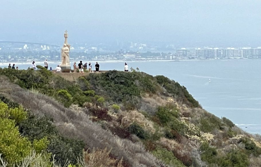
That large piece of land rising out of the water is Naval Air Station North Island, located on Coronado. From Cabrillo, it looks almost like an island floating in the bay because it’s low, flat, and surrounded by calm water. This is one of the most important naval aviation bases in the U.S. Navy, often called the “Birthplace of Naval Aviation.” The long, straight runways are easy to spot from above, stretching across the land like pale ribbons, with aircraft hangars and support buildings clustered around them.
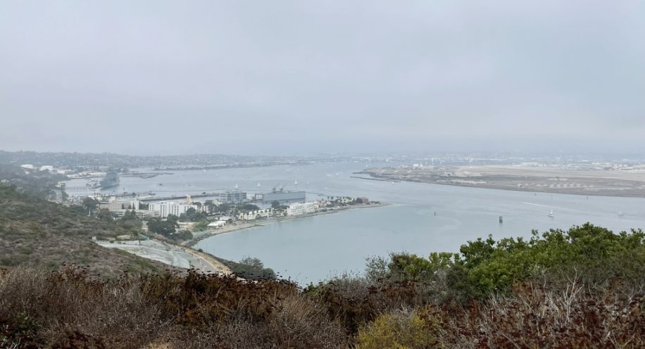
To the left, that cluster of white buildings is Naval Base Point Loma. From this height, it looks almost like a small coastal town tucked into the hills, but it’s a major Navy installation.
The buildings are painted white to reflect heat and blend into the bright coastal light, which makes them stand out sharply against the darker land and blue water. The base sits on the sheltered side of Point Loma, facing San Diego Bay, where the water is calm and ideal for naval operations.
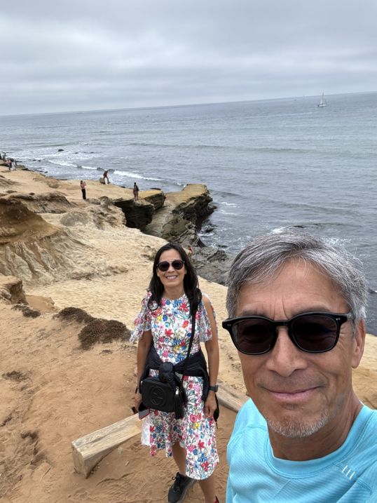
Heading toward Cabrillo National Monument.
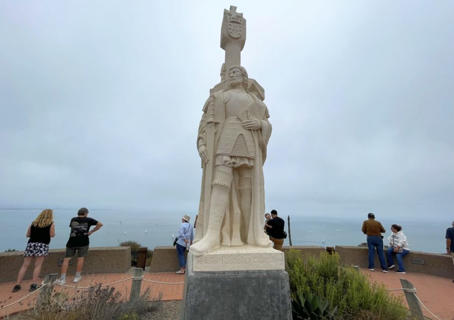
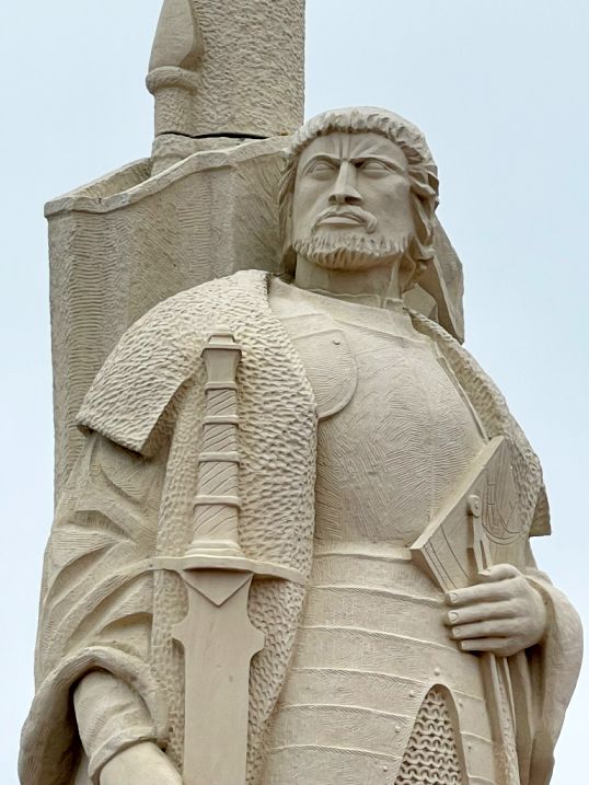
Cabrillo National Monument commemorates Juan Rodríguez Cabrillo, the first
European expedition to explore the West Coast of the United States. In
September 1542, Juan Rodríguez Cabrillo arrived in what he called a "very good
enclosed port," known today as San Diego Bay. The original 14-foot, seven-ton
statue was commissioned by the Portuguese government and created by sculptor
Alvaro DeBree in 1939. It was intended for the Golden Gate International
Exposition in San Francisco but arrived too late. After sitting in storage,
the statue was nearly given to Oakland. However, San Diego State Senator Ed
Fletcher essentially "liberated" it and brought it to San Diego. It spent
World War II in storage before being placed at the
 |
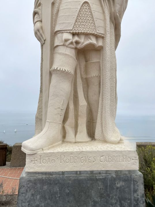 |
The statue we see today is actually a limestone replica installed in 1988. The original sandstone version was so heavily eroded by the salt air and wind of Point Loma that it had to be moved into storage. Since no contemporary portraits of Cabrillo exist, the explorer’s likeness is entirely based on the sculptor’s imagination of a 16th-century Spanish conquistador.
 |
 |
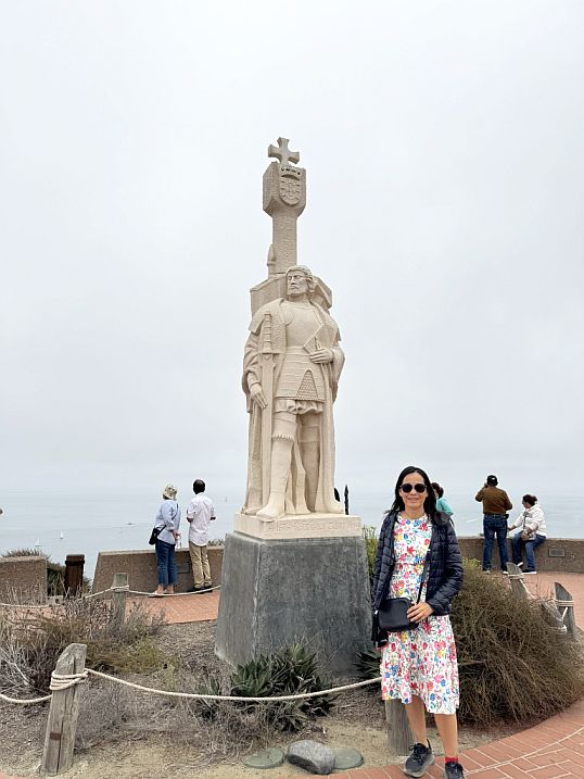
Behind the statue is the panoramic views of the San Diego skyline, the harbor, and North Island Naval Air Station. On clear days, you can see all the way to Mexico.
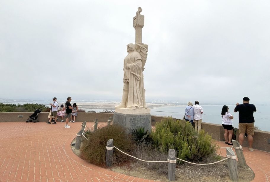
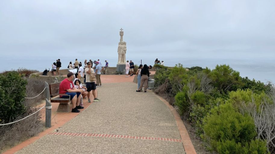
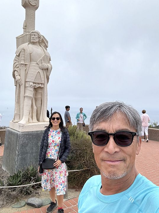
The statue is located at the southern tip of the Point Loma Peninsula
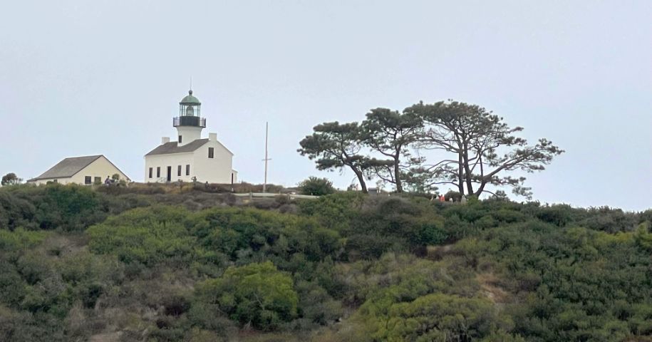
From the statue we can see the Old Point Loma Lighthouse one of San Diego’s most iconic landmarks, standing as a sentinel over the harbor since it was first lit in 1855.
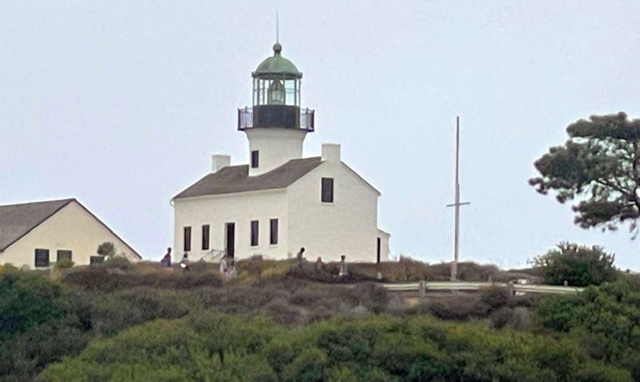
While it no longer serves as an active navigational aid, it is preserved as a museum that offers a vivid window into the isolated and rigorous life of a 19th-century light keeper.
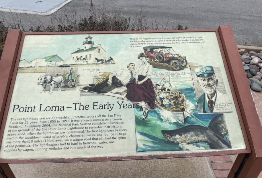
The lighthouse was one of the first eight lighthouses built on the West Coast, but its impressive location eventually led to its retirement. It was decommissioned Early because of the fog issues, it only served for 36 years. In 1891, it was replaced by the "New" Point Loma Lighthouse, which sits much lower to the water at the very tip of the point.
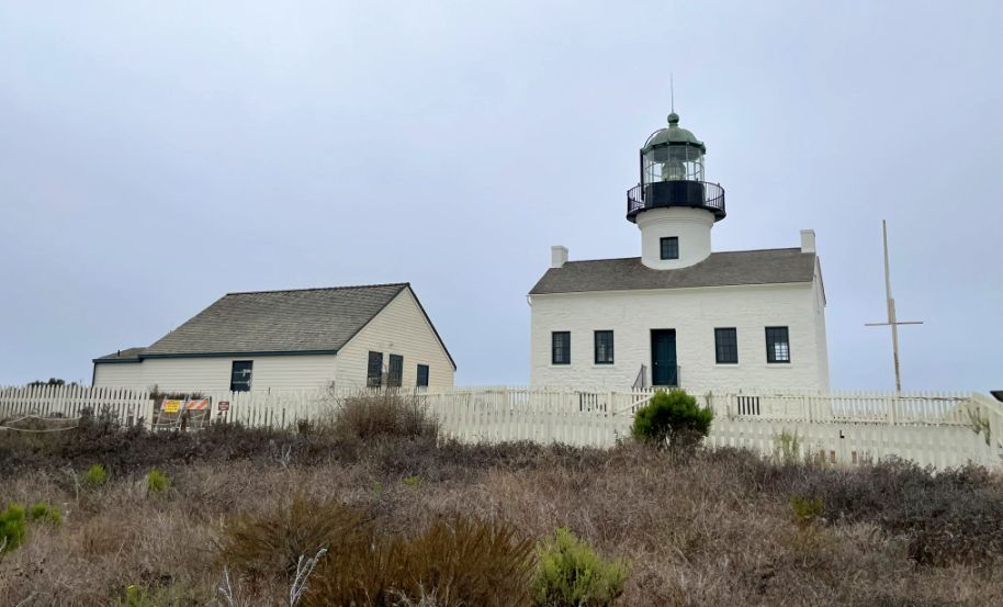
The lighthouse was one of the first eight lighthouses built on the West Coast, but its impressive location eventually led to its retirement.
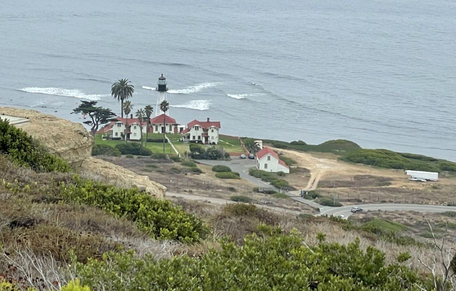
As we walked further I looked down and saw the New Point Loma Lighthouse and the surrounding residential area.
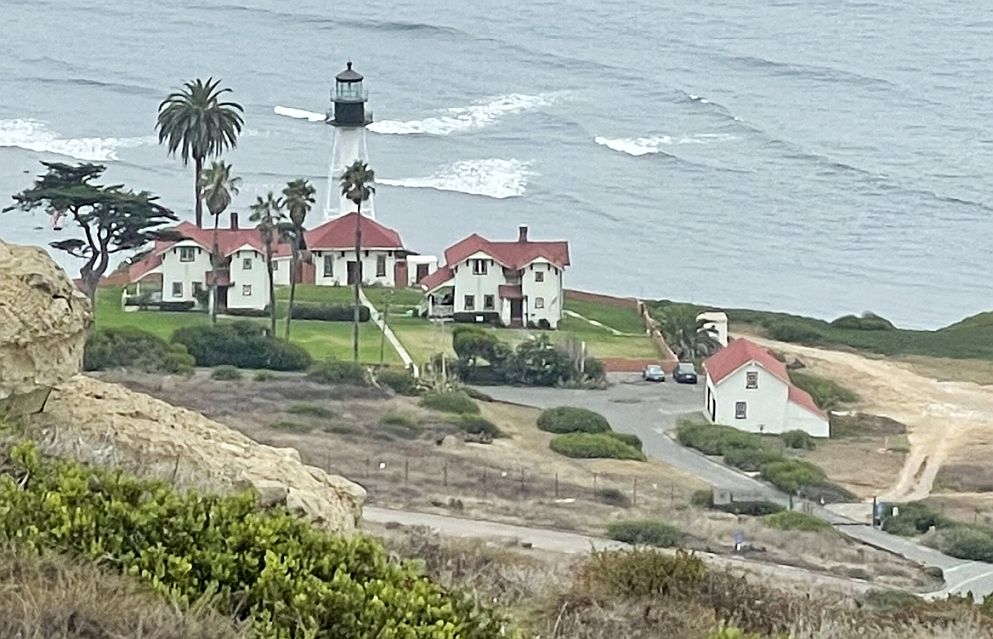
The new Lighthouse is a 70-foot metal skeletal tower that is still active. Unlike the old one, this is a working Coast Guard light station. It was first lit on March 23, 1891, specifically to solve the "fog problem" of the original lighthouse by being much closer to the water (only about 88 feet above sea level). It is the only pyramidal skeletal lighthouse remaining on the West Coast. Because it is an active military site managed by the U.S. Coast Guard, the lighthouse and the grounds immediately around it are off-limits to visitors. Historically, these housed the keepers' families. Today, they continue that tradition by serving as military housing.
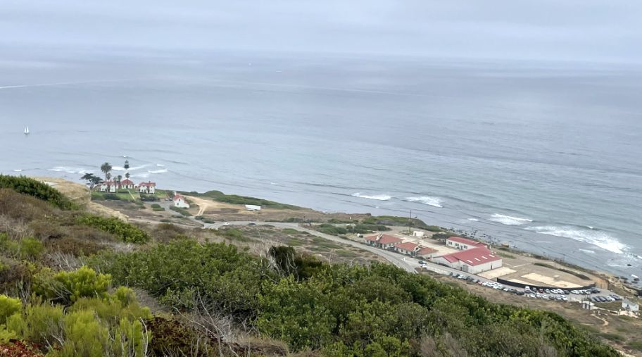
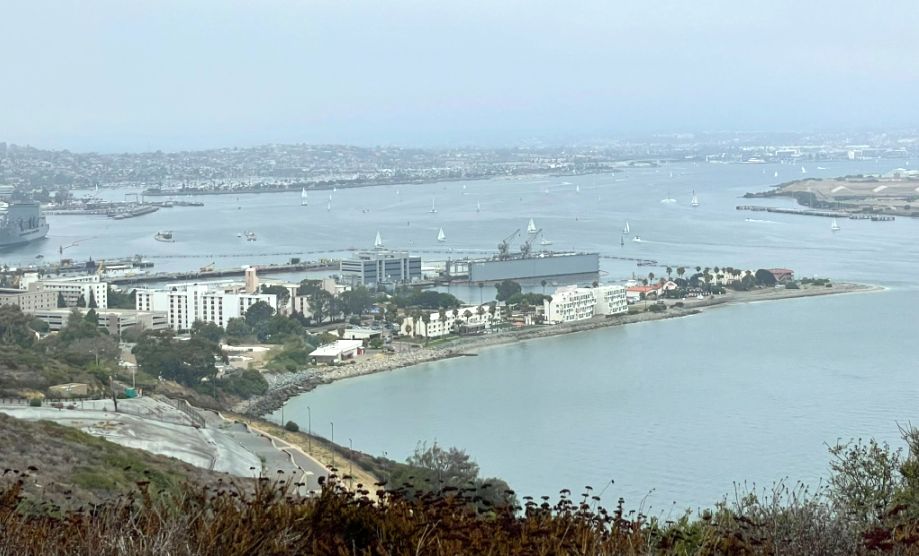
Panoramic view. To the left is the new Lighthouse and to the right is the Naval Information Warfare Center (NIWC) Pacific, formerly known as SSC Pacific or NAVWAR. This is a massive high-tech Navy research facility. While you can see the buildings from the Cabrillo National Monument, the facility itself is highly secure and restricted to military personnel. t serves as the Navy's primary research and development center for command, control, and communication systems.
Much of this land was once part of Fort Rosecrans, a coastal defense installation that protected the San Diego harbor entrance during both World Wars.
As we move farther along, the statue of Juan Rodríguez Cabrillo comes into view, standing tall on its raised platform. From there, he looks out over the open ocean, with the curve of the bay and distant buildings spread out behind him. It’s a powerful image, Cabrillo frozen in motion, pointing toward the horizon, set against endless water and sky, marking this spot as both a lookout and a place of first arrival.
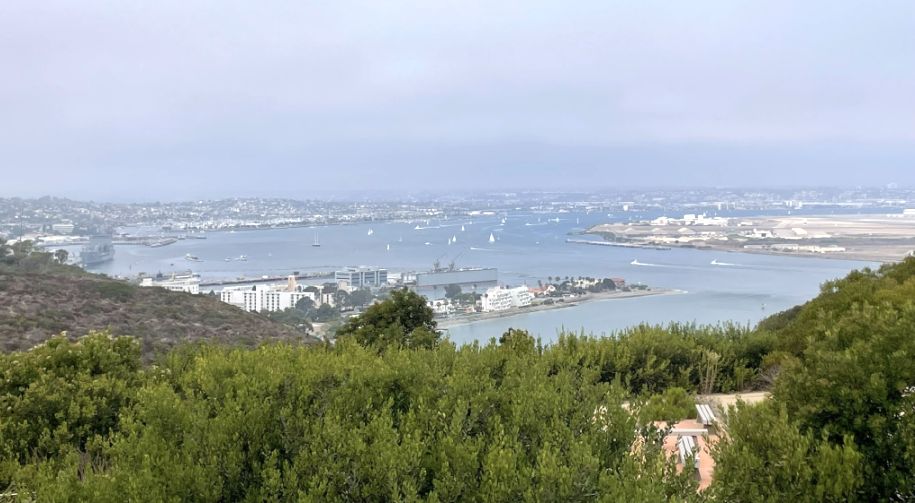
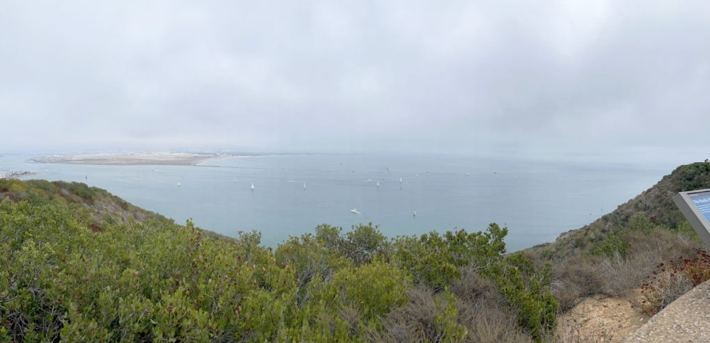
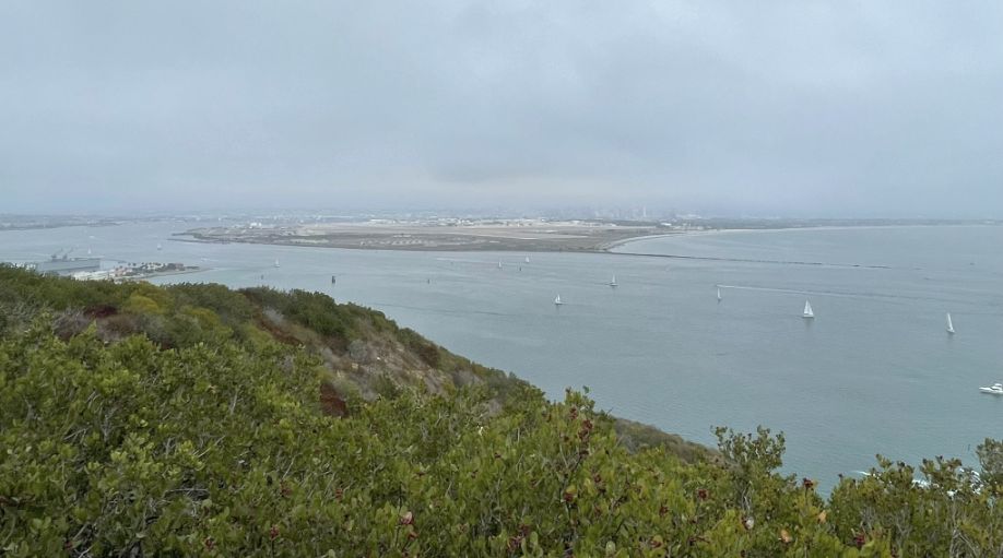
In the distance the bay looks so picturesque.
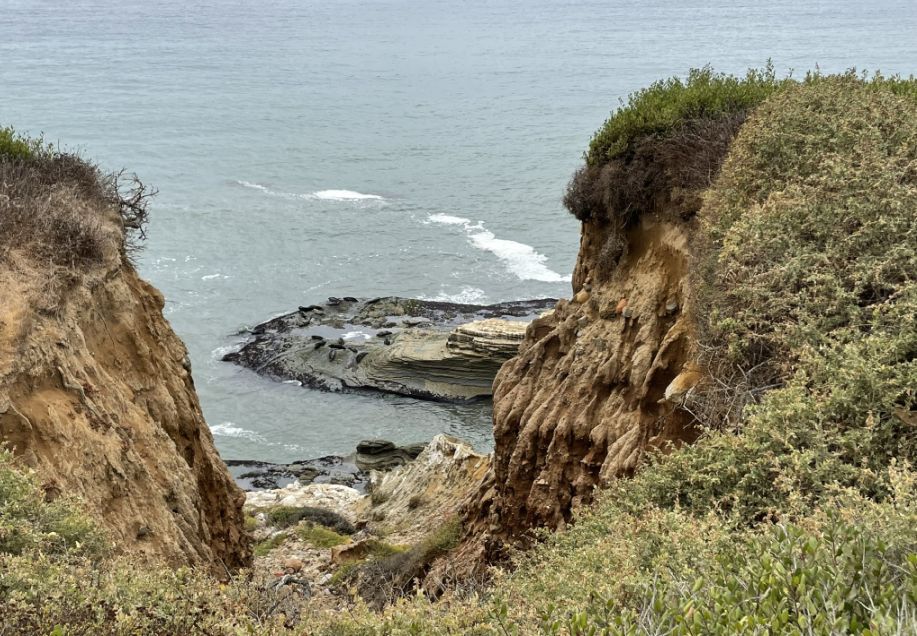
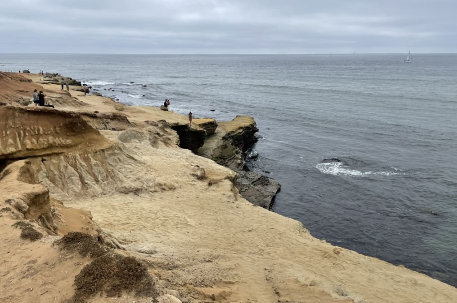
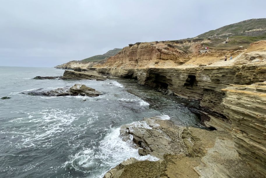
Continuing on, the landscape shifts again. Two rugged cliffs frame a natural opening, almost like a window cut into the land. Through that gap, you can see a long, elongated rock formation rising just above the water’s surface.
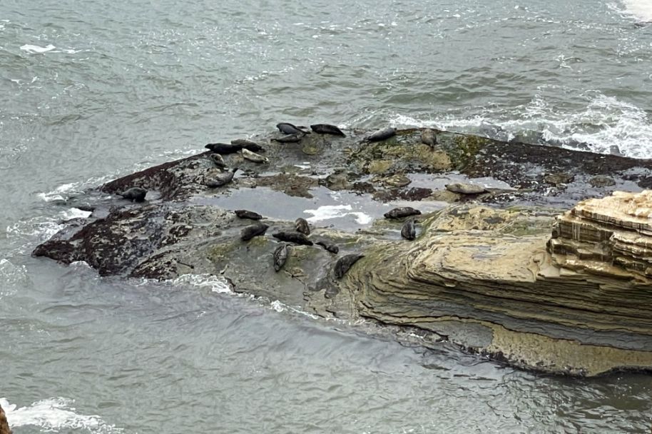
Near the waterline, the rock is dark, almost black, stained by constant waves, algae, and moisture. Higher up, it turns lighter, sun-bleached and dry, with moss clinging to the surface where spray still reaches. In the center, a small tide pool has formed, holding seawater between the ridges. The seals lie along the edges, draped over the rock where it’s flat and warm, close enough to slip back into the water when needed.
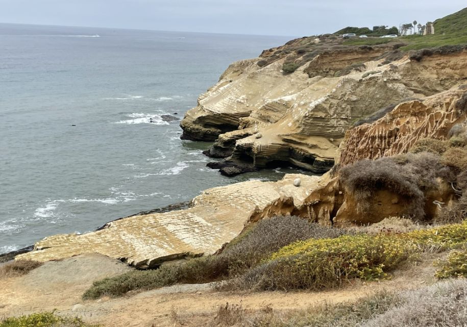
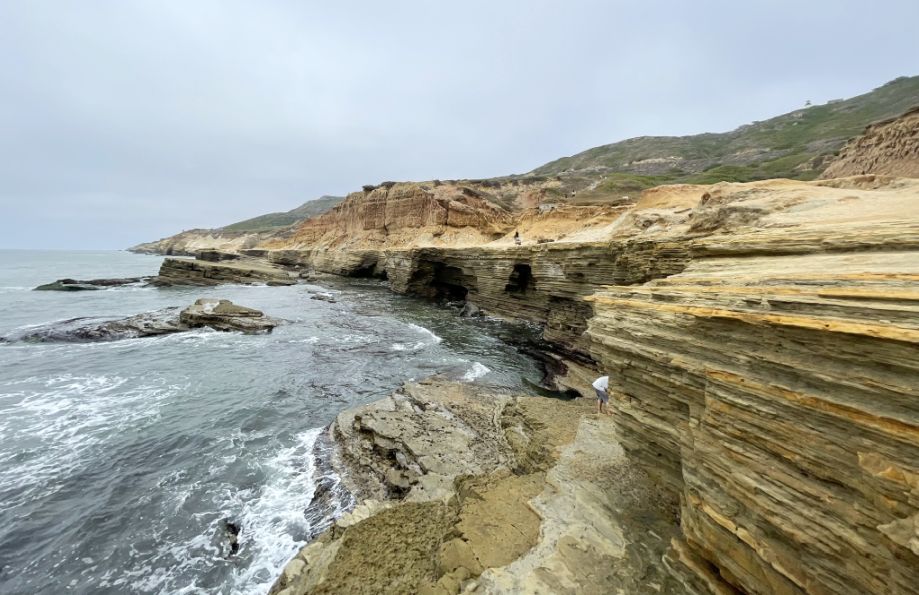
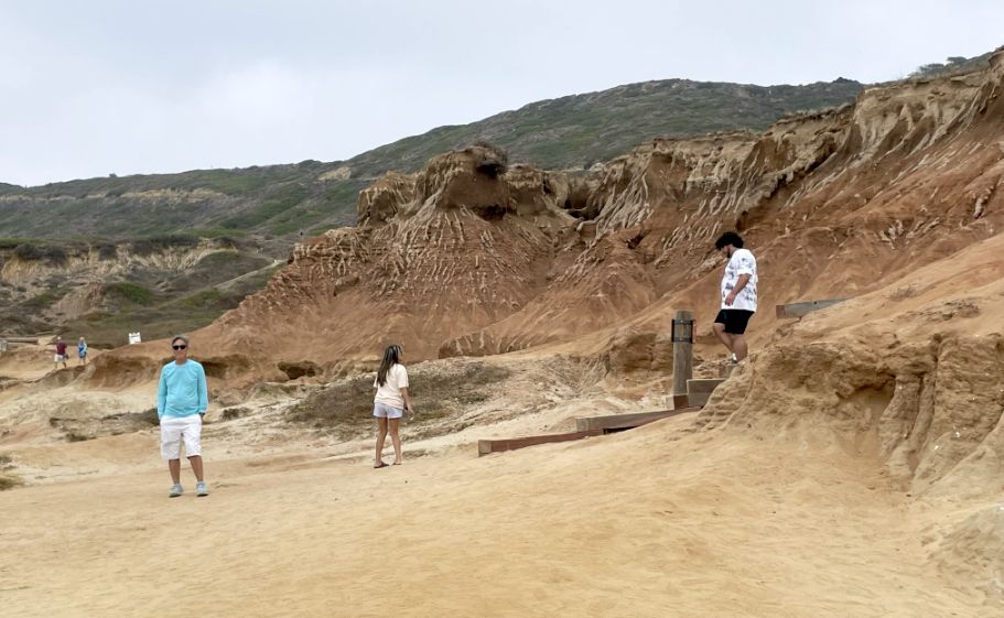
As we continue, the scenery becomes even more dramatic where the cliffs take your breath away. The cliff edge is etched with horizontal layers upon layers, like pages in a book, each one laid down millions of years apart. Below, an elongated platform of yellowish rock stretches outward, surrounded by mostly brown, sun-dried vegetation, with just a few bushes of yellow flowers brightening the hillside above.
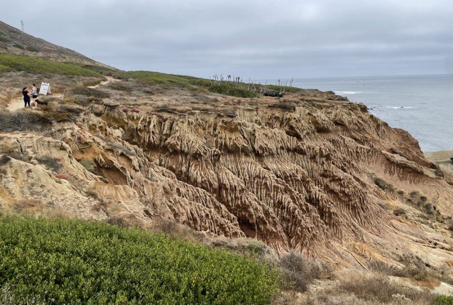
From here, the land feels raw and exposed, ancient rock, fragile plants, and the vast ocean working endlessly below. This is classic badlands topography, and at Cabrillo it feels bigger, bolder, and more muscular than at Torrey Pines.
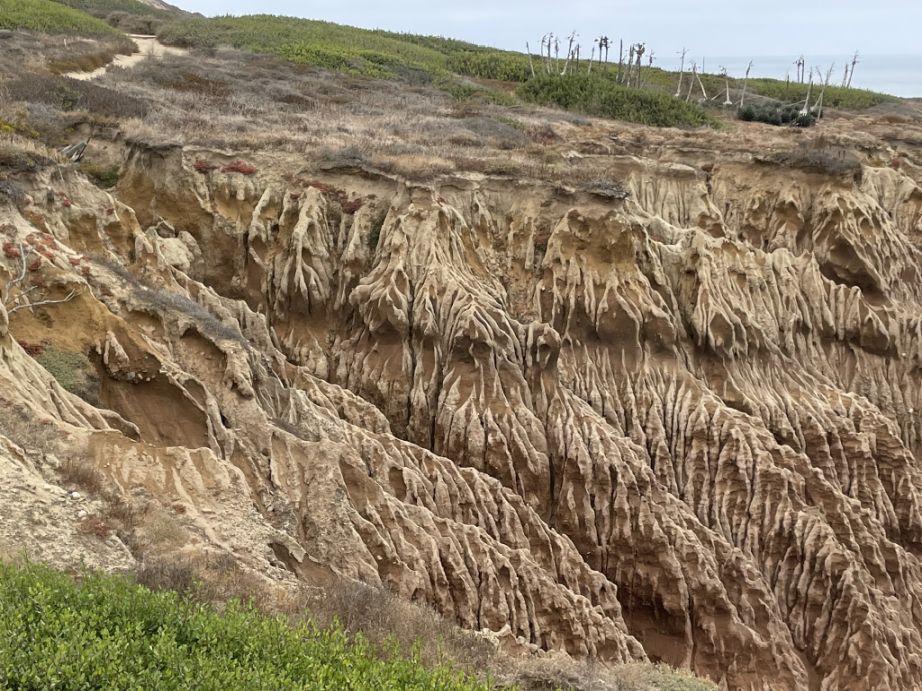
At Cabrillo, the badlands are more massive because the cliffs are higher and broader, the rock layers are thicker and more continuous, and the exposure to wind, salt spray, and winter storms is stronger. You can see vertical fluting cutting through horizontal layers, a crosshatch of time: ancient seabed sediments sliced by modern erosion. Lighter bands mark drier, harder layers; darker streaks show where water still flows after storms. Little shelves and ledges form briefly, then collapse, sending material down to the rocky platforms below.
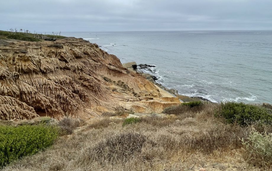
Unlike desert badlands, these are coastal badlands, shaped not just by rain but by the ocean undermining them from below. Waves carve at the base, weakening the cliffs, while gravity pulls the upper layers down. It’s a slow but relentless process, and the shapes you’re seeing are temporary, beautiful, but fragile.
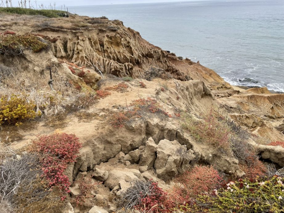
Near the badlands, the land suddenly comes alive with color. The vegetation stays low to the ground, hugging the soil for protection, but it spreads in rich tones, rusty reds, warm yellows, and deep browns, mixed with dusty greens. These are tough coastal plants adapted to thin soil, strong wind, and salt spray. Many of them change color with the seasons, so this is a natural palette shaped by sun and drought rather than flowers alone
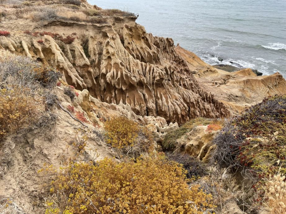
Standing there, it feels like the land is mid-transformation. Just like Torrey Pines, but on a grander scale, we are watching millions of years of geology being rewritten in real time, a living cliff face, constantly reshaped by water, wind, and time.
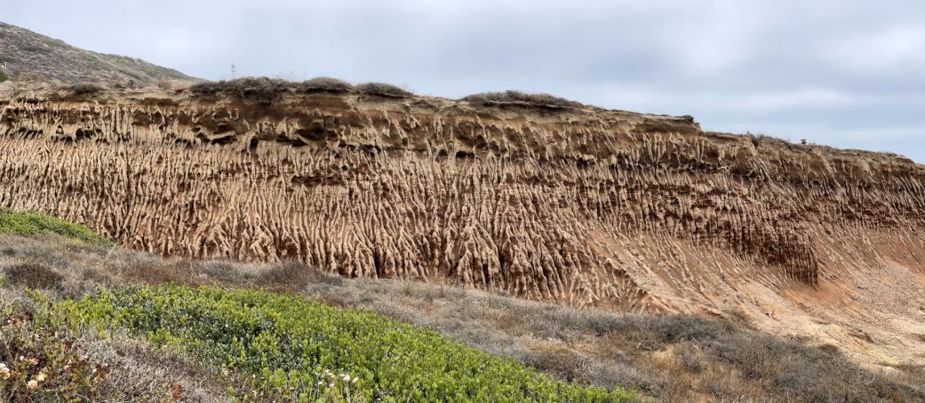
Panoramic view of the Badlands.
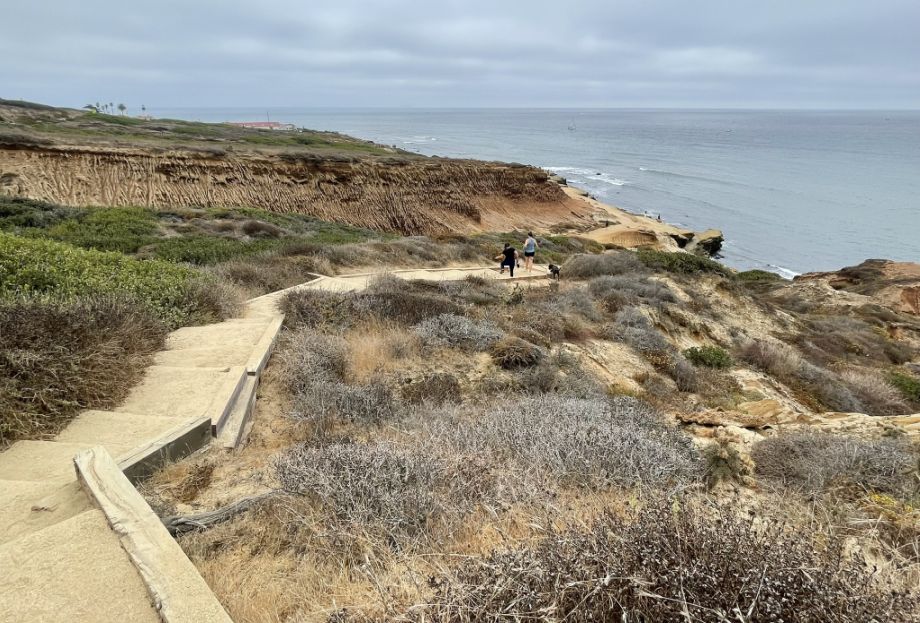
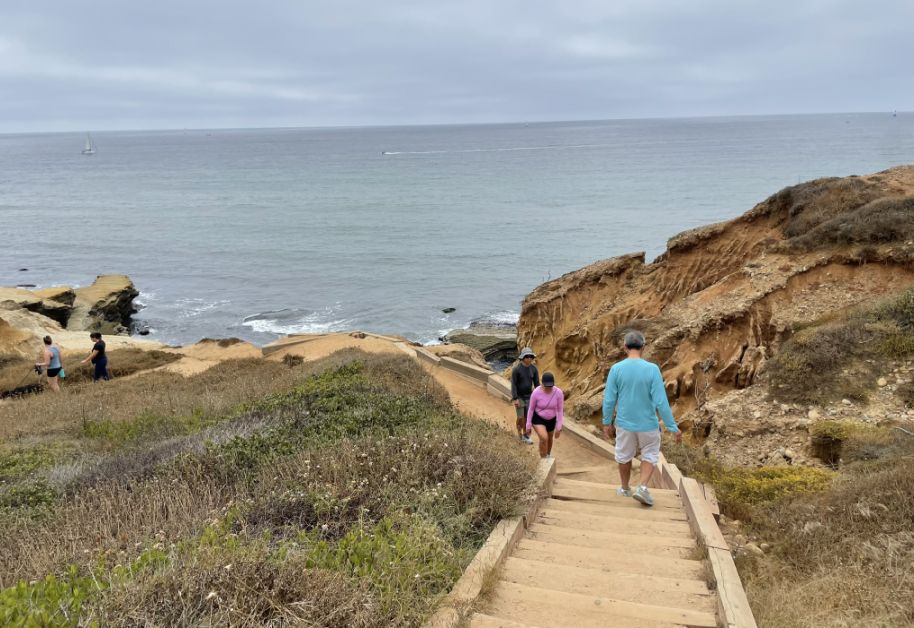
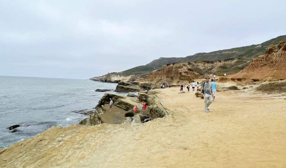
Then the path begins to drop.
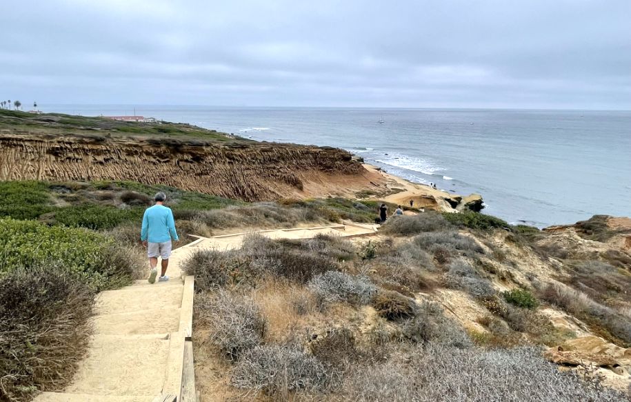
The zigzagging stairs cut sharply down the cliff, switching back and forth as they descend, giving new angles with every turn.
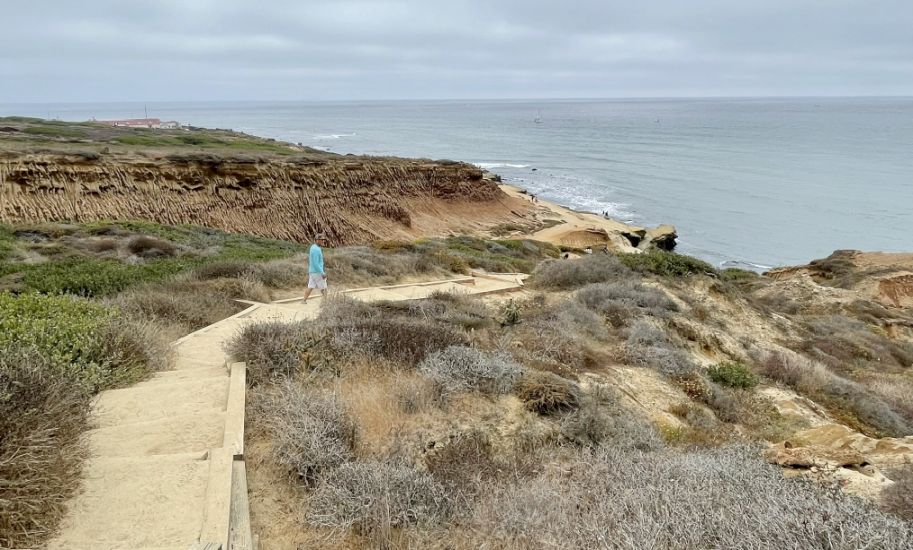
Heading to the cliffs below.
From here the view is already amazing!
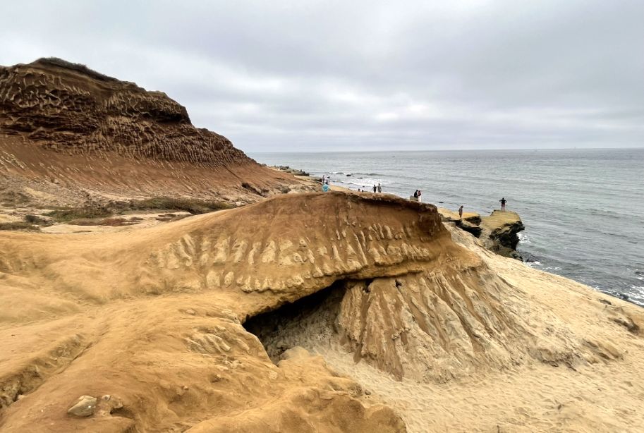
This is one of the most famous features of the tide pool area, often referred to by locals as the Whale Rock or simply the Sea Cave. The natural erosion of the cliffs has carved out a large overhang that, from certain angles, looks remarkably like a massive whale breaching the sand or a giant mouth opening toward the ocean.
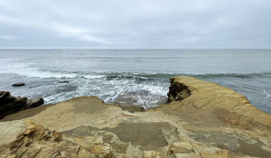
Reaching the edge of the water, the scale of the place really hits you.
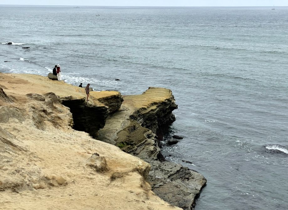
From above it was beautiful; from down here it’s powerful. The cliffs tower overhead, raw and sculpted, and you feel small in the best possible way, standing at the meeting point of ancient rock and restless sea, surrounded by one of the most striking coastal landscapes in Southern California.
 |
 |
What an amazing place!
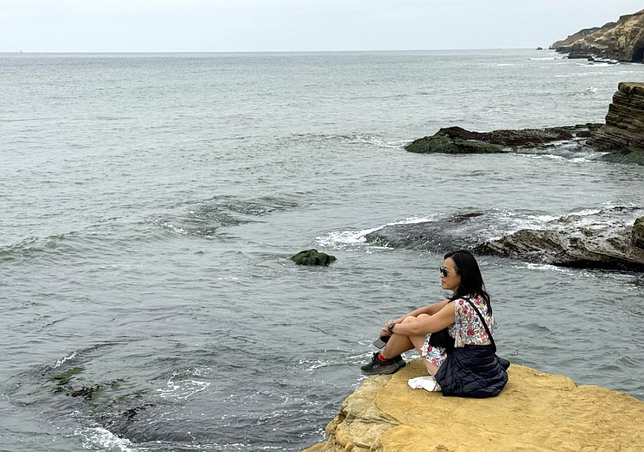
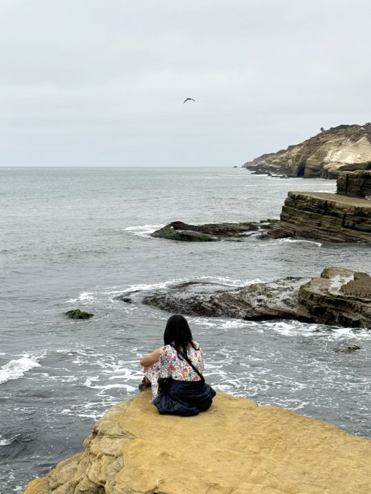
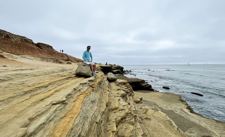
Sitting here on the cliff, everything slows down.
Being here feels both exposed and peaceful. There’s nothing between you and the horizon, just wind, water, and rock.
How peaceful is this?
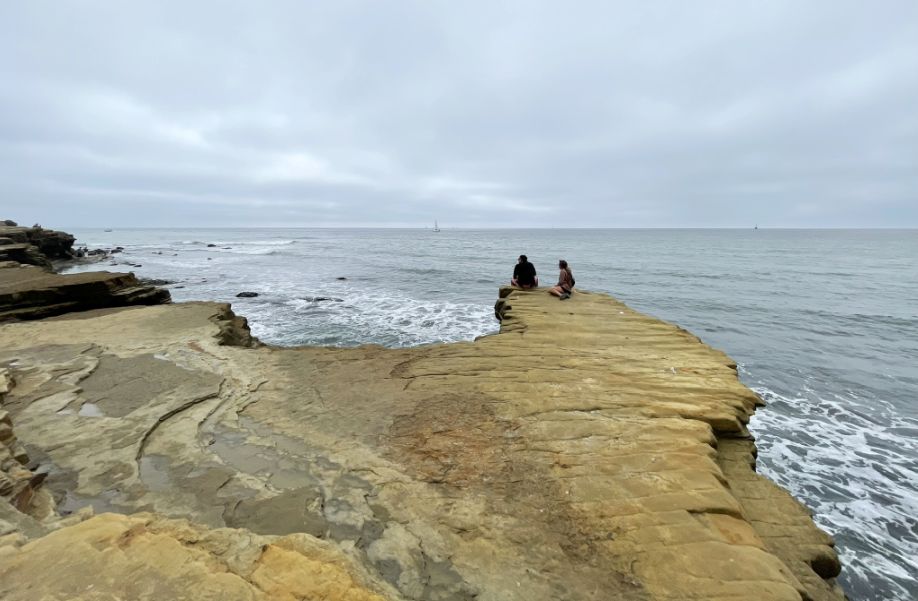
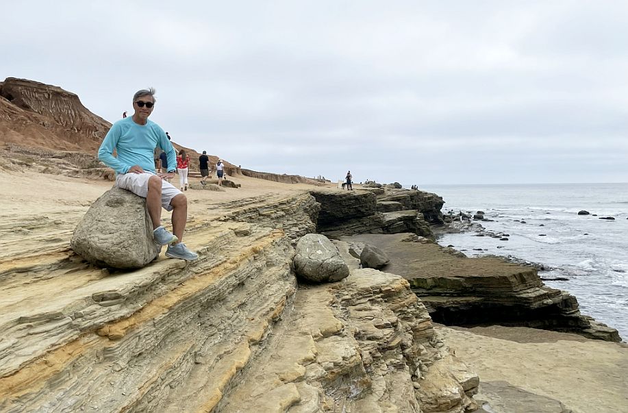
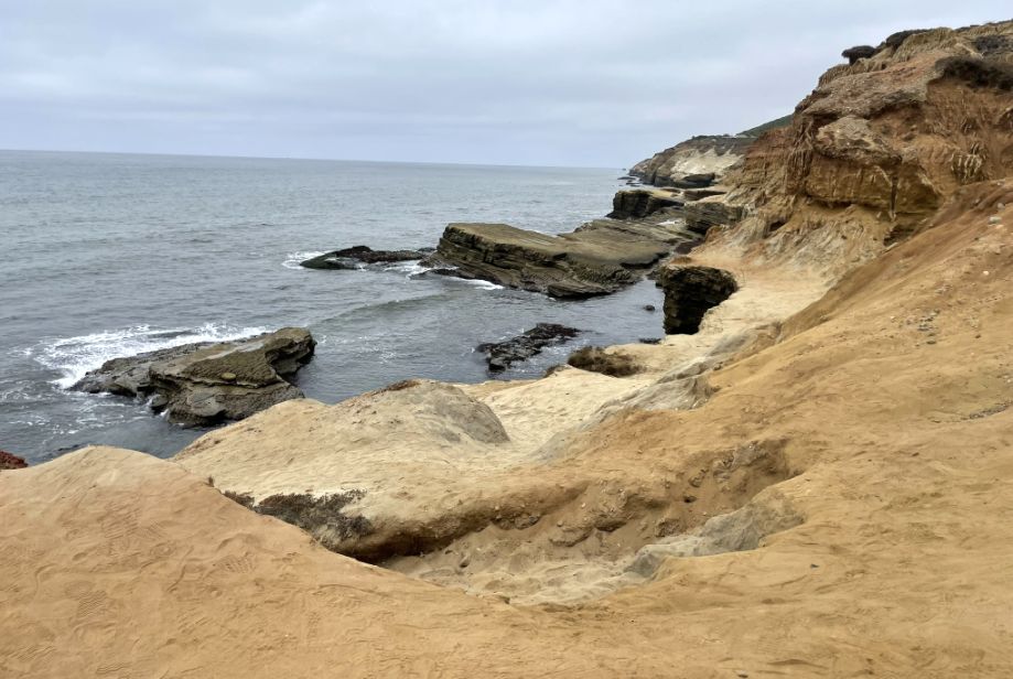
To our right, the cliffs stretch on continuously, rugged and layered, meeting the ocean in a long, powerful line.
From this angle, you can really feel their scale, solid, ancient, and unyielding, yet clearly shaped by the water below. The colors shift with the light: pale stone, darker bands, warm yellows and rusts, all softened by distance and sea air.
So glad we came here.
It’s a place that makes you sit quietly without trying, where the vastness of the ocean and the strength of the cliffs put everything else into perspective, leaving only a deep sense of calm and awe.
Between the two cliffs, the land opens into a shallow rocky basin, scattered with large and medium boulders. The ocean slips into this space gently, washing around the rocks rather than crashing, the water thinning and spreading as it moves across the stone. It feels sheltered here, as if the cliffs are holding the sea in place for a moment before letting it go again.
We are now making our back to the parking lot.
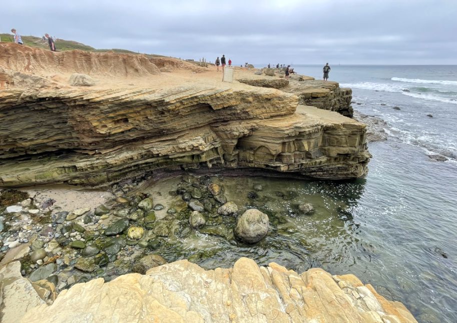
We are at the Point Loma Tide Pools, where the rock formations tell a 75-million-year-old story, stacked one on top of the other through ancient underwater events.. Geological often described the layers as "geological cake" because of their clearly visible horizontal layers.
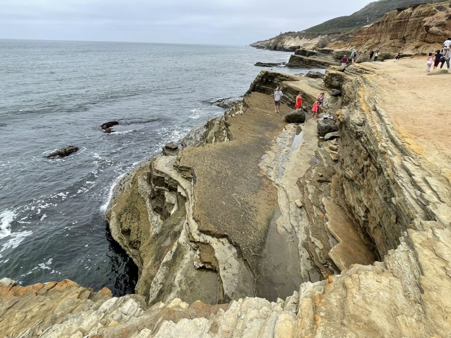
The Point Loma Tide Pools are a fragile and fascinating ecosystem where marine life has adapted to survive the harsh transitions between high and low tides. As you watch people walking around, you are seeing one of the best-preserved rocky intertidal areas in Southern California.
One last look at the area before taking off...
 |
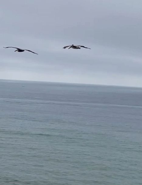 |
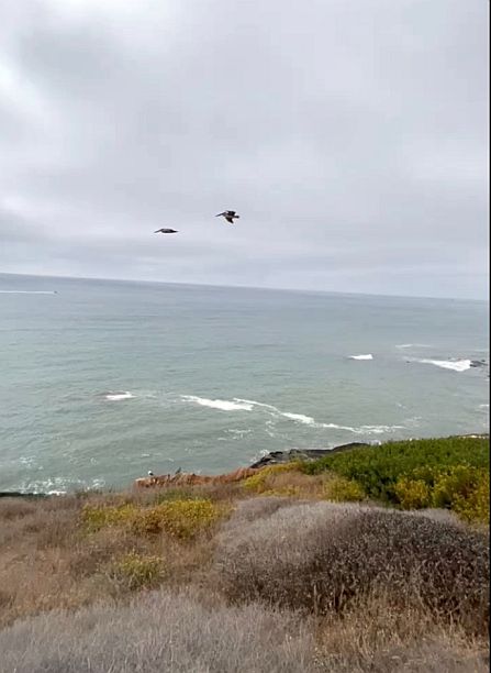
Above us birds are flying in unison.
NEXT... Day 2- Dinner at Kettner Exchange