4 days in San Diego-8/31- 9/3/2024
Day 1- Torrey Pines State Beach -8/31/2024
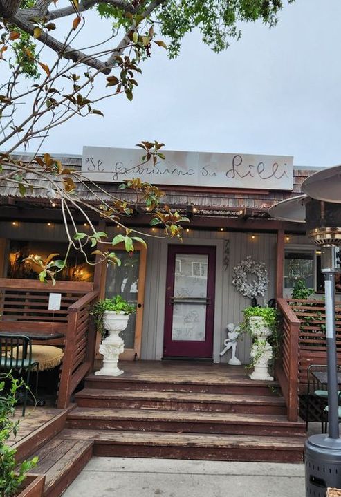
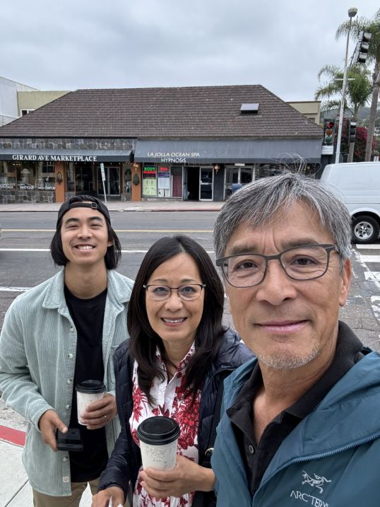
We were in San Diego over the Labor Day long weekend to attend a wedding held in the evening. During the day, we made the most of our time, waking up early, having breakfast at Il Giardino di Lilli, and then driving out to Torrey Pines State Beach to explore the coastline and trails, turning the trip into a relaxed three-day getaway alongside the celebration.
|
|
After getting our breakfast and coffee at Il Gardino di Lilli we are heading to Torrey Pines States Beach
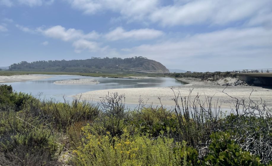
We parked our car and stepped into Los Peñasquitos Lagoon, which is the vibrant "nursery" of the Torrey Pines area.
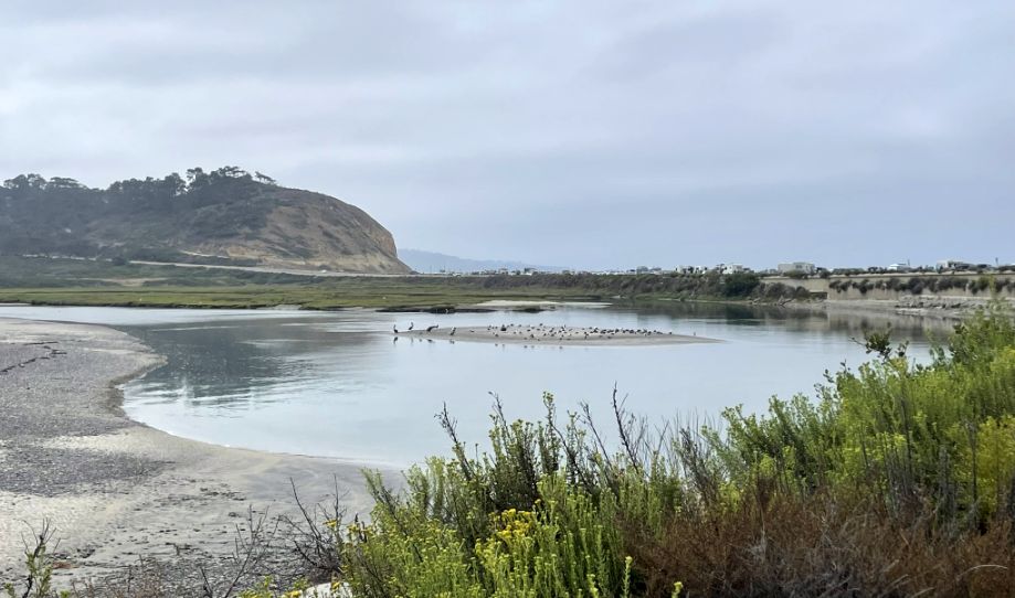
We are walking through one of the last remaining intact salt marshes in Southern California. The water you are looking at is a mix of fresh water coming down from the inland canyons and salt water pushed in by the Pacific tides. This "brackish" water creates a high-nutrient soup that supports an incredible amount of life.
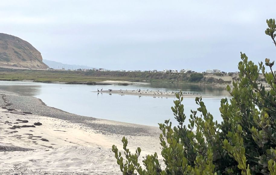
Los Peñasquitos is a major stop on the Pacific Flyway (a "highway" for migrating birds), creating a calm, shallow habitat that birds love.
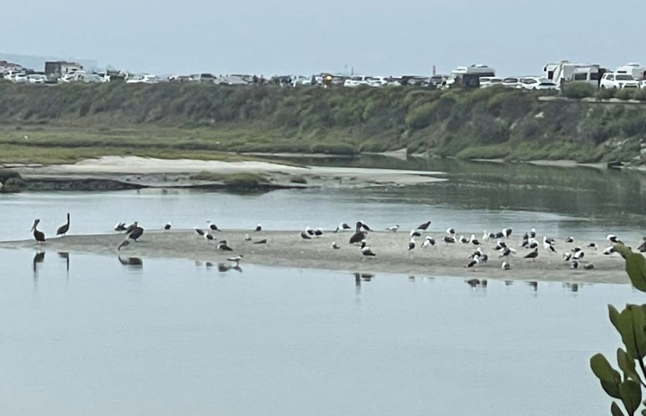
The large birds resting by the water are likely brown pelicans, along with egrets, herons, gulls, and sometimes even migrating shorebirds. The lagoon is a crucial resting and feeding stop on the Pacific Flyway, the major north–south migration route for birds along the West Coast. Fish, small crustaceans, and insects thrive in this protected water, making it a natural buffet for them.
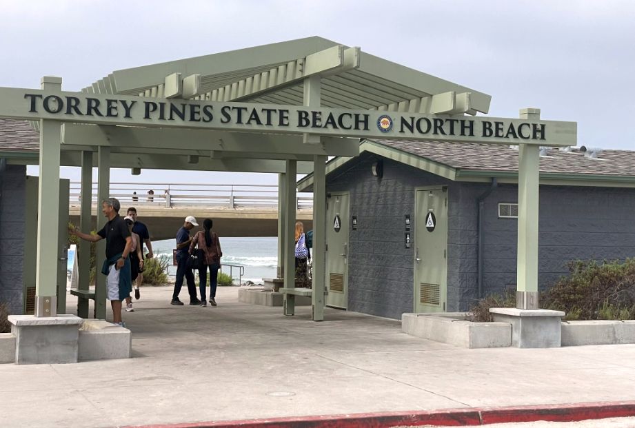
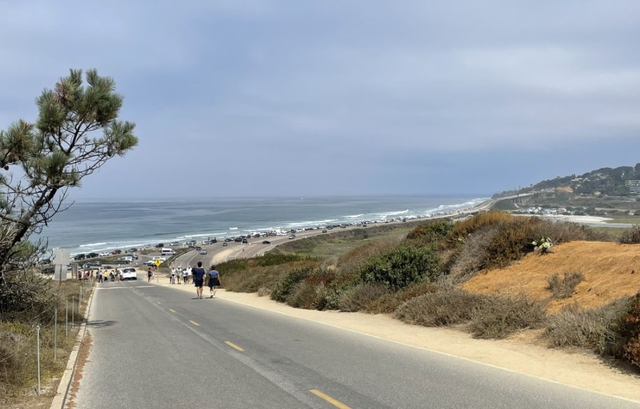
After the lagoon/wetland, the large green gate marked “Torrey Pines State Beach – North Beach” is the official boundary of the protected beach area.
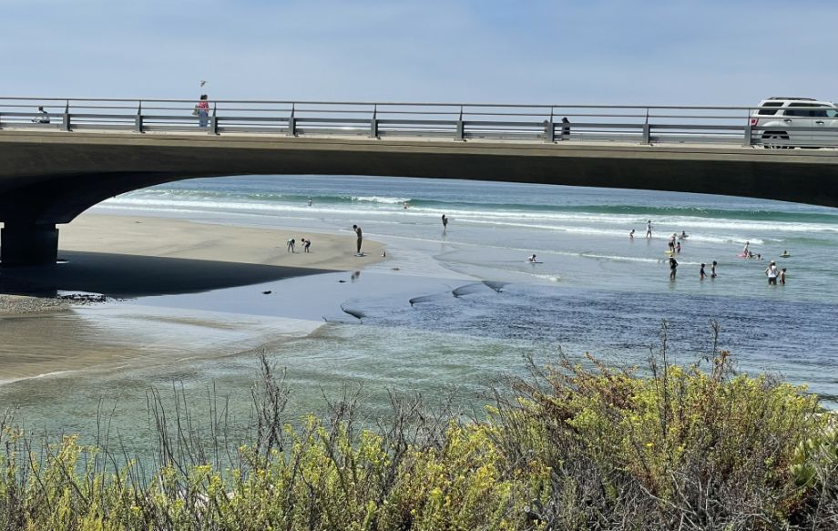
The bridge you’re seeing carries North Torrey Pines Road (and historically, the Pacific Coast Highway) over the mouth of the Los Peñasquitos Lagoon.
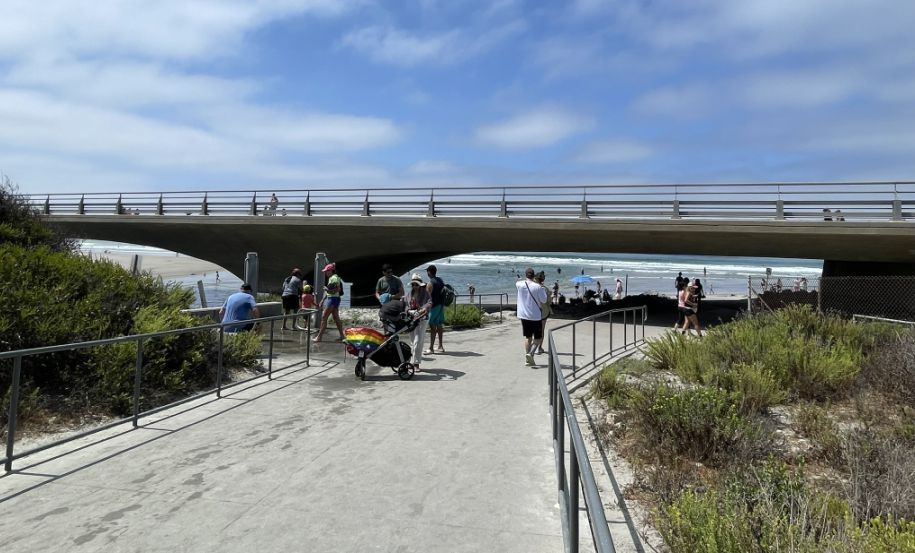
Walkway leading to the beach.
It feels a bit surprising to walk under such a busy highway and then suddenly emerge at a quiet, wide beach, but that contrast is part of what makes this spot memorable.
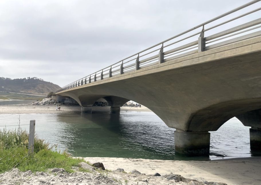
The bridge is built over the inlet the "mouth" where the Los Peñasquitos
Lagoon meets the Pacific. When the "Old Coast Highway" (Highway 101) was first
being developed in the 1910s and 20s, engineers had a choice: blast through
the massive sandstone cliffs or follow the flat, sandy coastline.
They chose
the coast because it was much easier to build on "comparatively level
country."
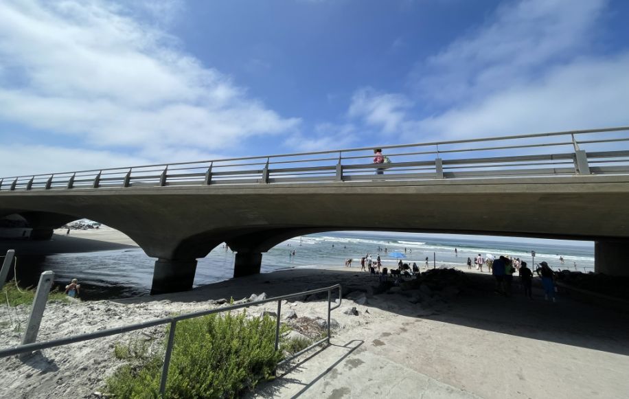
As you pass beneath the freeway, the sound changes first, the low echo of traffic rolling overhead, footsteps bouncing off concrete, the brief feeling of being enclosed. For a moment, the sky narrows and the space feels almost industrial. Then you step out from under it, and everything opens up at once.
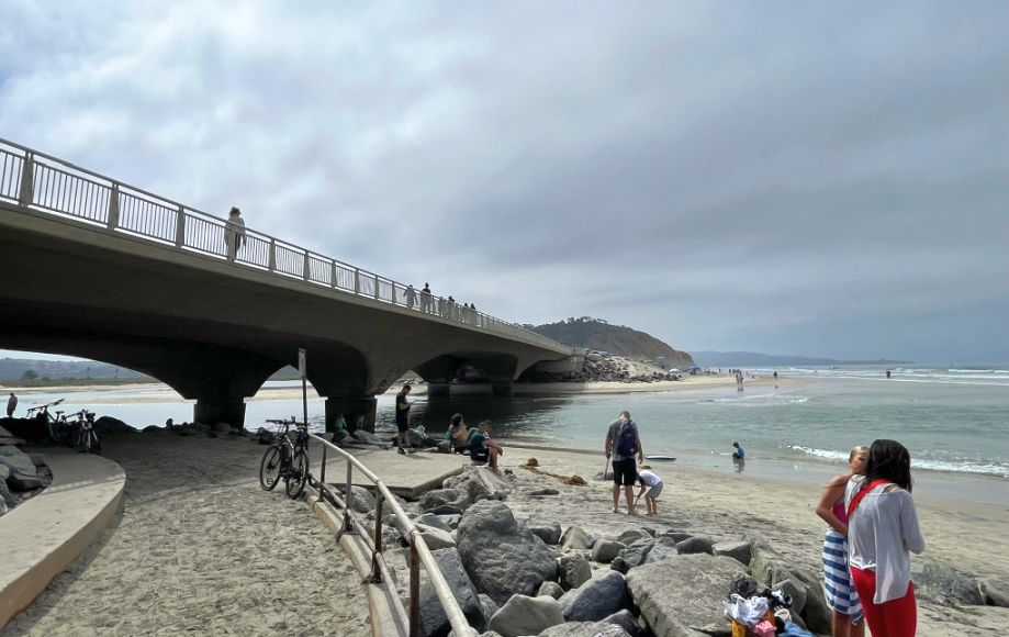
Suddenly there’s sand under your feet, salt in the air, and the Pacific stretching wide and blue. The noise of cars fades into the background, replaced by waves breaking and seabirds calling. It feels like crossing an invisible threshold, from the built world into something much older and calmer.
Looking up, you can see people walking across the bridge above, tiny silhouettes moving along the railing. There’s something poetic about that view: two worlds layered on top of each other. Down below, people wander barefoot along the beach, following the rhythm of the tide. Up above, others move quickly, passing through, barely aware of the lagoon, the birds, or the long curve of sand beneath them.
Kevin climbing up toward the bridge, the terrain shifts again and you really feel the character of Torrey Pines.
View from of the beach (looking to my right).
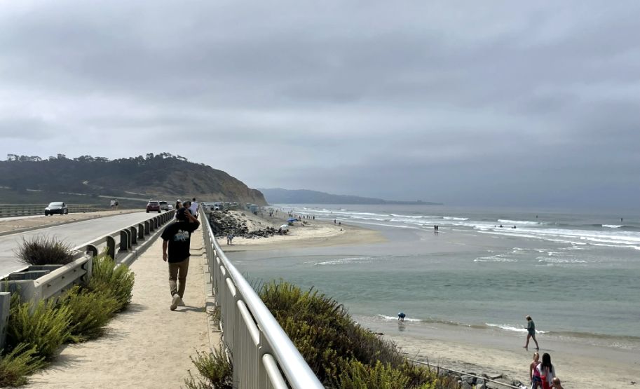
Walking on the bridge with car passing by us and walkers moving steadily along the railing, pausing for photos or leaning out to take in the view.
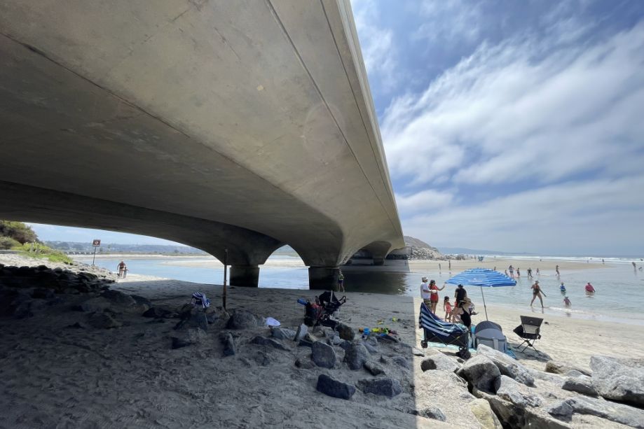
Below is the meeting point of the Pacific and the lagoon.
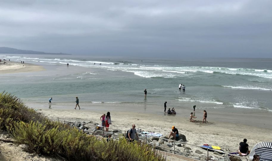
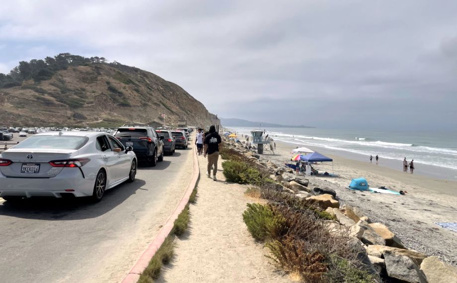
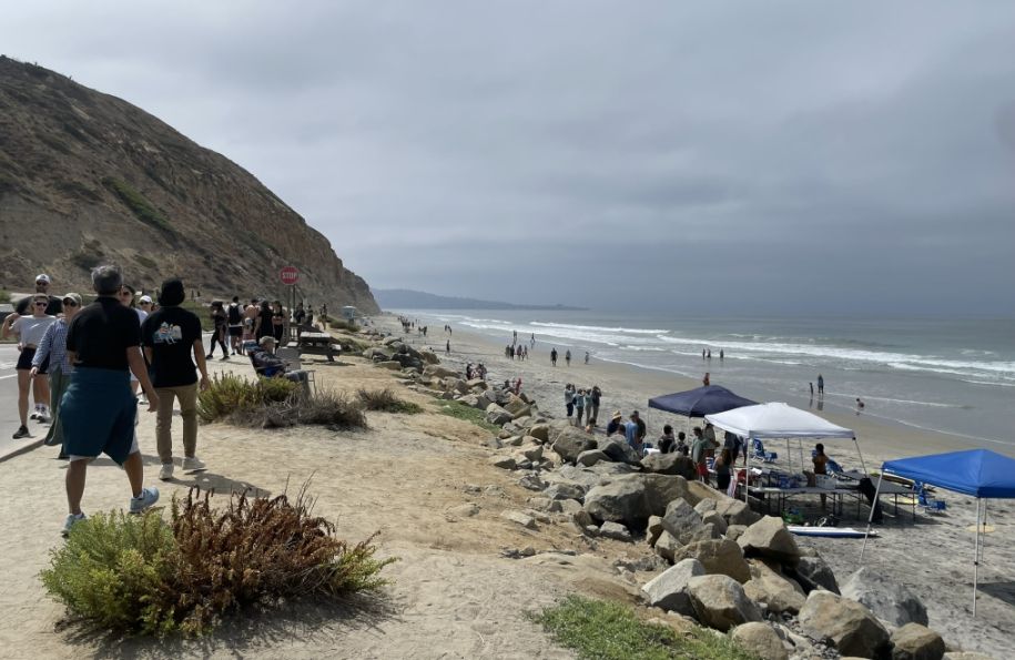
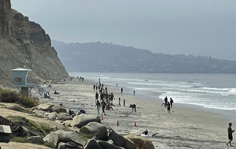
We were there on Labor Day Weekend so there were a good amount of people on the beach.
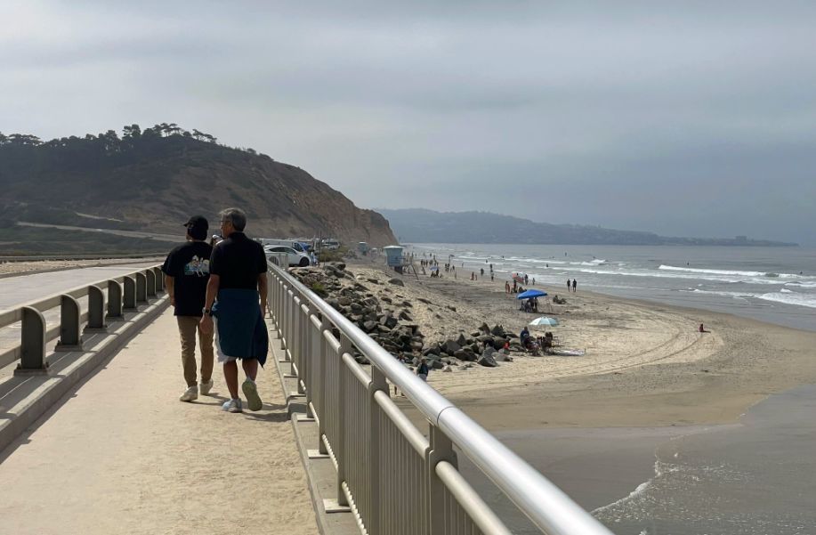
The rocky edge (just ahead of the bridge is man-made. Those large boulders (rip-rap) were placed there specifically to "train" the inlet. Without them, the rushing water from the tides would naturally wander up and down the coast, eventually eroding the foundations of the bridge we are standing on.
The reason there is so much sand there for people to hang out on is that the north end of Torrey Pines acts as a "sand trap." Ocean currents move sand south down the coast; when they hit the outflow of the lagoon water, the sand drops and settles, creating that wide playground.
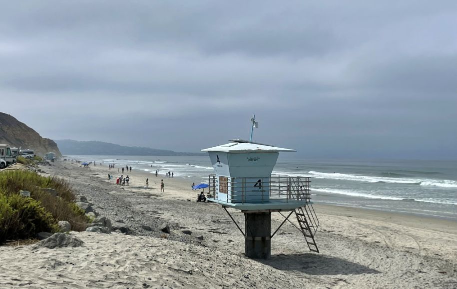
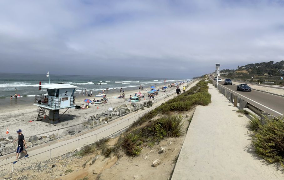
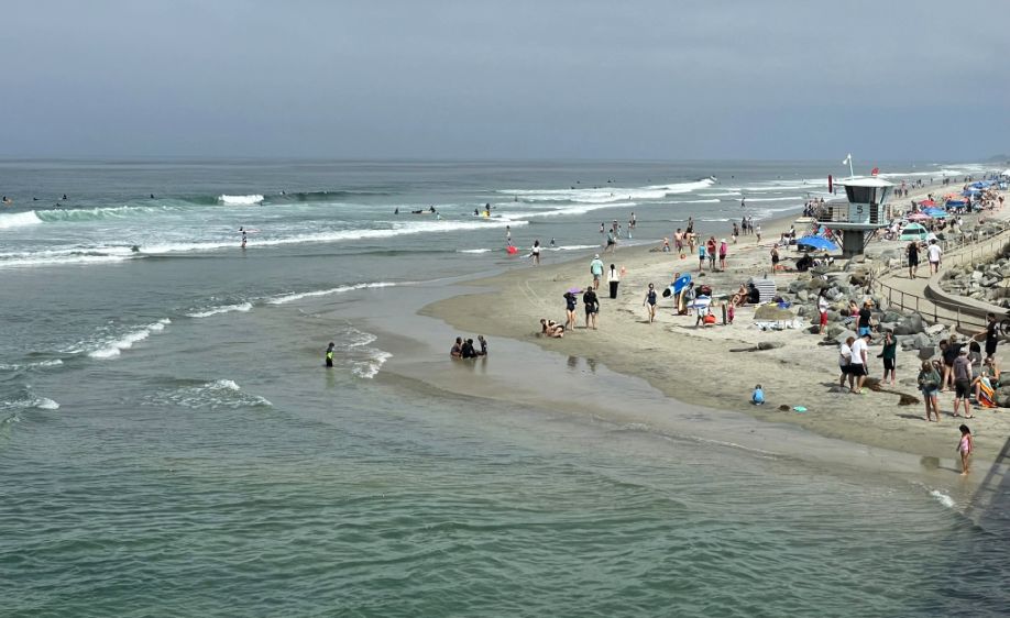
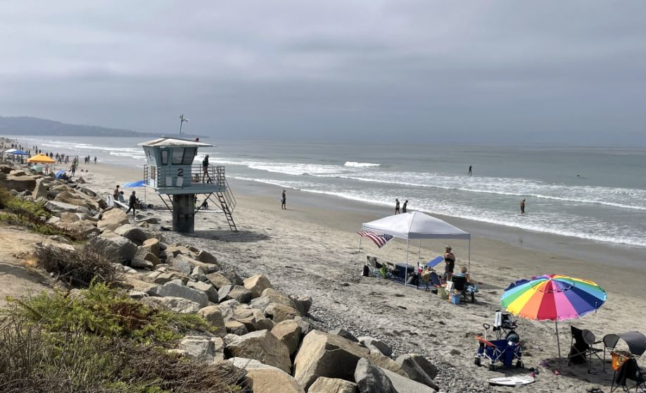
Lifeguard Station 4 is a major landmark at Torrey Pines! and a permanent structure. Station 4 also marks the transition from North of this point (toward Del Mar), the beach is relatively flat. South of this point, the massive cliffs begin to rise, and the beach becomes more rugged.
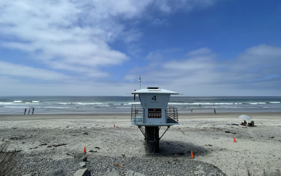
Because the lagoon inlet has very strong, unpredictable currents, the lifeguards at Station 4 have to be extra vigilant. When the tide goes out, the water rushes under that bridge like a river, and it can pull swimmers out into the surf unexpectedly.
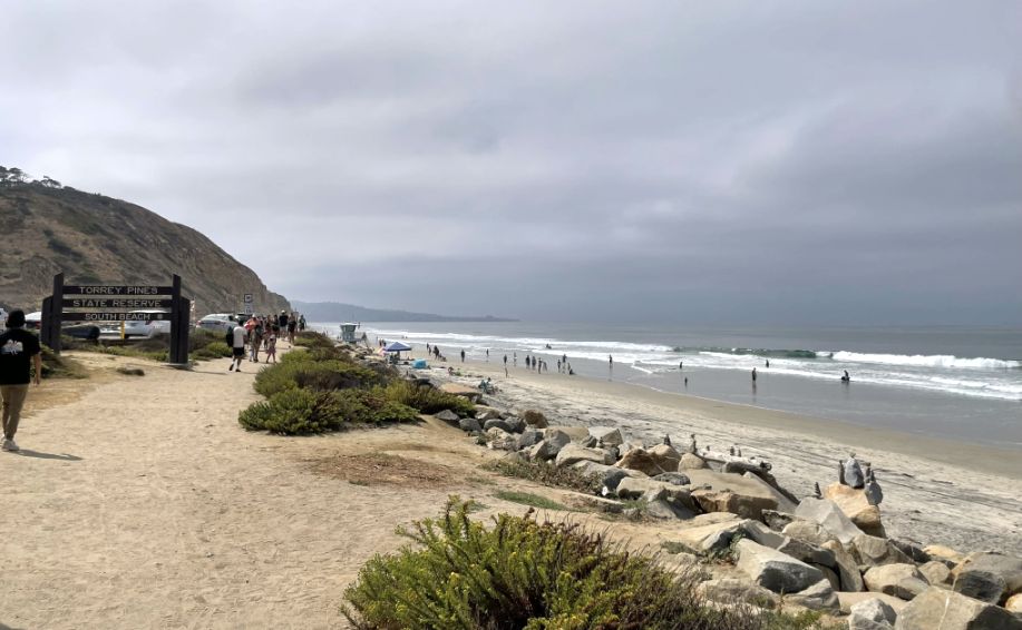
We have officially crossed over from the "lagoon side" to the South Beach area! This dirt path is the main artery that connects the lower parking lots to the base of the famous Torrey Pines cliffs.
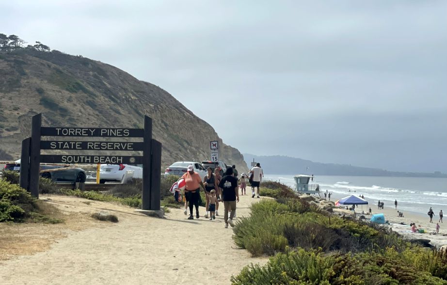
We are now entering South Beach, and the vibe changes completely. We are leaving the flat, open space of the bridge and entering the shadow of the bluffs.
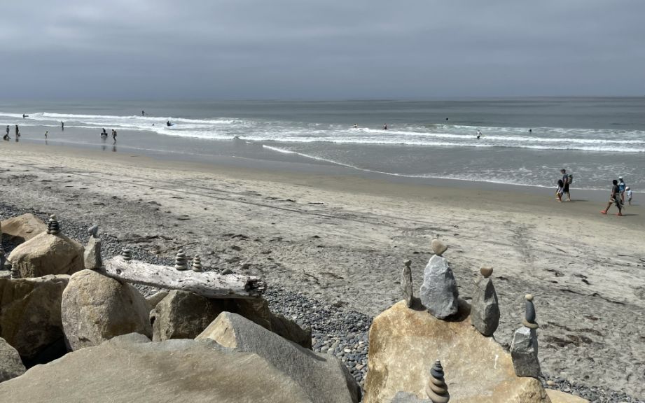
Beach art.
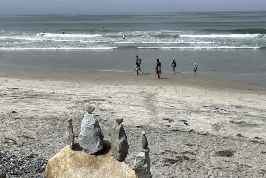
Torrey Pines is famous for the heart shape rocks, because the sandstone is relatively soft, the waves carve them into unique, rounded shapes. Finding a natural "heart" is like finding a four-leaf clover, it’s a favorite pastime for locals.
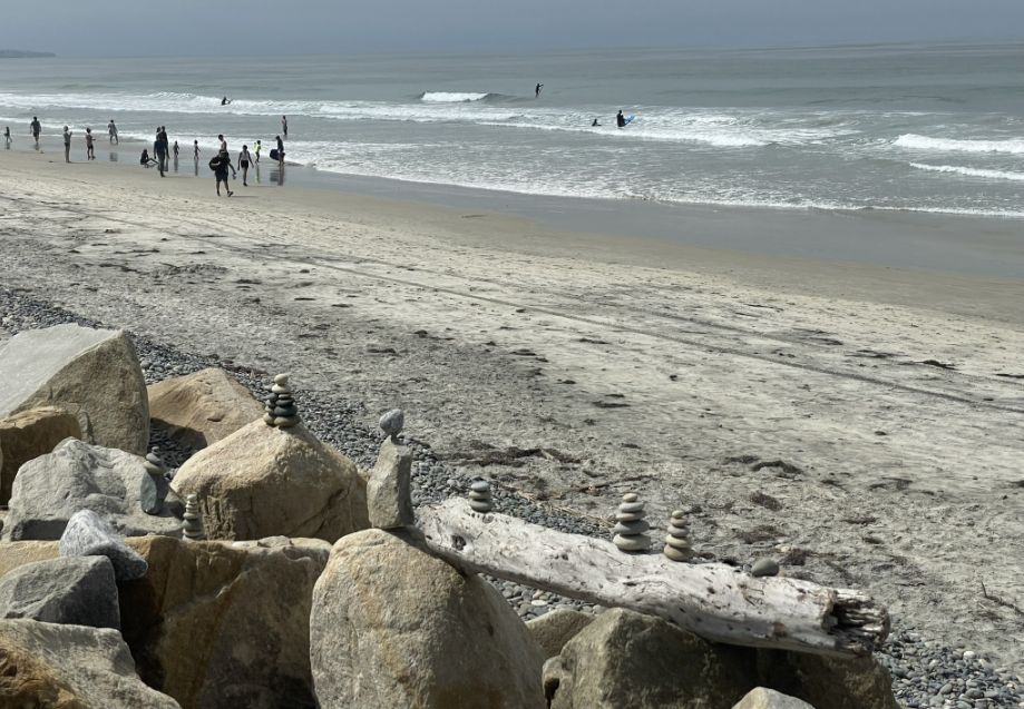
These stacks you see on top of the revetment (the big boulders) are called cairns. While they look like art, they have a few different "identities". Most people build them simply because it’s meditative. Balancing a heavy, jagged rock on a tiny point requires a lot of focus, it’s like "beach yoga." On the revetment, people often build them high up where the waves can’t reach. If you come back after a big storm, you’ll notice they are all gone, wiped clean by the ocean, and the process starts all over again.
Along the dirt path there is a long row of massive boulders you see to your right isn't just for decoration; it’s a revetment wall.
These rocks were placed there to act as armor. Without them, the high tides and winter storm surges would have washed away the very dirt path you are walking on long ago.
The further you walk along this dirt path toward the south, the "wilder" the beach becomes.
Straight ahead is the most dramatic and awe-inspiring part of Torrey Pines. Those 300-foot-tall cliffs (the Torrey Sandstone) are world-famous, but they are as dangerous as they are beautiful.
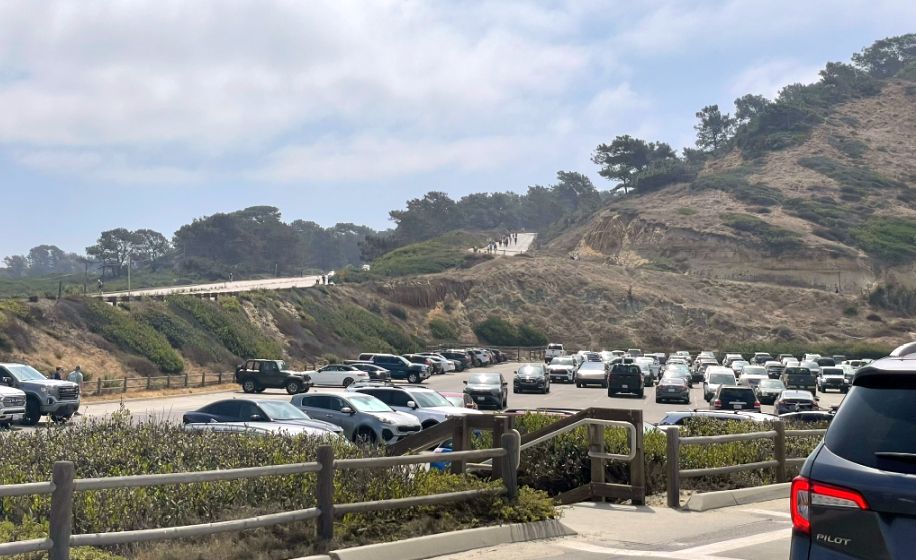
We passed by the North Parking Lot area. From here we will go up the hill heading towards the Torrey Pines State Natural Reserve.
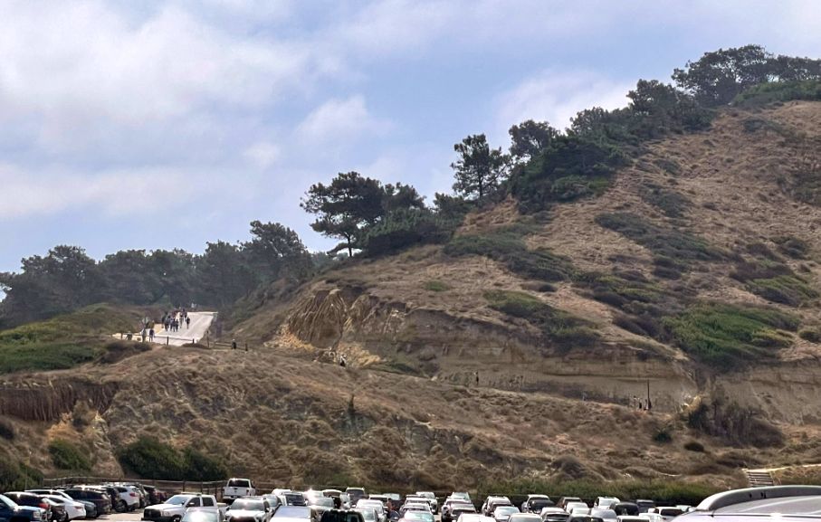
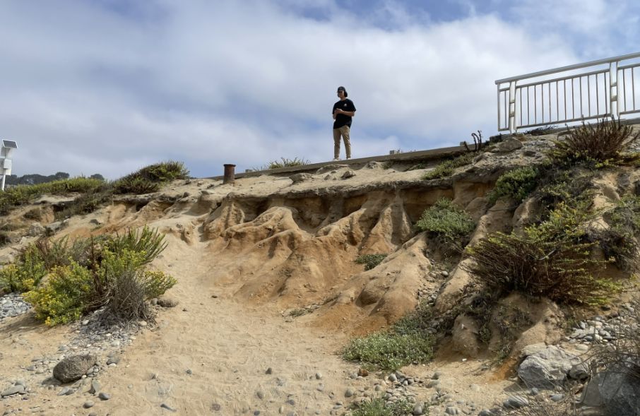
As you can see ahead, there are a lot of people going up hill. The hill you see is called the badlands.
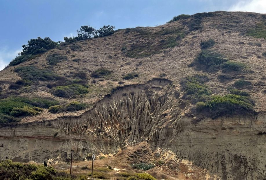
In the center is an erosion gullies and spires formed in very soft sandstone and clay. Over time, rainwater runs down the slope and cuts narrow channels into the cliff.
The cliffs and that sculpted middle section are made mostly of Torrey Sandstone, which was formed about 40–45 million years ago, during the Eocene period. Back then, this entire area was underwater. Sand, silt, and clay settled on the ocean floor in layers and eventually hardened into rock as sea levels changed and the land slowly uplifted.
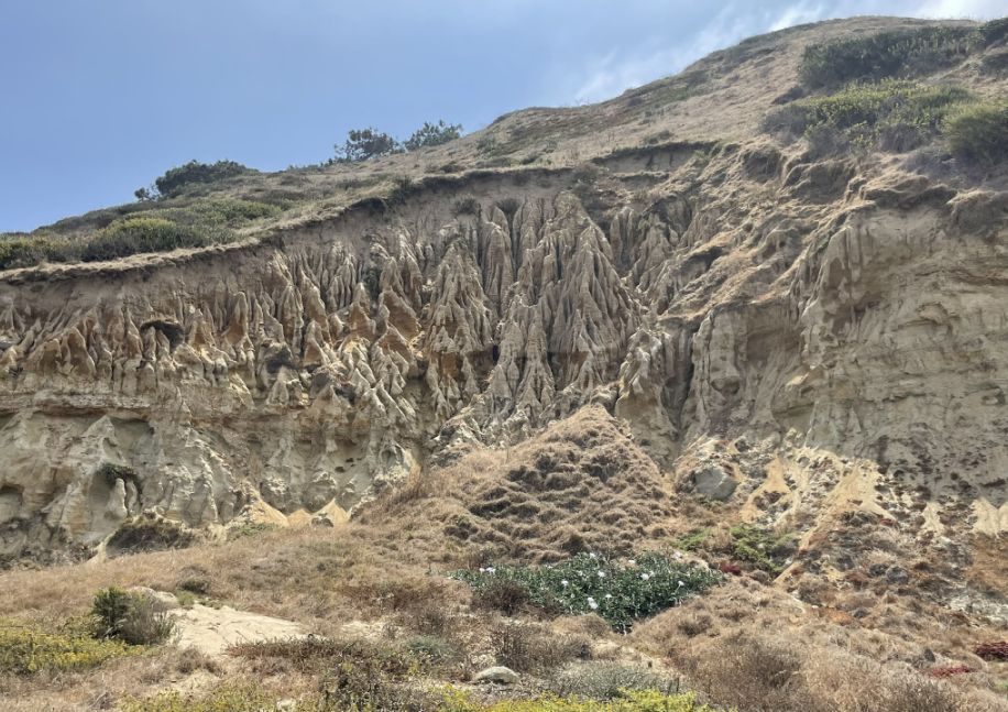
Because the rock here is uneven, some layers slightly harder, others very soft, the water doesn’t erode it evenly. The softer material washes away first, leaving behind those sharp, finger-like ridges and vertical flutes.
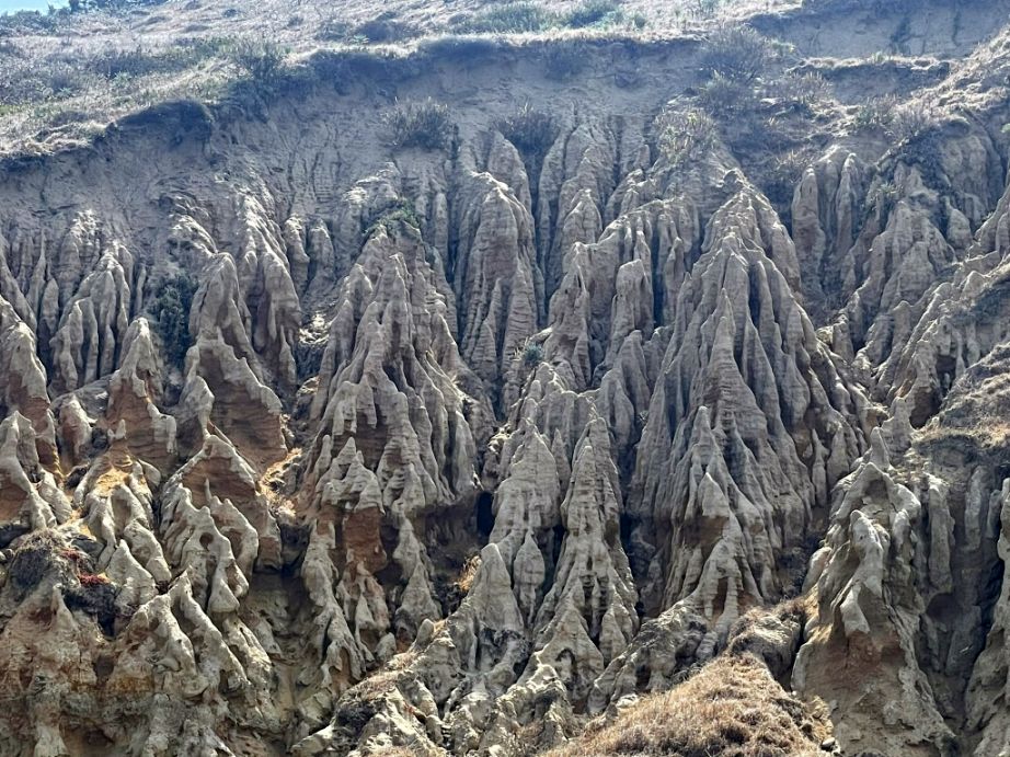
It looks like the hillside melted or collapsed, but it’s really slow, ongoing erosion, shaped by rainwater carving downward paths, gravity pulling loose material away, wind and salt air weakening the surface, and sparse vegetation, which means fewer roots to hold the soil together. The pale tan, gray, and rusty streaks you see mark different sediment layers that were laid down millions of years ago when this area was underwater.
As we go up the hill from South Beach, we are entering Torrey Pines State Natural Reserve. I turned around to take a picture of the South beach behind us.
NEXT... Torrey Pines State Natural Reserve